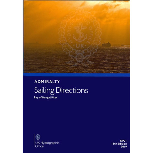




Ensure safe navigation in the Bay of Bengal with this detailed guide. Covers India, Bangladesh, Myanmar, Thailand, and key islands, providing critical insights for mariners and port entry.
Data sheet
Specific References
The *Sailing Directions: Bay of Bengal – NP021* is an indispensable navigational resource for mariners operating in one of the world’s most critical maritime regions. Designed to support safe and efficient coastal navigation, this publication delivers authoritative, up-to-date information for vessels transiting the Bay of Bengal, including the eastern coast of India, Bangladesh, Myanmar, western Thailand, and the Andaman and Nicobar Islands. As the 14th edition, released in 2025, it reflects the latest hydrographic data, ensuring compliance with international maritime standards and best practices.
Tailored for professionals in the merchant marine, this guide bridges the gap between nautical charts and real-world navigation. It provides detailed descriptions of coastal features, harbors, anchorages, and port entry procedures, along with critical insights into local regulations, tidal patterns, and meteorological conditions. By integrating this publication with standard Admiralty charts, mariners gain a layered understanding of the region, reducing risks and enhancing operational efficiency in complex or unfamiliar waters.
Covering a vast and strategically vital area, the *Sailing Directions: Bay of Bengal – NP021* spans from Point Calimere on India’s eastern coast to the Pakchan River in Thailand, including the entire coastlines of Bangladesh and Myanmar. It also encompasses the Andaman and Nicobar Islands, offering guidance through archipelagic waters where precise navigation is paramount. Whether navigating busy shipping lanes, approaching ports, or anchoring in remote locations, this publication ensures mariners have the localized knowledge needed to make informed decisions.
Published by a leading hydrographic office, this guide adheres to rigorous data collection and verification processes, making it a trusted reference for commercial shipping, offshore industries, and maritime authorities. The 2025 edition is fully compatible with digital updates, allowing users to maintain accuracy through regular revisions. Its paperback format ensures durability and accessibility, even in challenging onboard environments where digital systems may be unreliable.
While nautical charts provide the foundational visual data for navigation, the *Sailing Directions: Bay of Bengal – NP021* adds depth with contextual information that charts alone cannot convey. It includes warnings about navigational hazards, recommendations for safe routes, and details on port facilities, pilotage services, and local maritime customs. This holistic approach empowers mariners to navigate with confidence, minimizing delays and avoiding costly errors in high-traffic or environmentally sensitive areas.
Engineered for the demands of professional maritime operations, this publication is more than a reference—it’s a critical tool for risk management. Its structured format allows for quick access to information, while its comprehensive scope ensures no detail is overlooked. From deep-sea vessels to coastal traders, mariners rely on this guide to maintain safety, compliance, and efficiency in one of the world’s busiest and most dynamic maritime regions.
Navigate the Bay of Bengal with Unmatched Precision and Confidence
The *Sailing Directions: Bay of Bengal – NP021* is the definitive navigational aid for mariners requiring accurate, actionable intelligence for one of the most trafficked and geographically complex regions in the world. Weighing 1.9 kg, this 14th edition (2025) paperback publication is designed to withstand the rigors of onboard use while delivering the latest hydrographic insights for the eastern coast of India, Bangladesh, Myanmar, western Thailand, and the Andaman and Nicobar Islands.
Engineered for Professional Mariners and Commercial Operations
This guide is an essential companion for merchant vessels, offshore operators, and maritime authorities navigating the Bay of Bengal’s diverse and often challenging waters. It provides in-depth coverage of coastal features, port entry procedures, and local regulations, ensuring compliance with international maritime standards. The publication’s structured format allows for rapid access to critical information, from tidal data to navigational hazards, making it a vital tool for risk assessment and operational planning.
Seamless Integration with Nautical Charts for Enhanced Safety
While nautical charts offer the visual foundation for navigation, the *Sailing Directions: Bay of Bengal – NP021* adds a layer of contextual intelligence that charts alone cannot provide. It includes detailed descriptions of anchorages, pilotage services, and maritime customs, along with warnings about potential hazards such as shallow waters, strong currents, or restricted zones. This dual approach ensures mariners can make informed decisions, reducing the likelihood of incidents and delays in high-stakes environments.
Trusted Hydrographic Data for Reliable Navigation
Published by a globally recognized hydrographic authority, this guide is built on meticulously verified data, ensuring accuracy and reliability. The 2025 edition is fully compatible with digital updates, allowing users to stay current with the latest revisions. Whether navigating busy shipping lanes, approaching ports, or anchoring in remote locations, mariners can trust this publication to provide the localized knowledge needed for safe and efficient voyages.
Durable, Accessible, and Optimized for Onboard Use
Designed for the demands of professional maritime operations, the *Sailing Directions: Bay of Bengal – NP021* is available in a robust paperback format, ensuring durability in challenging onboard conditions. Its comprehensive scope and user-friendly layout make it an indispensable resource for vessels of all sizes, from deep-sea cargo ships to coastal traders. With coverage spanning latitudes from 6°N to 32°N and longitudes from 79°E to 99°E, this guide is the ultimate tool for navigating the Bay of Bengal with confidence.
The *Sailing Directions: Bay of Bengal – NP021* is a 1.9 kg paperback publication, offering the 14th edition (2025) of this essential navigational guide. It covers a vast geographic area, including the eastern coast of India north of Point Calimere, Bangladesh, Myanmar, western Thailand from the Pakchan River to Chong Pak Phra, and the Andaman and Nicobar Islands. Available in both print and digital (e-NP) formats, this guide is published in English and is part of a 74-volume series, ensuring comprehensive global coverage for professional mariners.
With over two centuries of hydrographic expertise, this publisher is a global leader in maritime navigation resources. Renowned for its precision, reliability, and adherence to international standards, its publications are trusted by commercial fleets, naval forces, and maritime authorities worldwide. Each guide is meticulously updated to reflect the latest hydrographic data, ensuring mariners have access to the most accurate and actionable information for safe and efficient navigation.
The guide covers the east coast of India north of Point Calimere, Bangladesh coastline, Myanmar (Burma) coastline, Thailand’s west coast from the Pakchan River to Chong Pak Phra, as well as the Andaman and Nicobar Islands.
This is the 14th edition, published in 2025, and it is referenced with available updates to ensure the latest navigational information.
Yes, a digital version (e-NP) is available, with a download size of approximately 7 MB.
The printed version weighs 1.9 kg.
The coverage spans latitudes from 6°N to 32°N and longitudes from 79°E to 99°E.
This publication is part of a series consisting of 74 volumes.
You might also like


























































![Admiralty - NP054 - Sailing directions: North Sea [West]](https://www.nautic-way.com/68595-home_default/admiralty-np054-sailing-directions-north-sea-west-maritime-bookshop-nautic-way.jpg)
![Admiralty - NP055 - Sailing directions: North Sea [East]](https://www.nautic-way.com/90871-home_default/admiralty-np055-sailing-directions-north-sea-east-maritime-bookshop-nautic-way.jpg)





































































































