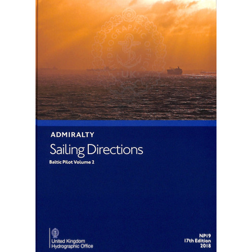




Navigate the southern Baltic and Gulf of Riga with expert sailing directions. Covers hazards, markings, ports, and weather for safe and efficient passage planning.
Data sheet
Specific References
Navigate the Baltic with Confidence Using Sailing Directions: Baltic Vol. 2
Sailing Directions: Baltic Vol. 2 is a critical navigational resource for merchant mariners operating in the southern Baltic Sea and the Gulf of Riga. Weighing 1.9 kg, this paper version publication provides comprehensive coverage of the region, including detailed information on navigational hazards, buoyage systems, pilotage procedures, and port facilities. Designed to complement standard nautical charts, it ensures safe and efficient passage planning for vessels of all types, from cargo ships to large ocean-going vessels.
Detailed Coverage for Professional Mariners
This publication offers an extensive overview of the southern Baltic Sea and the Gulf of Riga, with precise coordinates spanning latitudes from 53°N to 59.95°N and longitudes from 13.08°E to 26°E. It includes essential data on seasonal currents, ice limits, and climatic conditions, enabling mariners to anticipate and mitigate risks. The 16th edition (2014) is updated to reflect the latest maritime developments, ensuring that users have access to the most accurate and reliable information available.
Enhanced Situational Awareness with Visual Aids
Sailing Directions: Baltic Vol. 2 features high-quality diagrams and photographs, providing visual context to support passage planning and real-time decision-making. These visual aids enhance situational awareness, allowing mariners to better understand complex navigational environments and make informed choices. Whether navigating coastal waters or open seas, this resource equips professionals with the tools needed to ensure safe and efficient operations.
Designed for Merchant Shipping and Regulatory Compliance
Tailored to the needs of merchant shipping, this publication includes detailed information on port infrastructure, cargo handling facilities, and local maritime regulations. It supports compliance with international standards and industry best practices, ensuring that vessels operate safely and efficiently. The paper version is built for durability, making it a practical and reliable tool for onboard use, whether in port or at sea.
Sailing Directions: Baltic Vol. 2 is a paper version publication, weighing 1.9 kg, and is presented in English. This 16th edition (2014) covers the southern Baltic Sea and the Gulf of Riga, with precise coordinates ranging from latitudes 53°N to 59.95°N and longitudes 13.08°E to 26°E. Designed for professional mariners, it provides essential navigational data in a durable and easy-to-use format.
With a legacy of excellence in maritime navigation, this publisher is recognized globally for producing authoritative nautical publications. Their resources are trusted by professional mariners, shipping companies, and naval organizations worldwide, ensuring safe and efficient passage planning across all oceans. Each publication is meticulously updated to reflect the latest maritime developments, making them indispensable tools for modern navigation.
This volume covers the southern part of the Baltic Sea and the Gulf of Riga, including detailed navigation information for these regions.
Yes, the publication includes high-quality diagrams and photographs to enhance situational awareness during passage planning.
The paper version weighs 1.9 kg.
This is the 16th edition, published in 2014.
Yes, it includes information on seasonal currents, ice limits, and climatic conditions relevant to navigation.
Yes, it is designed for merchant navigators on all types of ocean-going vessels.
It offers details on port facilities, pilotage, and relevant regulations for safe navigation and docking.
You might also like


























































![Admiralty - NP054 - Sailing directions: North Sea [West]](https://www.nautic-way.com/68595-home_default/admiralty-np054-sailing-directions-north-sea-west-maritime-bookshop-nautic-way.jpg)
![Admiralty - NP055 - Sailing directions: North Sea [East]](https://www.nautic-way.com/90871-home_default/admiralty-np055-sailing-directions-north-sea-east-maritime-bookshop-nautic-way.jpg)





































































































