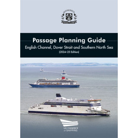
Navigate Indonesia’s Lombok and Sunda Straits with confidence using this detailed passage planning guide, covering TSS, PSSAs, VTS reporting, and more for seamless transits.
Data sheet
Specific References
Navigating the Lombok and Sunda Straits demands precision, local expertise, and up-to-date maritime intelligence. This guide delivers exactly that—a comprehensive, field-tested resource designed for captains, navigating officers, and vessel managers operating in one of the world’s most strategically important waterways. Developed in collaboration with Indonesia’s Ministry of Transportation, it reflects the latest regulatory frameworks, including the IMO-adopted Traffic Separation Schemes (TSS) implemented in July 2020, and the newly designated Particularly Sensitive Sea Area (PSSA) around Nusa Penida and Gili Matra Islands in the Lombok Strait. Every detail is tailored to enhance safety, compliance, and operational efficiency during transits in both directions.
This guide goes beyond basic navigation charts by integrating real-world operational insights. It covers essential passage planning practices, including traffic patterns, pilotage requirements, anchorage zones, Archipelagic Sea Lanes (ASL), tidal currents, and climatic conditions. Vessel Traffic Service (VTS) reporting protocols are clearly outlined, ensuring seamless communication with local authorities. The inclusion of annotated satellite maps highlights critical aids to navigation and potential hazards, while aerial photographs of Indonesian islands provide unmatched situational awareness. Bridge teams gain a visual reference of key landmarks along the transit route, reducing uncertainty and improving decision-making in high-traffic zones.
Preparedness is key to safe navigation, and this guide equips crews with actionable tools. A dedicated pre-entry bridge team meeting checklist ensures all critical factors—from weather conditions to equipment readiness—are reviewed before entering the straits. The guide’s structured approach aligns with industry best practices, making it an indispensable companion for vessels of all types, from container ships to tankers. Whether navigating the narrow passages of the Sunda Strait or the environmentally sensitive waters of the Lombok Strait, this resource provides the clarity and confidence needed to execute transits safely and efficiently.
Recognized as a standard reference for maritime professionals, this guide is regularly updated to reflect evolving regulations and local conditions. Its authoritative content is backed by collaboration with Indonesian maritime authorities, ensuring alignment with national and international standards. For shipping companies, vessel operators, and crew members, it represents a proactive investment in safety, compliance, and operational excellence in one of Southeast Asia’s most complex maritime environments.
Navigate Indonesia’s Critical Waterways with Confidence
The Lombok and Sunda Straits are among the most heavily trafficked and strategically vital maritime passages in Southeast Asia, demanding meticulous planning and local expertise. This guide is engineered to meet those challenges, offering captains, navigating officers, and vessel managers a complete, up-to-date resource for safe and compliant transits. With 78 pages of detailed insights, it combines regulatory compliance, operational best practices, and visual aids to ensure seamless navigation in both directions. Published in September 2025 and updated for the 2026-27 edition, it reflects the latest maritime regulations, including the IMO’s 2020 Traffic Separation Schemes (TSS) and the newly designated Particularly Sensitive Sea Area (PSSA) around Nusa Penida and Gili Matra Islands. Designed for professionals who cannot afford uncertainty, this guide transforms complex navigation into a structured, manageable process.
Precision Tools for High-Stakes Navigation
Beyond traditional charts, this guide provides a dynamic toolkit for real-world operations. Annotated satellite maps pinpoint critical aids to navigation and potential hazards, while aerial photographs of Indonesian islands offer unparalleled situational awareness. Tidal currents, climatic conditions, and Vessel Traffic Service (VTS) reporting requirements are clearly outlined, ensuring compliance with local and international standards. A pre-entry bridge team meeting checklist streamlines preparations, reducing the risk of oversights in high-pressure environments. Whether navigating the narrow confines of the Sunda Strait or the environmentally sensitive waters of the Lombok Strait, this guide delivers the clarity and confidence needed to execute transits safely and efficiently.
Built for Maritime Professionals, Backed by Authority
Developed in partnership with Indonesia’s Ministry of Transportation, this guide is more than a reference—it’s a trusted operational companion. Its content is regularly updated to reflect evolving regulations, local conditions, and industry best practices. For shipping companies, vessel operators, and crew members, it represents a proactive investment in safety, compliance, and operational excellence. With dimensions of 297 mm x 210 mm and a lightweight 0.8 kg, it’s designed for easy use on the bridge, ensuring critical information is always within reach when it matters most.
This guide is a printed, 78-page resource in English, published in September 2025 for the 2026-27 edition. It measures 297 mm in height and 210 mm in width, with a weight of 0.8 kg, making it practical for onboard use. The physical format ensures durability and ease of reference during transits through the Lombok and Sunda Straits.
With decades of expertise in maritime publications, this brand is a trusted name among shipping professionals worldwide. Specializing in navigation guides, regulatory updates, and operational resources, their products are developed in collaboration with maritime authorities and industry leaders. Known for accuracy, practicality, and alignment with international standards, their publications are essential tools for safe and efficient vessel operations.
The latest edition includes the Traffic Separation Schemes (TSS) adopted by the IMO in July 2020 and the new Particularly Sensitive Sea Area (PSSA) around Nusa Penida and Gili Matra islands in the Lombok Strait.
Yes, it provides detailed information on tidal currents, climate conditions, and other critical factors for safe passage planning.
Yes, the guide features annotated charts with satellite imagery highlighting navigational aids and potential hazards.
The physical book weighs 0.8 kg.
Yes, it includes a pre-entry bridge team meeting checklist to ensure preparedness.
The book measures 297 mm in height and 210 mm in width.
This edition was published in September 2025 and is valid for 2026-27.
You might also like