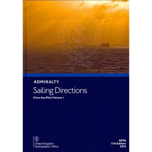




This 2024 sailing directions guide ensures safe navigation in the western South China Sea. Covers routes from Singapore Strait to Hong Kong, with detailed port and coastal information.
Data sheet
Specific References
Navigate the complex waters of the Western South China Sea with confidence using the Sailing Directions: China Sea Vol. 1. This comprehensive nautical publication is designed to provide mariners with critical, up-to-date information for safe and efficient passage planning, coastal navigation, and port entry. Covering high-traffic maritime routes from Tanjung Lompat in Malaysia to Zheland Yan in China, including key areas like the Anambas Islands, Hainan Island, and the bustling corridor between the Singapore Strait and Hong Kong, this guide is an indispensable tool for commercial shipping, offshore operations, and ocean-going vessels.
Used by captains, navigators, and maritime operators across the globe, this publication delivers authoritative insights directly from the United Kingdom Hydrographic Office. It is meticulously updated to reflect the latest navigational hazards, port developments, tidal patterns, and regulatory changes. Whether you're navigating through narrow straits, approaching busy ports, or transiting open waters, this guide ensures you have the most accurate and actionable information at your fingertips.
The Sailing Directions: China Sea Vol. 1 covers a vast and strategically important region, including major shipping lanes, offshore oil and gas fields, and key commercial ports. It provides detailed descriptions of coastlines, harbors, anchorages, and navigational aids, along with essential data on currents, weather patterns, and local regulations. This level of detail is crucial for route optimization, risk assessment, and compliance with international maritime standards.
Engineered for the rigors of professional maritime operations, this publication is built to withstand the challenges of life at sea. Its durable hardback format ensures longevity, even in harsh conditions, while its clear, concise language makes it easy to reference under pressure. As a complement to standard nautical charts, it offers an additional layer of situational awareness, helping crews make informed decisions in real time.
With regular updates and revisions, this guide remains a reliable source of information in an ever-changing maritime environment. The 2024 edition incorporates the latest hydrographic surveys, port infrastructure updates, and safety notices, ensuring that mariners have access to the most current data available. For vessels operating in the Western South China Sea, this publication is not just a reference—it’s a vital component of safe and efficient navigation.
Navigate the Western South China Sea with Precision and Confidence
The Sailing Directions: China Sea Vol. 1 is a must-have nautical publication for mariners operating in one of the world’s busiest and most complex maritime regions. Covering over 1,500 nautical miles of critical waterways—from the eastern coast of the Malay Peninsula to the shores of southern China—this guide provides unparalleled detail for safe passage planning, port entry, and coastal navigation. Whether you're transiting the Singapore Strait, navigating around Hainan Island, or approaching the ports of Hong Kong, this publication delivers the essential information needed to mitigate risks and optimize routes.
Engineered for Professional Mariners
Weighing 1.9 kg and presented in a durable hardback format, this publication is built to endure the demands of life at sea. Its 13th edition (2024) reflects the latest hydrographic data, port developments, and navigational updates, ensuring compliance with international maritime standards. The guide covers latitudes from 1.57°N to 25°N and longitudes from 99°E to 119°E, encompassing high-traffic zones, offshore installations, and key commercial hubs. With its clear, concise language and structured layout, it is designed for quick reference and easy integration into bridge operations.
Comprehensive Data for Informed Decision-Making
Beyond basic navigational instructions, this guide offers in-depth insights into local conditions, including tidal streams, weather patterns, and regulatory requirements. It details critical information on navigational hazards, such as shallow banks, wrecks, and restricted zones, as well as guidance on pilotage, anchoring, and port procedures. For vessels operating in the Western South China Sea, this publication is an indispensable tool for enhancing situational awareness and ensuring operational efficiency.
The Sailing Directions: China Sea Vol. 1 is a hardback nautical publication in English, weighing 1.9 kg. It covers the western South China Sea from Tanjung Lompat (Malaysia) to Zheland Yan (China), including the Anambas Islands, Hainan Island, and key routes between the Singapore Strait and Hong Kong. The 2024 edition (13th) is available in paper format and as a digital e-NP version, providing mariners with up-to-date navigational data for latitudes 1.57°N to 25°N and longitudes 99°E to 119°E.
With over two centuries of expertise in hydrography and maritime safety, the publisher behind this publication is a globally recognized authority in nautical information. Their publications are trusted by navies, commercial fleets, and offshore operators worldwide, setting the standard for accuracy, reliability, and compliance with international maritime regulations.
This volume covers the western part of the South China Sea, from Tanjung Lompat on the east side of the Malay Peninsula to Zheland Yan in China, including the Pulau-Pulau Anambas islands, Hainan Dao, and islands and banks along the main route from the Singapore Strait to Hong Kong.
Yes, this edition is available in both paper and digital (e-NP) formats.
The printed version weighs approximately 1.9 kg.
The paper version is hardback, ensuring durability for frequent use.
The latest edition is the 13th edition, published in 2024.
The guide provides comprehensive information on port entries, coastal navigation, and all aspects of safe navigation within the covered region.
Yes, the covered area spans latitudes from approximately 1.57°N to 25°N and longitudes from 99°E to 119°E.
You might also like



























































![Admiralty - NP054 - Sailing directions: North Sea [West]](https://www.nautic-way.com/68595-home_default/admiralty-np054-sailing-directions-north-sea-west-maritime-bookshop-nautic-way.jpg)
![Admiralty - NP055 - Sailing directions: North Sea [East]](https://www.nautic-way.com/90871-home_default/admiralty-np055-sailing-directions-north-sea-east-maritime-bookshop-nautic-way.jpg)




































































































