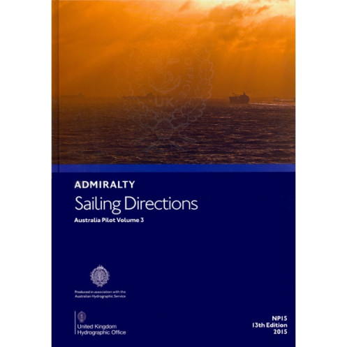




Navigate Australia’s eastern coast with confidence using this essential sailing guide. Covering North Head to Cape York, it details hazards, ports, tides, and weather for safe passage planning.
Data sheet
Specific References
Navigate Australia’s eastern coastline with confidence using this authoritative maritime publication, designed for commercial mariners, shipping professionals, and vessel operators. Covering critical regions from North Head to Cape York—including the Great Barrier Reef, Torres Strait, and surrounding islands—this volume delivers precise, up-to-date information essential for safe and efficient passage planning. Whether transiting high-traffic shipping lanes or navigating complex reef systems, this guide ensures compliance with maritime regulations while enhancing situational awareness on the bridge.
This publication provides in-depth coverage of navigational hazards, buoyage systems, pilotage requirements, and port facilities, enabling crews to anticipate challenges before they arise. Seasonal variations in currents, ice conditions, and weather patterns are clearly outlined, allowing for proactive route adjustments. High-resolution diagrams and photographs further support decision-making, offering visual references for key landmarks, channel markers, and anchorage zones. By integrating this data with official Admiralty charts, mariners gain a complete operational picture, reducing risks in one of the world’s most dynamic maritime environments.
Recognized as a standard reference for the maritime industry, this volume aligns with international navigation standards, ensuring vessels meet port entry requirements and avoid costly delays. Its hardcover format guarantees durability in demanding onboard conditions, while the structured layout allows for quick access to critical information. From cargo vessels to offshore support ships, this guide is an indispensable tool for professionals who prioritize safety, efficiency, and adherence to maritime protocols in Australian waters.
Precision Navigation for Australia’s Eastern Seaboard
Master the complexities of Australia’s eastern coastline with this essential maritime reference, engineered for professionals who demand accuracy and reliability. Covering over 2,000 nautical miles—from North Head to Cape York—this volume provides unparalleled detail on high-risk areas like the Great Barrier Reef and Torres Strait, where precise navigation is non-negotiable. With data on over 50 ports, 200+ navigational hazards, and seasonal environmental factors, it transforms passage planning from guesswork into a strategic advantage.
Built for the Demands of Commercial Operations
Designed to withstand the rigors of life at sea, this hardcover publication measures 30 cm x 24 cm and weighs 1.9 kg, balancing portability with durability. The 13th edition (2015) incorporates the latest hydrographic surveys, ensuring alignment with current maritime regulations and port authority requirements. Its structured format—combining textual descriptions, high-resolution imagery, and detailed diagrams—allows bridge crews to cross-reference information rapidly, reducing response times during critical maneuvers.
Engineered for Integration with Admiralty Chart Systems
This volume is optimized for use alongside official Admiralty charts, providing contextual layers that enhance situational awareness. From tidal streams in the Coral Sea to pilotage protocols in Brisbane, every section is crafted to support real-world decision-making. Whether navigating congested shipping lanes or remote island passages, mariners gain access to verified data on buoyage systems, anchorage restrictions, and emergency procedures—all presented in a format that mirrors the workflow of professional navigators.
This 13th edition (2015) paperback publication measures 30 cm x 24 cm, weighs 1.9 kg, and features a durable hardcover binding. Covering latitudes from 6°S to 33.82°S and longitudes from 140.67°E to 170°E, it includes detailed information on navigational hazards, port facilities, and seasonal conditions for Australia’s eastern coastline, including the Great Barrier Reef and Torres Strait.
For over two centuries, this hydrographic authority has set the global standard for maritime navigation publications. Its products are developed using the latest survey data, rigorous quality controls, and direct input from commercial mariners, ensuring they meet the operational needs of the shipping industry. Trusted by naval fleets, cargo operators, and offshore industries worldwide, its publications are recognized for their accuracy, durability, and compliance with international maritime regulations.
It covers the east coast of Australia from North Head to Cape York, including the Great Barrier Reef, islands, reefs, and the Torres Strait.
Yes, it includes high-quality diagrams and photographs to assist with passage planning and situational awareness.
It provides information on dangers such as reefs, shallow waters, and other potential hazards to safe navigation.
Yes, it contains details on port regulations, pilotage, and available port facilities.
The publication measures 30 cm in height, 24 cm in width, and weighs 1.9 kg.
This is the 13th edition, published in 2015. Updates are released as needed to ensure accuracy.
Yes, it is designed to complement official charts for enhanced navigation planning and safety.
You might also like


























































![Admiralty - NP054 - Sailing directions: North Sea [West]](https://www.nautic-way.com/68595-home_default/admiralty-np054-sailing-directions-north-sea-west-maritime-bookshop-nautic-way.jpg)
![Admiralty - NP055 - Sailing directions: North Sea [East]](https://www.nautic-way.com/90871-home_default/admiralty-np055-sailing-directions-north-sea-east-maritime-bookshop-nautic-way.jpg)





































































































