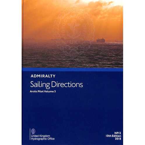




Navigate Arctic waters safely with this guide covering Davis Strait, Baffin Bay, and Greenland’s coasts. Includes hazards, weather, and port details for confident voyages in polar regions.
Data sheet
Specific References
Navigate the Arctic with Confidence Using Arctic Sailing Directions Volume 3
Arctic Sailing Directions Volume 3 is a cornerstone publication for commercial mariners navigating the remote and hazardous waters of the Arctic. Covering the Davis Strait, Baffin Bay, Greenland’s western and northwestern coasts, and Canada’s northern shoreline—including Hudson Bay and the Arctic Archipelago—this volume provides unparalleled guidance for vessels operating in one of the most challenging maritime environments. With a focus on safety and operational efficiency, it delivers detailed information on navigation hazards, buoyage systems, meteorological conditions, and pilotage requirements, ensuring that captains and crews can make informed decisions in real time.
Engineered for Professional Use in Extreme Conditions
Designed specifically for merchant vessels, this publication addresses the unique demands of Arctic navigation, where ice, limited infrastructure, and unpredictable weather pose constant challenges. It includes comprehensive port entry guides, descriptions of harbor facilities, and updates on local maritime regulations, enabling seamless compliance and operational planning. The 9th edition (2012) integrates the latest hydrographic data, offering a reliable foundation for voyage preparation and execution. Weighing just 1.9 kg, its lightweight, watermarked paper ensures durability without compromising portability, making it an ideal companion for the bridge.
Enhanced with Visual Aids for Precision Navigation
To support accurate decision-making, Arctic Sailing Directions Volume 3 features high-quality color photographs and coastal views, allowing mariners to visually confirm landmarks and identify potential hazards. These visual aids complement the detailed textual descriptions, providing an additional layer of clarity for navigating complex or poorly charted areas. Whether used alongside standard nautical charts or as a standalone reference, this volume equips professionals with the tools needed to mitigate risks and optimize routes in the Arctic’s dynamic and often unforgiving waters.
A Global Standard for Arctic Maritime Operations
As part of a 74-volume series covering the world’s oceans, this publication reflects decades of hydrographic expertise and a commitment to maritime safety. It is trusted by shipping companies, naval fleets, and commercial operators who rely on its accuracy and comprehensiveness. For vessels traversing the Arctic, Arctic Sailing Directions Volume 3 is more than a guide—it’s an essential resource for ensuring safe, efficient, and compliant navigation in one of the planet’s most extreme environments.
Arctic Sailing Directions Volume 3 is a paperback publication in English, weighing 1.9 kg, designed for professional maritime use. The 9th edition (2012) covers critical Arctic regions, including the Davis Strait, Baffin Bay, Greenland’s western and northwestern coasts, and Canada’s northern coastline from Baffin Bay to Alaska. Printed on lightweight, watermarked paper for durability, it includes high-resolution color photographs and coastal views to aid navigation. The volume spans latitudes from 47°N to 85°N and longitudes from 33.83°W to 141°W, providing comprehensive coverage for vessels operating in these high-latitude waters.
With a legacy spanning over two centuries, this publisher is a global leader in hydrographic data and maritime navigation resources. Renowned for its precision and reliability, it provides essential tools for commercial shipping, naval operations, and offshore industries worldwide. Its publications, including a 74-volume series of sailing directions, are trusted by mariners for their accuracy, comprehensive coverage, and adherence to the highest standards of maritime safety.
This volume covers the Davis Strait, Baffin Bay, the west and northwest coasts of Greenland, and the northern coast of Canada from Baffin Bay to Alaska, including Hudson Bay and the Arctic Archipelago.
Yes, it is designed for merchant vessels of all classes navigating Arctic waters.
It is printed on lightweight chart paper, watermarked by the UK Hydrographic Office.
Yes, it includes high-quality color photographs and views to assist with navigation.
The latest edition available is the 9th edition, published in 2012. Updates depend on new hydrographic data and navigational changes.
The publication weighs approximately 1.9 kilograms.
Yes, the publication includes detailed information on local regulations relevant to Arctic navigation.
You might also like


























































![Admiralty - NP054 - Sailing directions: North Sea [West]](https://www.nautic-way.com/68595-home_default/admiralty-np054-sailing-directions-north-sea-west-maritime-bookshop-nautic-way.jpg)
![Admiralty - NP055 - Sailing directions: North Sea [East]](https://www.nautic-way.com/90871-home_default/admiralty-np055-sailing-directions-north-sea-east-maritime-bookshop-nautic-way.jpg)