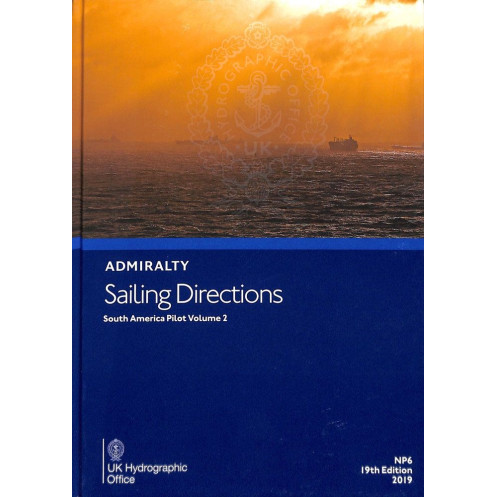




Navigate South America’s coastal waters with confidence. This guide delivers vital port entry details, weather data, and navigation hazards for merchant vessels, ensuring safety and efficiency.
Data sheet
Specific References
Navigate the complex coastal regions of South America with confidence using this essential maritime reference. Designed for commercial vessels of all sizes, this publication delivers critical insights for safe port entry and coastal navigation along South America’s eastern and southern shores. It bridges the gap between nautical charts and real-world conditions, offering practical, up-to-date information tailored to the needs of professional mariners.
This volume provides a detailed overview of navigational hazards, including reefs, shoals, and submerged obstacles, ensuring vessels can avoid risks while maintaining optimal routes. It includes precise buoyage and marking systems, helping crews identify key waypoints and channels with accuracy. Weather patterns, tidal currents, and seasonal variations are also documented, allowing for better voyage planning and risk mitigation in dynamic maritime environments.
Gain access to vital details on pilotage services, port regulations, and local maritime laws, ensuring compliance with regional requirements. The publication outlines port facilities, including berth availability, cargo handling capabilities, and repair services, enabling efficient logistical planning. Step-by-step guidance for entering major ports simplifies complex maneuvers, reducing delays and enhancing operational safety.
As part of a global collection of 74 volumes, this publication is meticulously maintained to align with the latest hydrographic data. It complements standard nautical charts by providing contextual information that charts alone cannot convey, such as local customs, communication protocols, and emergency procedures. This ensures that mariners have a complete toolkit for navigating one of the world’s most challenging maritime regions.
Engineered for the demands of commercial shipping, this reference is an indispensable resource for captains, navigators, and maritime operators. Its structured format allows for quick access to critical information, whether planning a voyage or making real-time decisions at sea. With a focus on accuracy and usability, it supports compliance with international maritime standards while enhancing operational efficiency.
Navigate South America’s Coastal Waters with Precision and Confidence
Sailing Directions: South America Vol. 2 is a vital printed resource for mariners navigating the eastern and southern coasts of South America. Weighing 1.30 kg, this 2025 edition (20th release) is published by the UK Hydrographic Office and provides authoritative guidance for safe port entry, coastal navigation, and hazard avoidance. Designed to complement nautical charts, it delivers real-world insights that charts alone cannot offer, making it an indispensable tool for commercial vessels operating in the region.
Critical Data for Safe and Efficient Voyages
This hardcover publication covers a vast area, spanning latitudes from -58° to -46.4° and longitudes from -50° to -100°. It includes detailed information on navigational dangers such as reefs, shoals, and submerged obstacles, along with buoyage systems, weather patterns, and tidal currents. Mariners will find step-by-step port entry guides, pilotage details, and local regulations, ensuring compliance and reducing risks in unfamiliar waters.
Trusted by Maritime Professionals Worldwide
As part of a global collection of 74 volumes, this publication is meticulously updated to reflect the latest hydrographic data. It serves as a reliable companion for captains, navigators, and maritime operators, offering contextual information that enhances decision-making. Whether planning a voyage or navigating in real time, this resource ensures operational efficiency and adherence to international maritime standards.
This printed publication, published in 2019 and updated for the 2025 edition, is a hardcover reference in English. It covers South America’s eastern and southern coasts, with detailed geographic coverage between latitudes -58° to -46.4° and longitudes -50° to -100°. Weighing 1.30 kg, it is designed for durability and ease of use on commercial vessels.
With over two centuries of expertise in maritime navigation, the publisher is a globally recognized authority in hydrographic data and nautical publications. Their comprehensive collection of sailing directions and charts is trusted by commercial fleets, naval forces, and maritime professionals worldwide, ensuring safe and efficient navigation across the globe.
This volume covers coastal and port entry information for South America, specifically between latitudes 58°S to 46.4°S and longitudes 50°W to 100°W.
Yes, it is designed for merchant vessels of all classes, providing essential navigation and port entry details.
New editions are typically released periodically to ensure updated navigation and port information. The latest edition is from 2025.
Yes, it provides meteorological data relevant to coastal and port navigation in the covered regions.
This publication is bound in a hardcover format for durability and ease of use on board.
Yes, it includes port regulations and guidelines for safe and compliant entry into major ports.
You might also like


























































![Admiralty - NP054 - Sailing directions: North Sea [West]](https://www.nautic-way.com/68595-home_default/admiralty-np054-sailing-directions-north-sea-west-maritime-bookshop-nautic-way.jpg)
![Admiralty - NP055 - Sailing directions: North Sea [East]](https://www.nautic-way.com/90871-home_default/admiralty-np055-sailing-directions-north-sea-east-maritime-bookshop-nautic-way.jpg)





































































































