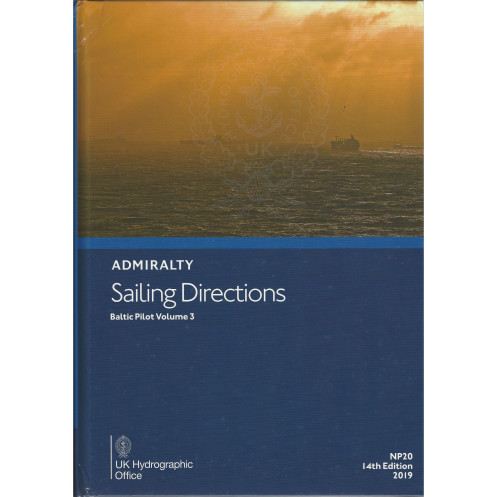




Navigate the Baltic safely with this trusted guide. It details hazards, port facilities, weather, and ice conditions for the Gulf of Finland, Gulf of Bothnia, and Åland Islands.
Data sheet
Specific References
Navigate the Baltic Sea with Confidence Using Sailing Directions: Baltic Vol. 3
Sailing Directions: Baltic Vol. 3 is the definitive navigational reference for mariners operating in the Baltic Sea’s most critical regions, including the Gulf of Finland, Gulf of Bothnia, and Åland Islands. This publication bridges the gap between nautical charts and real-world navigation, offering actionable insights that enhance safety, efficiency, and compliance. Whether you’re a captain, navigator, or maritime professional, this volume provides the detailed guidance needed to navigate complex waterways, avoid hazards, and optimize voyage planning in one of Europe’s busiest maritime corridors.
Precision-Engineered for Maritime Professionals
Weighing 1.9 kg, this hardback edition is built to endure the demands of onboard use, from frequent handling to exposure to marine environments. Its structured format ensures quick access to vital information, including buoyage systems, pilotage requirements, and port facilities. The 15th edition (2022) incorporates the latest hydrographic data, ensuring mariners have the most up-to-date information for safe and efficient navigation. With coverage spanning latitudes 59°N to 69°N and longitudes 11°E to 35°E, this volume is tailored to the unique challenges of the Baltic Sea, from seasonal ice to dense commercial traffic.
Comprehensive Data for Every Phase of Navigation
Beyond basic navigational aids, this publication delivers in-depth analysis of local conditions, including seasonal currents, ice formation, and climatic patterns. It outlines port entry procedures, regulatory requirements, and communication protocols, ensuring compliance with local maritime laws. Detailed descriptions of navigational hazards—such as shallow waters, submerged obstacles, and restricted zones—enable crews to plan routes with precision, reducing the risk of incidents. Whether navigating commercial vessels, cargo ships, or specialized maritime operations, this volume is an indispensable tool for mitigating risks and optimizing performance.
Trusted by the Global Maritime Community
As part of the Admiralty’s Sailing Directions series, this publication is recognized worldwide for its accuracy, reliability, and adherence to international standards. It complements nautical charts by providing contextual insights that charts alone cannot offer, such as recommended tracks, anchorage points, and real-world best practices. Regular updates ensure that mariners have access to the latest hydrographic data, making this volume a cornerstone of maritime safety and operational excellence. For professionals who demand nothing less than the best, Sailing Directions: Baltic Vol. 3 is the ultimate navigational resource.
Sailing Directions: Baltic Vol. 3 is a hardback publication in English, weighing 1.9 kg, designed for durability and frequent onboard use. The 15th edition (2022) covers critical regions of the Baltic Sea, including the Gulf of Finland, Gulf of Bothnia, and Åland Islands, with precise geographic coordinates spanning latitudes 59°N to 69°N and longitudes 11°E to 35°E. Published on August 18, 2022, this volume provides up-to-date navigational data, hazard descriptions, and regulatory information essential for safe and compliant maritime operations.
With a legacy spanning over two centuries, the publisher behind this publication is a global leader in hydrographic data and maritime safety. Renowned for its accuracy, reliability, and adherence to international standards, the brand’s navigational resources are trusted by mariners, shipping companies, and naval organizations worldwide. Its comprehensive series of sailing directions and nautical charts set the benchmark for maritime navigation, ensuring professionals have access to the most current and precise information available.
This volume covers the Gulf of Finland, the Gulf of Bothnia, and the Åland Islands, including detailed coastal navigation and port entry information for these regions.
Yes, the publication includes comprehensive information on seasonal currents, ice conditions, and climatic factors affecting navigation in the covered areas.
The paper version is hardback, ensuring durability for frequent use in marine environments.
No, this edition is only available in English.
The publication weighs approximately 1.9 kilograms.
Yes, it provides details on local navigation regulations, pilotage, and buoyage systems relevant to the covered regions.
The latest edition is the 15th, published on August 18, 2022.
You might also like


























































![Admiralty - NP054 - Sailing directions: North Sea [West]](https://www.nautic-way.com/68595-home_default/admiralty-np054-sailing-directions-north-sea-west-maritime-bookshop-nautic-way.jpg)
![Admiralty - NP055 - Sailing directions: North Sea [East]](https://www.nautic-way.com/90871-home_default/admiralty-np055-sailing-directions-north-sea-east-maritime-bookshop-nautic-way.jpg)





































































































