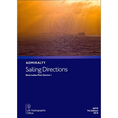




Plan your voyage through the West Indies with this trusted nautical guide. Includes ports, navigation hazards, tides, and climate insights for Bermuda, Cuba, and the Bahamas—ideal for safe sailing.
Data sheet
Specific References
Navigate the Western Caribbean with confidence using this comprehensive sailing directions guide, designed for professional mariners and commercial vessels. Covering critical regions from the Bahamas to the Cayman Islands, this publication delivers authoritative, up-to-date information to ensure safe and efficient voyages. Whether entering ports, avoiding hazards, or planning coastal routes, this guide is an indispensable tool for maritime operations in the region.
This volume provides detailed insights into key areas, including the Bahamas, Turks and Caicos, the Florida Strait, Cuba, Hispaniola, Jamaica, and the Cayman Islands. It includes vital data on navigation dangers, buoyage systems, pilotage procedures, port regulations, and seasonal currents. With high-quality diagrams and photographs, mariners gain a clear visual understanding of complex waterways, enhancing decision-making during transit and port entry.
Published by a leading hydrographic authority, this guide adheres to the highest standards of accuracy and reliability. The 2021 edition reflects the latest hydrographic surveys, regulatory updates, and environmental conditions, ensuring mariners have the most current information at their fingertips. Printed on durable, watermarked chart paper, this hardback edition is built to withstand the demands of onboard use, making it a dependable resource for commercial fleets and professional navigators.
Tailored for the maritime industry, this publication supports a wide range of vessels, from cargo ships to passenger liners. It includes critical details on port facilities, local regulations, and climatic conditions, enabling operators to streamline logistics and comply with regional requirements. By integrating this guide into voyage planning, mariners can mitigate risks, reduce delays, and enhance operational efficiency in one of the world’s busiest maritime corridors.
As part of a broader series of sailing directions, this volume complements other Admiralty publications, providing a cohesive navigation system for the Caribbean. Its structured format allows for quick reference, while its comprehensive coverage ensures no detail is overlooked. Whether navigating shallow waters, congested shipping lanes, or unfamiliar ports, this guide equips mariners with the knowledge needed to operate safely and effectively.
Navigate the Western Caribbean with Unmatched Precision
This essential sailing directions guide delivers critical navigation data for the Western Caribbean, covering high-traffic regions from the Bahamas to the Cayman Islands. Designed for professional mariners, it provides the latest hydrographic intelligence to support safe and efficient voyages, whether entering ports, avoiding hazards, or planning coastal routes. With its 2021 edition, this publication ensures access to the most current information, making it a cornerstone resource for commercial fleets and maritime operators.
Comprehensive Coverage for Complex Waterways
From the Florida Strait to Hispaniola, this guide offers in-depth details on navigation dangers, buoyage systems, pilotage requirements, and port regulations. It also includes seasonal currents, climatic conditions, and high-quality diagrams to enhance situational awareness. Mariners can rely on this publication to navigate challenging areas with confidence, reducing risks and optimizing route planning for vessels of all sizes.
Built for Durability and Onboard Use
Printed on watermarked, lightweight chart paper and bound in a durable hardback format, this guide is engineered to withstand the rigors of maritime environments. Weighing 1.25 kg, it strikes a balance between portability and robustness, ensuring it remains a reliable reference throughout extended voyages. Its physical design prioritizes ease of use, allowing quick access to critical information when it matters most.
Trusted by Maritime Professionals Worldwide
With a legacy dating back to 1859, this publication is part of a globally recognized series trusted by commercial fleets, naval operations, and maritime authorities. The 2021 edition reflects the latest hydrographic surveys and regulatory updates, ensuring compliance with international standards. By integrating this guide into their navigation toolkit, mariners gain a competitive edge in operational efficiency and safety.
This sailing directions guide provides authoritative navigation data for the Western Caribbean, including the Bahamas, Turks and Caicos, Cuba, Hispaniola, Jamaica, and the Cayman Islands. The 2021 edition (8th) is printed in English on durable, watermarked chart paper and bound in a hardback format for onboard use. Weighing 1.25 kg, it covers latitudes from 15°N to 28.47°N and longitudes from -84.52°W to -50°W, ensuring comprehensive coverage of critical maritime routes.
With over two centuries of expertise in hydrography and maritime navigation, this publisher is a global leader in providing accurate, up-to-date nautical publications. Renowned for their precision and reliability, their sailing directions are trusted by commercial fleets, naval operations, and maritime authorities worldwide, ensuring safe and efficient navigation in even the most challenging waters.
This volume covers the Western Indies, including Bermuda, the Bahamas, Turks and Caicos Islands, the Florida Strait and the Cayes, Hispaniola, Cuba, Jamaica, and the Cayman Islands.
The publication uses light chart paper, supplied and watermarked by the UK Hydrographic Office.
Yes, it includes high-quality diagrams and photographs to assist with route planning and coastal navigation.
The publication weighs approximately 1.25 kg.
Yes, it provides information on seasonal currents, ice conditions, and climatic factors relevant to navigation.
Yes, it is designed for port entry and coastal navigation for all types of ships.
The most recent edition available is the 8th Edition, published in 2021.
You might also like



























































![Admiralty - NP054 - Sailing directions: North Sea [West]](https://www.nautic-way.com/68595-home_default/admiralty-np054-sailing-directions-north-sea-west-maritime-bookshop-nautic-way.jpg)
![Admiralty - NP055 - Sailing directions: North Sea [East]](https://www.nautic-way.com/90871-home_default/admiralty-np055-sailing-directions-north-sea-east-maritime-bookshop-nautic-way.jpg)




































































































