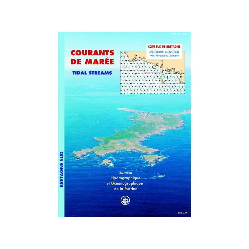




This tidal currents atlas covers southern Brittany, from Audierne to Le Croisic, with hourly maps for spring and neap tides. Perfect for safe navigation, fishing, and diving.
Data sheet
Specific References
Navigate the challenging waters of Southern Brittany with confidence using this comprehensive tidal current atlas. Designed for mariners, this publication provides hourly tidal current charts for both spring and neap tides, ensuring you have the most accurate data for safe and efficient voyages. Whether you're a commercial vessel operator, a competitive sailor, or a recreational boater, this atlas is your key to mastering the dynamic currents of the region.
This atlas covers the entire Southern Brittany coastline, from Audierne to Le Croisic, including critical sectors such as Penmarc’h, Groix - Lorient, Quiberon Bay, and the Gulf of Morbihan. Each sector is meticulously mapped with 12 detailed charts, offering a complete overview of tidal currents at one-hour intervals. The Mercator projection ensures accurate spatial representation, making it easier to plan your route and anticipate changes in current patterns.
Developed by experts in hydrodynamic modeling, this atlas is based on precise data, including tidal patterns, bathymetry, and current measurements. It is an indispensable resource for professionals in maritime transport, fishing, and environmental studies, as well as for sailors, divers, and regatta participants. The atlas provides critical insights for projects such as marine discharge planning, port developments, and coastal engineering, ensuring compliance with safety and environmental standards.
With a focus on practicality, this atlas presents tidal currents in a clear and accessible format. The resolution varies from 50 meters to 1 kilometer, depending on the area, with finer details provided for complex zones like the Gulf of Morbihan. The semi-diurnal tide cycle is fully accounted for, allowing you to adapt your navigation strategy to both spring and neap tides. Whether you're navigating narrow channels or open waters, this atlas equips you with the knowledge to make informed decisions.
This paperback edition is designed for durability, with a sturdy construction that withstands the rigors of onboard use. Weighing just 1 kg, it is lightweight and easy to handle, making it a practical addition to any vessel’s navigation library. While a digital version is available, many mariners prefer the reliability of a physical atlas, especially in environments where electronic devices may fail. This publication remains valid indefinitely, ensuring it remains a trusted resource for years to come.
Master the Tides of Southern Brittany with Unrivaled Precision
Navigating the waters of Southern Brittany demands more than just skill—it requires accurate, up-to-date data on tidal currents. This tidal current atlas delivers just that, offering mariners a detailed and reliable resource for understanding the dynamic currents between Audierne and Le Croisic. Whether you're charting a course for commercial shipping, planning a regatta, or ensuring the safety of your crew, this atlas provides the critical information you need to navigate with confidence.
Engineered for Accuracy and Practicality
This atlas is the result of advanced hydrodynamic modeling, combining tidal data, bathymetry, and expert analysis to create a precise representation of tidal currents. Each of the four key sectors—Penmarc’h, Groix - Lorient, Quiberon Bay, and the Gulf of Morbihan—is covered by 12 hourly charts, allowing you to visualize current patterns at any stage of the tide. The Mercator projection ensures spatial accuracy, while the resolution varies from 50 meters in complex areas to 1 kilometer in open waters, providing the level of detail required for safe navigation.
Designed for Professionals and Enthusiasts Alike
From commercial mariners to recreational sailors, this atlas is an indispensable tool for anyone navigating Southern Brittany’s waters. It is particularly valuable for professionals involved in maritime transport, fishing, and environmental studies, offering data that supports projects like marine discharge planning and port development. For competitive sailors and divers, the atlas provides the insights needed to optimize performance and ensure safety. With its clear, easy-to-read format, it is equally useful for seasoned navigators and those new to the region.
Built to Withstand the Demands of Onboard Use
This paperback edition is designed for durability, with a robust construction that ensures it remains a reliable resource even in challenging conditions. Weighing just 1 kg, it is lightweight and easy to store, making it a practical addition to any vessel’s navigation library. While a digital version is available, many mariners prefer the dependability of a physical atlas, especially in situations where electronic devices may not be an option. With no expiration date, this atlas remains a trusted companion for all your maritime adventures.
This tidal current atlas provides comprehensive coverage of Southern Brittany’s coastal waters, from Audierne to Le Croisic, with detailed hourly charts for spring and neap tides. It includes 12 charts per sector, covering key areas such as Penmarc’h, Groix - Lorient, Quiberon Bay, and the Gulf of Morbihan. The atlas uses a Mercator projection for spatial accuracy and offers high-resolution data, with finer details for complex zones. Published in 2005, this paperback edition weighs 1 kg and remains valid indefinitely.
With a legacy rooted in maritime expertise, this publisher is a trusted authority in hydrography and oceanography. Specializing in navigation aids, tidal data, and hydrodynamic modeling, their publications are designed to meet the needs of professional mariners, researchers, and recreational sailors. Each product is crafted with precision, ensuring reliability and accuracy for safe and efficient navigation.
The spatial resolution varies from 50 to 150 meters inside the Gulf of Morbihan and from 400 to 1000 meters around its edges.
The atlas represents two tide conditions: mean spring tides and mean neap tides.
Each current chart is spaced at one-hour intervals.
Yes, it provides crucial data for environmental studies, such as marine discharge projects or port developments.
The maps use a Mercator projection.
The atlas covers four geographic sectors: Penmarc’h, Groix - Lorient, Quiberon Bay, and the Gulf of Morbihan.
Yes, it is available in a paper version and also as a digital PDF.
You might also like