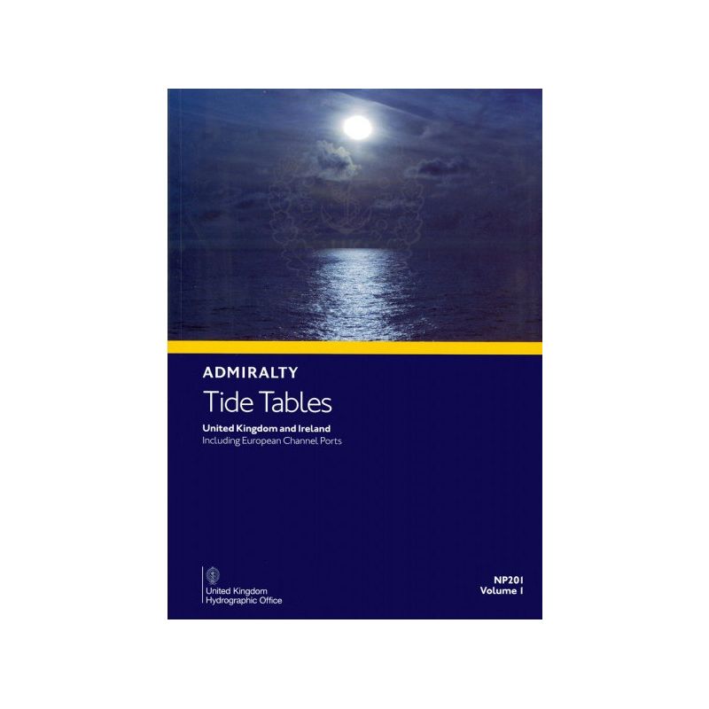


Admiralty - NP201 - Tide Tables Vol 1 United Kingdom and Ireland
search
  • googlemap
  • Admiralty - NP201 - Tide Tables Vol 1 United Kingdom and Ireland

Admiralty - NP201 - Tide Tables Vol 1 United Kingdom and Ireland

€79.80
Tax included
Admiralty - United Kingdom Hydrographic Office
In English language
Estimated preparation time: 5 to 14 days

Accurate tide predictions for the UK and Ireland, covering 230+ primary and 6,000 secondary ports. Includes heights, times, and tidal insights for safer, precise navigation.

NP201

Data sheet

Who is the publisher or the author?
Admiralty
On what digital medium is this nautical chart / book stored?
paper medium
From which year does this nautical chart date?
2026
What type of navigation book is this?
tide tables
What is the size?
paper medium
Picto
In English language

Specific References

UPC
400000062730
EAN13
4000000107743
New
Description détaillée

Tide Tables Vol 1 United Kingdom and Ireland

Publication in English
Printed version

Essential Data for Safe and Efficient Navigation

Plan your voyages with precision using this comprehensive tide table, designed to provide mariners with accurate tidal predictions for over 230 standard ports and 6,000 secondary locations across the United Kingdom, Ireland, and key international waters. Whether navigating coastal routes or preparing for port arrivals, this publication delivers the critical data needed to optimize passage planning and ensure safety at sea.

Comprehensive Tidal Predictions for Professional Mariners

This publication is an indispensable tool for commercial shipping, fishing fleets, and maritime professionals requiring reliable tidal information. It includes daily high and low water times and heights, enabling precise calculations for vessel draft, under-keel clearance, and optimal transit windows. With coverage extending to Europe, the Indian Ocean, the South China Sea, and the Pacific, it supports operations across diverse maritime regions.

Advanced Tidal Analysis and Practical Guidance

Beyond raw data, this volume explains tidal prediction methods, the impact of meteorological conditions on tides, and exceptional tidal factors specific to each zone. These insights help mariners anticipate anomalies and adjust their strategies accordingly, reducing risks associated with unpredictable tidal behavior.

Trusted by the Global Maritime Industry

Recognized as a standard reference for professional navigation, this tide table is distributed worldwide through official maritime distributors. Its structured format ensures quick access to information, while its annual updates guarantee the most current data for the year. Ideal for vessels operating in UK and Irish waters, it remains a cornerstone of maritime planning and operational safety.

Optimized for Professional Use

Designed for durability and ease of use, this printed edition is tailored to withstand the demands of onboard environments. Its clear layout and detailed port listings make it a practical resource for bridge teams, port authorities, and maritime logistics planners. Whether used for routine voyages or complex tidal calculations, it delivers the accuracy and reliability required by today’s maritime professionals.


Unmatched Precision for Tidal Planning in UK and Irish Waters
Navigate with confidence using this authoritative tide table, offering unparalleled coverage of tidal patterns across the United Kingdom, Ireland, and beyond. Designed for professional mariners, this publication provides daily predictions for high and low water times and heights at over 230 standard ports and 6,000 secondary locations, ensuring accurate planning for safe and efficient voyages.

Engineered for Maritime Professionals
This printed volume is a critical resource for commercial shipping, fishing operations, and port authorities, delivering essential data for draft management, under-keel clearance, and optimal transit scheduling. Its comprehensive scope includes key international waters, such as Europe, the Indian Ocean, the South China Sea, and the Pacific, making it a versatile tool for global maritime operations.

Beyond Predictions: Expert Insights for Informed Decision-Making
More than just a tide table, this publication offers in-depth guidance on tidal prediction methodologies, the influence of weather conditions on tides, and regional tidal anomalies. These insights empower mariners to anticipate and mitigate risks, ensuring safer and more efficient navigation in dynamic maritime environments.

Built for Durability and Onboard Use
Weighing 1.9 kg, this printed edition is designed to endure the rigors of onboard use, with a robust format that ensures longevity. Its clear, structured layout allows for quick reference, while its annual update cycle guarantees access to the most current tidal data for the year. Trusted by mariners worldwide, it remains an indispensable tool for professional navigation.

This printed tide table provides daily tidal predictions for over 230 standard ports and 6,000 secondary locations, covering the United Kingdom, Ireland, and key international waters. It includes high and low water times and heights, tidal stream data, and expert guidance on prediction methods and meteorological influences. Updated annually, it ensures mariners have access to the latest tidal information for safe and efficient navigation.

For over two centuries, this organization has been a global leader in maritime data and hydrographic services, providing essential navigation resources to commercial and military fleets worldwide. Renowned for accuracy and reliability, their publications are trusted by mariners, port authorities, and maritime professionals for safe and efficient voyage planning.

  • This tide table offers unmatched coverage of tidal predictions for UK and Irish waters, including over 6,000 ports, with expert insights on tidal behavior and meteorological impacts.
  • Its durable printed format ensures reliability in onboard environments, while annual updates guarantee the most current data for professional maritime operations.
  • Ideal for commercial shipping, fishing fleets, and port authorities, it enhances safety and efficiency in tidal planning and navigation.
What areas are covered beyond the United Kingdom and Ireland?

The tables include tide predictions for ports in Europe, the Indian Ocean, the South China Sea, and the Pacific Ocean.

How often are the tide predictions updated in this edition?

The predictions are provided for every day of the year, based on the 2026 edition.

Are tidal currents included in the data provided?

Yes, the tables include tidal currents along with high and low tide times and heights for planning port arrivals and departures.

What is the difference between standard and secondary ports?

Standard ports (over 230) have direct tide predictions, while secondary ports (around 6,000) rely on calculations based on nearby standard ports.

Does this edition cover the Isles of Scilly?

No, the Isles of Scilly are excluded from the coverage in this volume.

How does weather affect the tide predictions in these tables?

The tables describe how weather conditions can influence tides and provide guidance on accounting for these variations.

What is the weight of the printed volume?

The printed edition weighs approximately 1.9 kg.

Loading...