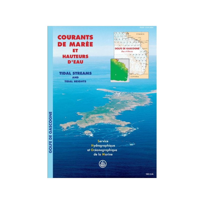


Shom - 565-UJA - courant de marée : Golfe de Gascogne
search
  • googlemap
  • Shom - 565-UJA - courant de marée : Golfe de Gascogne

Shom - 565-UJA - courant de marée : Golfe de Gascogne

€42.40
Tax included
Shom - Service Hydrographique et Océanographique de la Marine
In French language
Estimated preparation time: 0 to 5 days

Navigate the Bay of Biscay with precision using this tidal currents atlas, mapping hourly currents for mean spring and neap tides. Essential for sailors, fishermen, and environmental studies.

shom-565UJA

Data sheet

Who is the publisher or the author?
Shom
On what digital medium is this nautical chart / book stored?
paper medium
From which year does this nautical chart date?
2002
What type of navigation book is this?
tidal currents
What is the size?
paper medium
Picto
In French language

Specific References

UPC
400000064376
EAN13
4000000180746
New
Description détaillée

Tidal Currents Atlas: Bay of Biscay

Publication in French
Printed book version

Essential Navigation Tool for Atlantic Waters

Navigate the Atlantic coast with confidence using this comprehensive tidal currents atlas covering the Bay of Biscay from Brest to Saint-Jean-de-Luz. Designed for professional mariners, this printed reference provides hourly tidal current data for both mean spring tides (coefficient 95) and mean neap tides (coefficient 45), enabling precise voyage planning and safe navigation in these dynamic waters.

Precision Data for Professional Operations

  • Detailed Mercator projection charts showing current fields at each hour of the tidal cycle
  • Clear representation of semi-diurnal tidal patterns characteristic of the region
  • Contour lines indicating equal water heights for accurate depth assessment
  • Comprehensive coverage of the entire Atlantic coastline from Brittany to the Spanish border
  • Professional-grade data suitable for commercial shipping, fishing operations, and maritime studies

Engineered for Maritime Professionals

This atlas serves as a critical resource for merchant marine operations, providing the technical data needed for efficient route planning, fuel optimization, and schedule adherence. The printed format ensures reliable access to information without dependence on electronic systems, making it an indispensable backup for onboard navigation systems. The durable paper construction withstands the challenging marine environment while maintaining readability in all conditions.

Versatile Applications Across Maritime Industries

  • Commercial shipping: Optimize routes and fuel consumption with precise current predictions
  • Fishing operations: Plan efficient fishing grounds access based on tidal patterns
  • Port authorities: Support infrastructure planning and environmental impact assessments
  • Renewable energy: Evaluate tidal energy potential and site selection
  • Environmental studies: Assess water circulation patterns for coastal management projects
  • Regatta planning: Develop competitive strategies based on accurate current data

Technical Foundation for Maritime Decision-Making

Developed using advanced hydrographic survey techniques, this atlas represents the culmination of extensive oceanographic research. The data presentation follows international maritime standards, ensuring compatibility with other navigation tools and systems. Each chart provides a complete picture of tidal dynamics, allowing mariners to anticipate current shifts and make informed operational decisions. The 2002 edition remains valid indefinitely, offering a permanent reference for professional maritime activities in the Bay of Biscay region.


Master the Atlantic Tides with Professional-Grade Precision
This comprehensive tidal currents atlas delivers the critical data maritime professionals need to navigate the challenging waters of the Bay of Biscay. Covering the entire Atlantic coastline from Brest to Saint-Jean-de-Luz, this printed reference provides hourly tidal current information for both mean spring tides (coefficient 95) and mean neap tides (coefficient 45), enabling precise operational planning in these dynamic maritime environments.

Engineered for Professional Maritime Operations
Developed specifically for merchant marine applications, this atlas features Mercator projection charts that clearly display current fields at each hour of the tidal cycle. The semi-diurnal tidal patterns characteristic of the region are presented with contour lines indicating equal water heights, providing a complete picture of tidal dynamics. This technical foundation supports efficient route planning, fuel optimization, and schedule adherence for commercial shipping operations.

Durable Construction for Challenging Marine Environments
The printed format measures 26.5 x 19 cm and weighs 1 kg, designed to withstand the demanding conditions of professional maritime use. The paper construction ensures reliable access to information without dependence on electronic systems, making it an essential backup for onboard navigation equipment. The 2002 edition remains valid indefinitely, offering a permanent reference that maintains its value over time.

Versatile Applications Across Maritime Industries
Beyond commercial shipping, this atlas serves multiple maritime sectors including fishing operations, port authorities, renewable energy developers, and environmental researchers. The detailed current data supports everything from efficient fishing ground access to tidal energy site selection and coastal management projects. For regatta organizers and participants, the atlas provides the technical foundation for competitive strategy development based on accurate tidal predictions.

This professional-grade tidal currents atlas provides comprehensive coverage of the Bay of Biscay region from Brest to Saint-Jean-de-Luz. The printed edition features Mercator projection charts showing hourly tidal current data for both mean spring tides (coefficient 95) and mean neap tides (coefficient 45). The 26.5 x 19 cm paper format weighs 1 kg and includes contour lines indicating equal water heights, with all information presented in French for professional maritime applications.

With a legacy dating back to 1720, this organization represents France's official hydrographic and oceanographic service. Specializing in the precise measurement and documentation of marine environments, they produce the authoritative navigation references used by professional mariners worldwide. Their comprehensive data collection and analysis capabilities support everything from commercial shipping operations to environmental protection initiatives, maintaining the highest international standards for maritime safety and efficiency.

  • Professional-grade tidal current data for precise navigation planning
  • Comprehensive coverage of the entire Bay of Biscay region
  • Hourly current information for both spring and neap tides
  • Durable printed format resistant to marine conditions
  • Mercator projection charts for accurate distance measurements
  • Contour lines showing equal water heights for depth assessment
  • Indefinite validity ensuring long-term reference value
  • Essential backup for electronic navigation systems
  • Supports fuel optimization and route efficiency for commercial shipping
  • Critical resource for fishing operations, port planning, and environmental studies
What is the geographic coverage of this tidal current atlas?

The atlas covers the Atlantic coast from Brest to Saint-Jean-de-Luz, including the Bay of Biscay region.

Are the tidal current charts available in digital format?

The official version is now available only in digital PDF format, but this product is the paper version.

What tidal coefficients are represented in the charts?

The charts show tidal currents for both mean spring tides (coefficient 95) and mean neap tides (coefficient 45).

How often are the tidal current conditions updated in the atlas?

The atlas provides tidal current data for every hour of the tidal cycle, based on a typical semi-diurnal tide pattern.

What projection is used for the maps in this atlas?

The maps use a Mercator projection, which is standard for nautical charts.

Is this atlas suitable for professional maritime studies?

Yes, it is designed for navigation, environmental studies, port development, and renewable energy projects.

What are the dimensions and weight of the paper atlas?

The atlas measures 26.5 x 19 cm and weighs approximately 1 kg.

Loading...