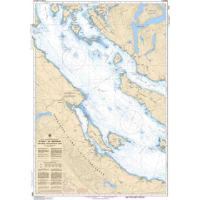




Essential for sailors, this Tidal Stream Atlas delivers hourly tidal current data for France’s west coast. Optimize your route with detailed flow directions and speeds in knots.
Data sheet
Specific References
Master the Tides of the West Coast of France with Unmatched Precision
Navigating the tidal waters of the West Coast of France demands accuracy, and this Tidal Stream Atlas delivers just that. Designed for mariners who refuse to compromise on safety or efficiency, this printed atlas provides hourly tidal stream data, including direction and speed, for every hour before and after the reference port. With tidal rates expressed in tenths of a knot—covering mean, neap, and spring tides—this tool ensures you can calculate tidal behavior for any date with confidence. Whether you're plotting a course through narrow channels or planning an offshore passage, this atlas is your trusted companion for navigating one of Europe’s most dynamic maritime regions.
Visual and Intuitive Tidal Data for Quick Decision-Making
This atlas stands out with its pictorial representations of tidal streams, offering a clear and intuitive way to understand complex tidal patterns. Each diagram illustrates the direction and strength of currents, allowing mariners to quickly assess conditions and adjust their routes accordingly. The durable paper format ensures reliability in all weather conditions, making it a dependable resource for professionals who need accurate data at their fingertips. No digital device can match the clarity and accessibility of this printed reference.
Built for Professionals Who Demand Reliability
Engineered for commercial mariners, shipping professionals, and experienced sailors, this tidal stream atlas is a critical tool for safe and efficient navigation. Covering the West Coast of France, it provides essential insights for voyages in the North-West European waters, where tidal currents can significantly impact travel time and fuel consumption. The 2006 2nd edition remains a benchmark for tidal stream analysis, combining decades of hydrographic expertise with a user-friendly design that professionals trust.
This Tidal Stream Atlas provides detailed tidal stream data for the West Coast of France, including hourly direction and speed of currents in tenths of a knot. It covers mean, neap, and spring tide rates, with pictorial representations for every hour before and after the reference port. The printed version features a durable paper format, weighing 0.18 kg, and is designed for professional use in maritime navigation.
With a legacy spanning over two centuries, this publisher is a global leader in hydrographic and maritime navigation solutions. Renowned for its precision, reliability, and commitment to safety at sea, it provides essential tools trusted by mariners, shipping professionals, and naval forces worldwide. Its publications set the standard for accuracy in tidal data, nautical charts, and navigational references, ensuring safe and efficient voyages across the globe.
The atlas covers the tidal streams along the west coast of France, providing detailed hourly data on current direction and strength.
Tidal current speeds are shown in tenths of a knot, including mean, neap, and spring rates for precise navigation planning.
Yes, it features pictorial diagrams showing the direction of tidal streams for each hour before and after the reference port.
The atlas is printed on plain white paper, updated from previous reprints to ensure clarity and durability.
Yes, it allows users to calculate tidal stream rates for any given date, aiding in accurate voyage planning.
This is the 2nd edition, published in 2006.
The atlas weighs 0.18 kg, making it lightweight and easy to handle on board.
You might also like