




Stay updated with essential maritime radio signal details for 3,800+ locations in the Indian Ocean, Southeast Asia, and the Pacific. Ideal for port operations, pilotage, and vessel traffic management.
Data sheet
Specific References
Navigate the vast waters of the Indian Ocean, Southeast Asia, Australia, and the Pacific with confidence using this comprehensive digital guide. Designed for mariners, port authorities, and vessel traffic services, this publication delivers critical radio communication details for over 3,800 service locations, ensuring seamless and safe maritime operations in one of the world’s busiest and most diverse regions.
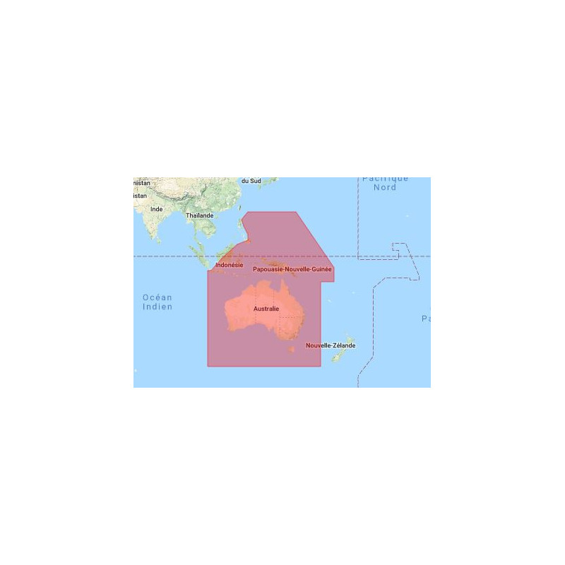
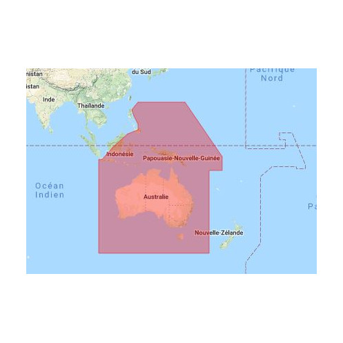
This digital guide covers a vast geographic area spanning from -48° to 21.5° latitude and 105° to 168° longitude, including key maritime hubs such as:
Whether you're a ship captain, port operator, or maritime authority, this guide provides:
This digital publication is engineered to enhance your operational efficiency:
Compatible with Windows 7 and later, this digital guide integrates effortlessly into your existing systems. Whether you're onshore or at sea, access the information you need without the bulk of physical manuals. Ideal for use in offices, control centers, and onboard vessels, it ensures that critical data is always at your fingertips.
Maritime safety begins with reliable communication. This digital guide ensures that you have the most accurate and up-to-date radio signal information, helping you comply with international maritime regulations and maintain the highest standards of safety. Equip your team with the tools they need to navigate confidently and efficiently.
Unlock Seamless Maritime Communications with the Digital List of Radio Signals, Volume 6 – Zone 7
In the fast-paced world of maritime navigation, reliable and up-to-date radio signal information is not just a necessity—it’s the backbone of safe and efficient operations. The Digital List of Radio Signals, Volume 6 – Zone 7, is your ultimate digital companion, offering instant access to critical communication data for over 3,800 service locations across the Indian Ocean, Southeast Asia, Australia, and the Pacific. Designed for mariners, port authorities, and vessel traffic services, this digital guide ensures you stay connected and compliant in one of the most dynamic maritime regions on the planet.
Precision Coverage for a Vast Maritime Landscape
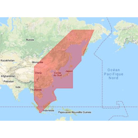
Spanning a geographic area from -48° to 21.5° latitude and 105° to 168° longitude, this digital publication covers a diverse and strategically vital region. From the bustling ports of Australia and New Zealand to the critical waterways of Southeast Asia and the vast expanses of the Indian and Pacific Oceans, this guide provides comprehensive radio signal data tailored to your operational needs. Whether you're navigating congested shipping lanes or coordinating port operations, this resource delivers the precision and reliability you require.
Designed for Modern Maritime Professionals
Gone are the days of flipping through cumbersome paper manuals. This digital guide is optimized for Windows 7 and later, offering a user-friendly interface that allows for quick searches, easy navigation, and efficient data retrieval. With an annual license, you’ll receive regular updates to ensure your information is always current, reflecting the latest changes in maritime regulations and infrastructure. This means you can focus on what matters most—safe and efficient maritime operations—without worrying about outdated or incomplete data.
Enhance Safety and Compliance with Confidence
Safety at sea begins with clear and reliable communication. This digital guide provides detailed information on pilotage services, vessel traffic services (VTS), port operations, and emergency procedures, ensuring you have the tools to handle any situation. By equipping your team with this essential resource, you’re not just investing in a product—you’re investing in the safety, compliance, and efficiency of your maritime operations. Stay ahead of the curve and navigate with confidence, knowing you have the most accurate and up-to-date radio signal information at your fingertips.
This digital guide delivers comprehensive radio signal information for over 3,800 service locations across a vast maritime region, spanning from -48° to 21.5° latitude and 105° to 168° longitude. Compatible with Windows 7 and later, it offers an annual license for regular updates, ensuring you always have the latest data. Available in English, this digital publication is designed for seamless integration into your workflow, providing quick access to critical communication details for pilotage, VTS, port operations, and emergency procedures.
Published by a globally recognized authority in hydrographic data, this digital guide is part of a trusted series used by maritime professionals worldwide. With a legacy of providing accurate and reliable navigation resources, this brand ensures that mariners, port authorities, and vessel traffic services have access to the most up-to-date and essential information for safe and efficient maritime operations.
This digital guide is compatible with PCs running Windows 7 and later versions.
This volume covers approximately 3,800 service locations for maritime radio communications.
No, this product is available only in English.
This digital guide requires an annual license for access and use.
No, this product is only compatible with PCs running Windows 7 and later versions.
This volume covers parts of the Indian Ocean, Southeast Asia, Australia, and the Pacific, spanning latitudes from -48° to 21.5° and longitudes from 105° to 168°.
Yes, a paper version of this guide is also available for purchase.
You might also like