





Navigate confidently with this comprehensive digital guide to 85,000+ global navigation lights and fog signals. Weekly updates and SOLAS compliance ensure reliability for mariners.
Data sheet
Specific References
Navigate Every Corner of the Globe with the Ultimate Digital Light List
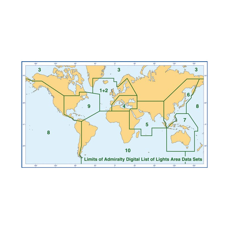
For mariners who refuse to compromise on safety or efficiency, this digital guide to worldwide navigation lights and fog signals is the gold standard. Covering all ADLL zones (1 to 10), it provides instant access to over 85,000 critical navigation aids—from towering lighthouses to floating beacons—each entry packed with precise details like international numbers, geographic coordinates, light characteristics, and nominal ranges. With 5,000+ high-resolution photos, identifying structures in low-visibility conditions or unfamiliar waters becomes effortless, while built-in range calculation tables help you plan with confidence. Updated weekly and fully compliant with SOLAS requirements, this tool is designed to integrate seamlessly with electronic charting systems, making it indispensable for commercial vessels, recreational sailors, and maritime professionals alike.
Built for the Demands of Modern Navigation
Gone are the days of flipping through cumbersome paper volumes or manually correcting outdated charts. This digital publication is engineered for speed and accuracy, offering automatic updates via ADMIRALTY Notices to Mariners, internet downloads, or email—ensuring your data is always current. Compatible with Windows 7 and later, it delivers a user-friendly experience with instant search functionality, multilingual support (English and French), and foreign language equivalents for key terms. Whether you're plotting a course through the congested waters of Zone 5 or the remote expanses of Zone 10, this guide adapts to your needs, providing the same level of detail and reliability as its paper predecessors but with the added convenience of digital technology. It’s not just a reference; it’s a critical component of your navigation toolkit, designed to keep you safe, compliant, and ahead of the curve.
This digital guide delivers unparalleled coverage of over 85,000 navigation lights and fog signals across ADLL zones 1 to 10, with 5,000+ high-resolution photos for visual identification. Updated weekly via ADMIRALTY Notices to Mariners, internet, email, or CD, it ensures compliance with SOLAS requirements and integrates seamlessly with electronic charting systems. Compatible with Windows 7 and later, it supports English and French languages and includes tools for calculating geographic and luminous ranges, making it a versatile and reliable resource for mariners worldwide.
With a legacy spanning over two centuries, this publisher is the global authority in maritime navigation data, trusted by commercial fleets, naval forces, and recreational sailors alike. Renowned for its precision, reliability, and adherence to international standards, its publications are the backbone of safe and efficient navigation, setting the benchmark for accuracy in an ever-evolving maritime landscape.
This digital publication is compatible only with PCs running Windows 7 and later versions.
The listings are updated weekly to ensure accuracy and compliance with the latest maritime notices.
No, this digital publication is designed exclusively for PCs running Windows 7 or later versions.
It includes lighthouses, lighted buoys over 8 meters tall, fog signals, and other navigation lights, totaling over 85,000 entries worldwide.
Yes, the publication includes over 5,000 photos of navigation lights to assist with identification.
Updates can be received via ADMIRALTY Notices to Mariners, internet downloads, email, or CD.
Yes, it complies with SOLAS (Safety of Life at Sea) transport requirements for maritime navigation.
You might also like