



Admiralty - ADLL zone 6 - Liste des feux et signaux de brume
search
  • googlemap
  • Admiralty - ADLL zone 6 - Liste des feux et signaux de brume

Admiralty - ADLL zone 6 - Liste des feux et signaux de brume

€138.85
Tax included
Admiralty - United Kingdom Hydrographic Office
Chart or book in digital version In English language In French language
Book programmed to order
Estimated preparation time: 0 to 3 days

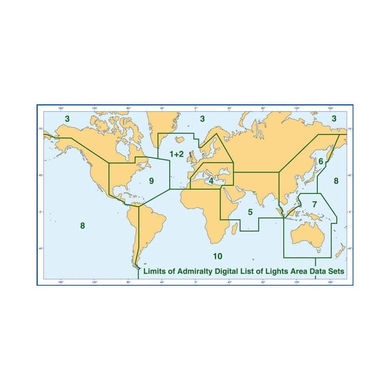
Essential digital guide for navigators covering Zone 6, from Singapore to the Sea of Okhotsk. Provides critical data on over 85,000 navigation lights and fog signals, updated weekly for accuracy.

CDR565-6

Data sheet

Who is the publisher or the author?
Admiralty
On what digital medium is this nautical chart / book stored?
digital medium
download
From which year does this nautical chart date?
2017 / 2018
What type of navigation book is this?
guide to fog lights and signals
Picto
Chart or book in digital version
In English language
In French language

Specific References

UPC
400000134642
EAN13
4000000105329
New
Book programmed to order
Description détaillée

ADLL Zone 6 – Digital List of Lights and Fog Signals

Publication in English
Digital publication readable only on PC with Windows 7 and later versions

Precision Navigation Data at Your Fingertips

Navigate with confidence using the most comprehensive digital reference for maritime lights and fog signals. Covering over 85,000 navigation aids worldwide, this advanced digital publication delivers unmatched accuracy and detail for mariners operating in Zone 6—from Singapore to the Sea of Okhotsk, including the western coast of the Philippines. Whether you're charting coastal routes or transiting busy shipping lanes, this tool ensures you have the critical data needed for safe and efficient passage planning.

Why Choose a Digital Navigation Resource?

  • Global Coverage, Local Precision: Access detailed entries for lighthouses, lighted beacons (over 8 meters high), fog signals, radar beacons, and other luminous marks, all standardized for consistency and reliability.
  • Up-to-Date Information: Stay ahead with weekly updates via Admiralty Notices to Mariners, ensuring your data reflects the latest changes in navigation aids, port configurations, and maritime infrastructure.
  • Seamless Integration: Compatible with Windows 7 and later versions, this digital format is designed for easy integration into your onboard navigation systems, reducing manual input and minimizing errors.
  • Multilingual Support: Benefit from foreign language equivalents for light descriptions, making it easier to interpret international navigation marks and communicate with global maritime authorities.

Designed for Professional Mariners

Every entry in this digital list includes the international number, precise geographic coordinates (WGS84), light characteristics (IALA), intensity, elevation in meters, range in nautical miles, and a description of the structure. Additional tools, such as tables for calculating geographic and luminous ranges, empower you to make informed decisions in real time, even in low-visibility conditions or unfamiliar waters.

Optimized for Modern Navigation Systems

  • Multiple Data Formats: Available in ABN (ASCII), XML, and S-57 (ENC-compatible) formats, ensuring compatibility with a wide range of navigation software and electronic chart display systems (ECDIS).
  • Efficient Performance: With a modest file size (15–25 MB), this digital resource runs smoothly on systems with a minimum of 4GB RAM, making it ideal for both commercial vessels and recreational craft.
  • Annual Licensing: A single annual license provides continuous access to updates, eliminating the need for manual replacements and ensuring your navigation data is always current.

A Trusted Standard for Safe Navigation

Trusted by mariners worldwide, this digital publication is an indispensable tool for voyage planning, risk assessment, and compliance with international maritime regulations. Whether you're navigating congested waterways, remote coastlines, or open seas, this resource equips you with the critical information needed to avoid hazards and optimize your route.

Key Features at a Glance

  • Comprehensive coverage of over 85,000 navigation lights and fog signals.
  • Weekly updates via Admiralty Notices to Mariners.
  • Detailed entries including coordinates, light characteristics, elevation, and range.
  • Multilingual descriptions for international navigation marks.
  • Compatible with Windows 7 and later versions.
  • Available in multiple digital formats for seamless integration.

Elevate Your Maritime Navigation with the ADLL Zone 6 Digital List of Lights
When precision and reliability are non-negotiable, the ADLL Zone 6 Digital List of Lights and Fog Signals stands as the ultimate resource for mariners navigating one of the world’s most critical maritime regions. Covering the expansive waters from Singapore to the Sea of Okhotsk—including the strategically vital western coast of the Philippines—this digital publication provides instant access to over 85,000 verified navigation aids, ensuring you have the most accurate and up-to-date information at your fingertips. Designed for professionals who demand excellence, this tool eliminates guesswork and enhances safety in even the most challenging conditions.

Unmatched Data Depth for Every Voyage
Every entry in this digital list is meticulously curated to deliver the highest level of detail. From lighthouses and lighted beacons (over 8 meters high) to fog signals, radar beacons, and other luminous marks, each record includes the international number, precise geographic coordinates (WGS84), light characteristics (IALA), intensity, elevation in meters, and range in nautical miles. Additionally, you’ll find descriptions of the structure, foreign language equivalents for light descriptions, and specialized tables for calculating geographic and luminous ranges. This level of detail ensures you can plan routes with confidence, whether you're navigating congested shipping lanes or remote coastal areas.

Stay Ahead with Weekly Updates and Seamless Integration
Maritime navigation is dynamic, with conditions and infrastructure constantly evolving. That’s why this digital publication is updated weekly via Admiralty Notices to Mariners, guaranteeing that your data reflects the latest changes in navigation aids, port configurations, and maritime hazards. Compatible with Windows 7 and later versions, the ADLL Zone 6 integrates effortlessly into your existing navigation systems, reducing manual input and minimizing the risk of errors. Available in ABN (ASCII), XML, and S-57 (ENC-compatible) formats, it ensures compatibility with a wide range of electronic chart display systems (ECDIS) and navigation software, making it a versatile choice for commercial vessels, naval operations, and recreational craft alike.

Optimized for Performance and Compliance
With a modest file size (15–25 MB) and a minimum RAM requirement of 4GB, this digital resource is engineered for efficiency without compromising on performance. Its annual licensing model provides continuous access to updates, eliminating the need for manual replacements and ensuring compliance with international maritime regulations. Whether you're conducting voyage planning, risk assessment, or real-time navigation, the ADLL Zone 6 equips you with the tools needed to make informed decisions, avoid hazards, and optimize your route—no matter where your journey takes you.

The ADLL Zone 6 Digital List of Lights and Fog Signals is a high-performance digital publication designed for modern maritime navigation. It provides comprehensive coverage of over 85,000 navigation aids, including lighthouses, lighted beacons, fog signals, and radar beacons, with detailed entries featuring geographic coordinates (WGS84), light characteristics (IALA), elevation, range, and structural descriptions. Updated weekly via Admiralty Notices to Mariners, this resource ensures data accuracy and relevance. Compatible with Windows 7 and later versions, it supports multiple formats (ABN, XML, S-57) for seamless integration with navigation systems. With a minimum RAM requirement of 4GB and an annual licensing model, it delivers reliable performance and compliance with international standards.

For over two centuries, this organization has set the global standard for maritime navigation and hydrographic data. Renowned for its precision, reliability, and innovation, it provides mariners with the tools they need to navigate safely and efficiently across the world’s oceans. Its publications and digital solutions are trusted by commercial fleets, naval operations, and recreational sailors alike, ensuring compliance with international maritime regulations and enhancing operational excellence.

  • This digital publication offers unparalleled accuracy with over 85,000 verified navigation aids, ensuring you have the most reliable data for safe passage planning. Its weekly updates via Admiralty Notices to Mariners keep your information current, while multilingual descriptions and detailed entries—including coordinates, light characteristics, and range calculations—provide the depth of information needed for confident decision-making. Compatible with multiple formats and optimized for performance, it integrates seamlessly into modern navigation systems, reducing manual input and minimizing errors. With an annual license, you gain continuous access to updates, eliminating the need for replacements and ensuring compliance with international standards.
What is the geographic coverage area for zone 6?

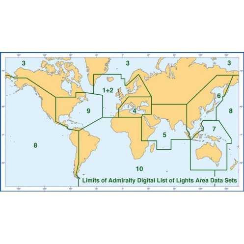
Zone 6 covers the region from Singapore to the Sea of Okhotsk, including the west coast of the Philippines.

How often are updates provided for this digital publication?

Updates are provided weekly via Notices to Mariners.

What operating systems are compatible with this digital publication?

It is compatible with Windows 7 and later versions, as well as Linux and macOS.

What are the minimum RAM requirements for running this digital publication?

A minimum of 4 GB of RAM is required.

Are foreign language descriptions of lights included?

Yes, it includes foreign language equivalents for light descriptions.

What file formats are available for this digital publication?

Available formats include ABN (ASCII), XML, and S-57 (compatible with ENC).

Does this publication include information on fog signals?

Yes, it provides comprehensive details on fog signals and radar beacons.

Loading...