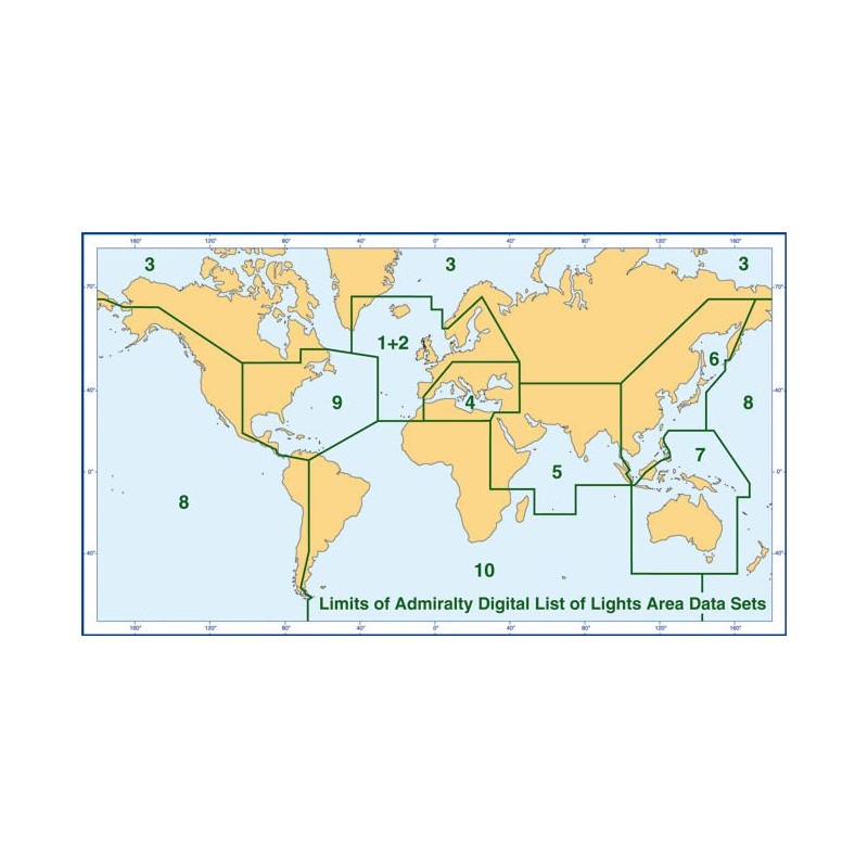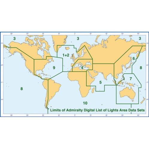






Ensure safe navigation in Zone 3 with this digital guide covering 85,000+ lights and fog signals. Includes coordinates, characteristics, and weekly updates for accuracy. For Windows PCs only.
Data sheet
Specific References
Navigate the challenging waters of the North Atlantic and Arctic regions with confidence. This digital guide delivers comprehensive, up-to-date information on over 85,000 fixed navigational lights, including lighthouses, lightships, illuminated buoys (over 8 meters high), fog signals, and other critical aids to navigation. Designed for mariners who demand accuracy, this tool ensures you have the most reliable data at your fingertips, whether you're planning a voyage or navigating in real time.
This digital guide is engineered for seamless integration with electronic charting systems, including ECDIS, ECS, and the Admiralty Vector Chart Service (AVCS). Its structured XML format ensures compatibility with a wide range of navigation software, making it an indispensable tool for commercial vessels, naval operations, and maritime professionals. Trusted by over 80% of the world's merchant fleets, it meets the highest standards of accuracy and reliability.
Whether you're navigating icy Arctic waters or bustling North Atlantic shipping lanes, this digital guide provides the precision and reliability you need to ensure safe passage. With its unparalleled depth of information and seamless integration with modern navigation systems, it’s the ultimate tool for mariners who refuse to compromise on safety.
Navigate with Confidence Using the Ultimate Digital Guide to Navigational Lights and Fog Signals
Sail through the world’s most demanding waters with the Admiralty Digital List of Lights (ADLL) for Zone 3—a comprehensive, digital navigation tool designed to provide mariners with unparalleled accuracy and reliability. Covering the vast expanse of the North Atlantic and Arctic regions, this guide is your trusted companion for safe and efficient voyages, whether you're navigating commercial shipping lanes, exploring remote Arctic waters, or ensuring compliance with international maritime standards.
Precision Data for Over 85,000 Navigational Aids
This digital guide offers detailed information on more than 85,000 fixed navigational lights, including lighthouses, lightships, illuminated buoys (over 8 meters high), fog signals, and other critical aids to navigation. Each entry is meticulously curated to include the international number, precise geographic coordinates, light characteristics, intensity, elevation, range in nautical miles, and a description of the structure. With this level of detail, mariners can make informed decisions, even in the most challenging conditions.
Seamless Integration with Modern Navigation Systems
Engineered for compatibility with electronic charting systems, including ECDIS, ECS, and the Admiralty Vector Chart Service (AVCS), this digital guide ensures seamless integration into your existing navigation workflow. Its structured XML format allows for effortless data exchange, making it an indispensable tool for commercial vessels, naval operations, and maritime professionals who rely on cutting-edge technology to enhance safety and efficiency.
Stay Current with Weekly Updates and Multilingual Support
Navigational safety depends on up-to-date information. This guide is updated weekly via Admiralty Notices to Mariners, ensuring that your data reflects the latest changes in navigational aids. Additionally, light and fog signal characteristics are provided with equivalent descriptions in multiple languages, making it an invaluable resource for international crews. Whether you're navigating in English or French, this guide ensures clarity and precision in every situation.
Trusted by the World’s Leading Maritime Fleets
Approved by flag states representing over 80% of the world’s merchant fleet, this digital guide is recognized as the gold standard for navigational safety. Its annual license ensures a full year of access to the most accurate and reliable data available, making it an essential investment for any vessel operating in Zone 3. From calculating geographic and luminous ranges to identifying critical navigational aids, this tool empowers mariners to navigate with confidence, no matter the conditions.
This digital navigation guide provides comprehensive coverage of Zone 3, spanning the North Atlantic and Arctic regions, with detailed data on over 85,000 navigational lights and fog signals. Compatible with Windows 7 and later versions, it features an annual license, weekly updates via Admiralty Notices to Mariners, and multilingual support in English and French. Designed for integration with ECDIS, ECS, and other electronic charting systems, it includes structured XML data for seamless compatibility with modern navigation software.
For over two centuries, this organization has been the global leader in hydrographic and maritime data, providing the most accurate and reliable navigation tools for mariners worldwide. Their publications are trusted by over 80% of the world’s merchant fleets, ensuring safety and efficiency in even the most challenging waters. With a commitment to innovation and precision, their digital solutions set the standard for modern navigation.
The digital guide is compatible exclusively with PCs running Windows 7 or later versions.
Updates are provided weekly through the Admiralty Notices to Mariners.
Yes, it is compatible with ECDIS, ECS, Admiralty Vector Chart Service (AVCS), and other electronic charting systems.
It includes lighthouses, lightships, illuminated floating marks (over 8 meters high), fog signals, and other critical navigation lights.
Yes, equivalent descriptions for light characteristics and fog signals are provided in foreign languages.
Zone 3 covers waters in the North and North Atlantic regions, spanning latitudes from 43°N to 68°N and longitudes from 7°E to 144.5°E and -177°W to -2°W.
The guide provides information on over 85,000 fixed navigational lights.
You might also like