



Admiralty - ADLL zone 5 - Liste des feux et signaux de brume
search
  • googlemap
  • Admiralty - ADLL zone 5 - Liste des feux et signaux de brume

Admiralty - ADLL zone 5 - Liste des feux et signaux de brume

€138.85
Tax included
Admiralty - United Kingdom Hydrographic Office
Chart or book in digital version In English language In French language
Book programmed to order
Estimated preparation time: 0 to 3 days

Navigate safely in Zone 5 with this digital guide featuring 85,000+ light structures, fog signals, and navigational aids. Includes weekly updates and multilingual descriptions for precision.

CDR565-5

Data sheet

Who is the publisher or the author?
Admiralty
On what digital medium is this nautical chart / book stored?
digital medium
download
From which year does this nautical chart date?
2016 / 2017
What type of navigation book is this?
guide to fog lights and signals
Picto
Chart or book in digital version
In English language
In French language

Specific References

UPC
400000134659
EAN13
4000000105312
New
Book programmed to order
Description détaillée

Admiralty - ADLL Zone 5 - List of Lights and Fog Signals

Publication in English
Digital publication readable only on PC with Windows 7 and later versions

Essential Navigation Tool for Maritime Professionals

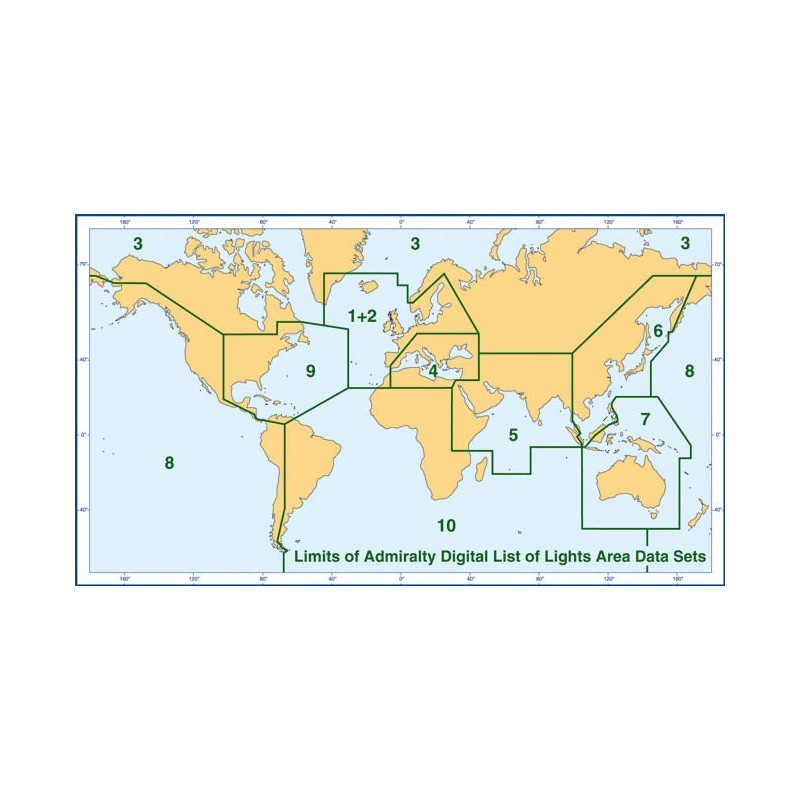
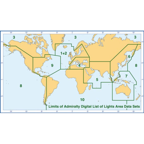
Navigate the Red Sea, Gulf, and northern Indian Ocean with confidence using this comprehensive digital guide. Designed for mariners, shipping companies, and naval authorities, this publication delivers unparalleled accuracy and detail for safe and efficient voyages in Zone 5. With over 85,000 fixed light structures—including lighthouses, lightships, and illuminated floating marks—this resource is indispensable for modern navigation.

Unmatched Coverage and Precision

Every entry in this digital guide provides critical data: international numbers, exact locations, geographic coordinates, light characteristics, intensity, elevation in meters, and nominal range in nautical miles. Foreign language equivalents for light descriptions ensure clarity across international waters, while built-in tables simplify calculations for geographic and luminous ranges. Whether you're plotting a course or verifying navigational aids, this tool delivers the precision you need.

Seamless Updates and Compatibility

Stay current with weekly updates delivered via email, CD, or online access, ensuring your navigational data is always up to date. Compatible with Windows 7 and later, this digital publication integrates effortlessly with ECDIS, ARCS, and other chart folio systems. The annual license guarantees continuous access to the latest information, making it a cost-effective solution for long-term maritime operations.

Optimized for Modern Navigation Systems

With a file size of approximately 500 MB, this dataset is lightweight yet comprehensive, covering all navigational lights and fog signals in the region. The S-57 ENC format ensures compatibility with industry-standard electronic chart display systems, while the intuitive search function allows for quick retrieval of critical data. From commercial vessels to private yachts, this guide is engineered to meet the demands of today’s mariners.

Reliable Support for Safe Voyages

Beyond its technical capabilities, this publication is backed by a legacy of trust and reliability. Whether you're navigating busy shipping lanes or remote coastal areas, it provides the confidence to make informed decisions. The included descriptions of structures and signals further enhance situational awareness, reducing risks and improving operational efficiency. For mariners who demand the best, this is the ultimate navigational companion.

Navigate with Precision Using the Digital List of Lights and Fog Signals for Zone 5
Sail through the Red Sea, Gulf, and northern Indian Ocean with unmatched confidence. This digital navigation guide is your ultimate resource for over 85,000 fixed light structures, including lighthouses, lightships, and illuminated floating marks. Designed for mariners, shipping companies, and naval authorities, it delivers critical data—geographic coordinates, light characteristics, intensity, elevation, and nominal range—to ensure safe and efficient voyages in one of the world’s busiest maritime regions.

Stay Updated with Weekly Navigational Data
Maritime safety demands accuracy, and this guide delivers with weekly updates via email, CD, or online access. Compatible with Windows 7 and later, it integrates seamlessly with ECDIS, ARCS, and other electronic chart systems. The annual license ensures continuous access to the latest information, making it a cost-effective solution for long-term operations. Whether you're navigating commercial routes or private voyages, this tool keeps you ahead of the curve.

Optimized for Modern Navigation Systems
With a lightweight 500 MB dataset, this guide covers all navigational lights and fog signals in Zone 5 without compromising performance. The S-57 ENC format ensures compatibility with industry-standard systems, while the intuitive search function allows for quick retrieval of critical data. From calculating geographic ranges to verifying light characteristics, this tool is engineered to meet the demands of today’s mariners.

Enhance Situational Awareness and Reduce Risks
Beyond its technical capabilities, this guide provides detailed descriptions of structures and signals, improving situational awareness in both busy shipping lanes and remote coastal areas. Foreign language equivalents for light descriptions ensure clarity across international waters, while built-in tables simplify range calculations. For mariners who prioritize safety and efficiency, this is the definitive navigational companion.

This digital navigation guide covers Zone 5, including the Red Sea, Gulf, and northern Indian Ocean, with over 85,000 fixed light structures. It provides geographic coordinates, light characteristics, intensity, elevation, and nominal range in nautical miles. Compatible with Windows 7 and later, it supports ECDIS and ARCS systems, with weekly updates via email, CD, or online access. The S-57 ENC format ensures seamless integration, while the annual license guarantees continuous access to the latest data.

With a legacy spanning centuries, this trusted name in maritime navigation sets the standard for accuracy and reliability. Renowned for its comprehensive charts, publications, and digital solutions, it supports mariners, shipping companies, and naval authorities worldwide. Its products are designed to enhance safety, efficiency, and compliance with international maritime regulations, making it the preferred choice for professionals navigating global waters.

  • Unparalleled precision with over 85,000 navigational light structures, ensuring safe voyages in Zone 5.
  • Weekly updates keep data current.
  • Compatibility with ECDIS and ARCS systems guarantees seamless integration.
  • The intuitive search function and foreign language equivalents enhance usability.
  • The annual license provides cost-effective, long-term access to critical navigational information.
What is the exact coverage area for this digital publication?

The coverage area includes the Red Sea, Gulf, and northern Indian Ocean, spanning latitudes from 27°N to 22.5°S and longitudes from 30°E to 105°E.

How often are updates provided for this digital navigation guide?

Updates are provided weekly via email, CD, or online access to ensure the latest navigational information.

What are the minimum system requirements for running this digital guide?

It requires a PC with Windows 7 or later, a 1 GHz processor, 1 GB RAM (2 GB for 64-bit), and at least 16 GB of free disk space. Additional requirements include a CD/DVD drive and a Super VGA monitor.

Can this digital guide be used on older Windows systems like Windows XP?

Yes, it is compatible with Windows XP SP3, requiring a 233 MHz processor (300 MHz recommended), 64 MB RAM (128 MB recommended), and 1.5 GB of free disk space.

What file format is used for this digital navigation guide?

The guide is provided in S-57 ENC format, ensuring compatibility with ECDIS, ARCS, and other chart folio systems.

How many navigational light structures are included in this guide?

The guide includes detailed information on over 85,000 fixed light structures, such as lighthouses, lightships, and illuminated buoys.

Is the digital guide available in languages other than English?

Yes, it includes foreign language equivalents for light descriptions, supporting both English and French.

Loading...