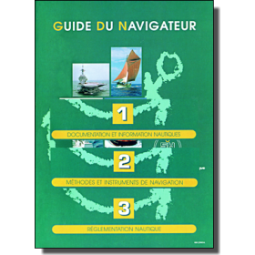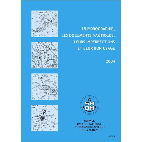




Master hydrography and nautical charts with this essential guide. Learn about survey accuracy, GPS use, electronic charts, and maritime safety tips to navigate confidently.
Data sheet
Specific References
Master the Art of Navigation with This Essential Hydrographic Reference
Unlock the secrets of safe and efficient maritime navigation with this comprehensive guide to hydrography and nautical documentation. Published in 2004, this third edition remains a cornerstone resource for understanding the complexities of hydrographic surveys, their inherent limitations, and the proper use of navigational charts. Whether you're navigating coastal waters or open seas, this book provides the critical knowledge needed to interpret and apply nautical data with confidence.
Precision and Practicality for Maritime Professionals
Dive deep into the technical aspects of hydrographic surveys, learning how to assess their accuracy and recognize potential imperfections. This guide offers clear, actionable advice on using nautical documents effectively, ensuring you can make informed decisions in any maritime scenario. With a focus on real-world applications, it bridges the gap between theory and practice, making it an invaluable tool for merchant marine professionals.
Stay Ahead with Modern Navigation Technologies
Equip yourself with the latest insights on GPS technology and electronic chart systems. This book provides a thorough overview of how to integrate these advanced tools with traditional navigation methods, enhancing both safety and efficiency. Learn the best practices for combining digital and paper-based navigation, ensuring you’re prepared for any situation at sea.
Learn from Real-World Maritime Incidents
Gain a deeper understanding of navigational safety through detailed case studies of maritime accidents. By analyzing these real-life scenarios, you’ll learn to identify common pitfalls and apply lessons learned to your own navigation practices. This practical approach ensures that you’re not just reading about navigation—you’re learning how to navigate more safely and effectively.
Built for Long-Term Reliability
Updated to GAN 12/40 standards, this third edition offers unlimited validity, making it a timeless resource for maritime professionals. Its compact dimensions (265 mm x 190 mm x 3 mm) and lightweight design (50 g) ensure it’s easy to carry and reference, whether you’re on deck or in the chartroom. With no illustrations, the focus remains solely on delivering precise, technical content that you can rely on.
This essential hydrographic reference is presented in a practical paperback format, measuring 265 mm in width, 190 mm in height, and 3 mm in thickness, with a lightweight design of just 50 grams. Published in 2004 and updated to GAN 12/40 standards, this third edition offers unlimited validity, ensuring its relevance for years to come. Written in French, it provides a focused, technical exploration of hydrography and nautical documentation without illustrations, making it a pure resource for professional mariners.
With a legacy rooted in maritime excellence, this publisher is a leading authority in hydrographic and oceanographic sciences. Renowned for producing precise, reliable, and technically advanced resources, their works are trusted by maritime professionals worldwide. Their publications are designed to meet the highest standards of accuracy and practicality, ensuring they remain indispensable tools for navigation and safety at sea.
The book explains the methods and precision of hydrographic surveys, highlighting their limitations and how navigators can account for potential inaccuracies in nautical documents.
Yes, it provides guidelines on using GPS and electronic charts, including their integration with traditional nautical documents.
The book presents case studies of maritime accidents to illustrate the importance of proper nautical document usage and hydrographic data interpretation.
The printed edition measures 265 mm in width, 190 mm in height, and 3 mm in thickness, with a weight of 50 grams.
No, the book is currently available only in French.
The book has an unlimited validity period, but it was last updated in 2004 according to the GAN 12/40 edition.
No, the book does not contain any illustrations.
You might also like












![Admiralty - NP247[1] - Annual Summary of Admirlaty Notice to Mariners Pt.1](https://www.nautic-way.com/80676-home_default/admiralty-np247-1-annual-summary-of-admirlaty-notice-to-mariners-pt1-maritime-bookshop-nautic-way.jpg)
![Admiralty - NP247[2] - Annual Summary of Admirlaty Notice to Mariners Pt.2](https://www.nautic-way.com/80678-home_default/admiralty-np247-2-annual-summary-of-admirlaty-notice-to-mariners-pt2-maritime-bookshop-nautic-way.jpg)

![Admiralty - eNP247[1] - Annual Summary of Admirlaty Notice to Mariners Pt.1](https://www.nautic-way.com/80716-home_default/admiralty-enp247-1-annual-summary-of-admirlaty-notice-to-mariners-pt1-maritime-bookshop-nautic-way.jpg)
![Admiralty - eNP247[2] - Annual Summary of Admirlaty Notice to Mariners Pt.2](https://www.nautic-way.com/80718-home_default/admiralty-enp247-2-annual-summary-of-admirlaty-notice-to-mariners-pt2-maritime-bookshop-nautic-way.jpg)