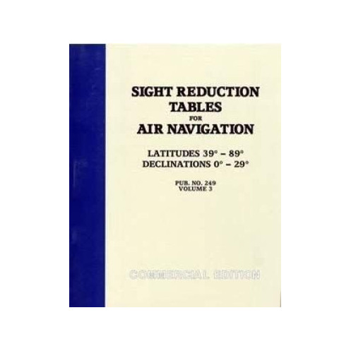



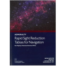
High-latitude navigation made simple with sight reduction tables for 39°–89° latitudes and 0°–29° declinations. Covers Sun, Moon, planets, and stars for air and marine use.
Data sheet
Specific References
Master celestial navigation in extreme latitudes with this essential reference for aviators and mariners. Designed for accuracy and efficiency, this volume delivers streamlined sight reduction tables tailored for latitudes between 39° and 89°—critical for polar routes, high-altitude flights, and Arctic or Antarctic expeditions. Whether navigating by the Sun, Moon, planets, or key stars, these tables simplify complex calculations, ensuring reliable fixes even in the most challenging environments.
Engineered for professionals who demand speed and precision, this publication condenses the functionality of the six-volume HO-229 series into a single, portable resource. Covering declinations from 0° to 29° (North or South), it provides precomputed data for rapid sight reduction, reducing manual computation time without sacrificing accuracy. The spiral-bound format ensures durability and ease of use in dynamic settings, from cockpit jump seats to ship bridges.
Valid for an eight-year period centered on its epoch date, this volume offers long-term utility for route planning and emergency navigation scenarios. Its compact design—weighing just 1.5 kg—makes it ideal for weight-sensitive operations where space is at a premium. Trusted by commercial pilots, naval officers, and long-distance sailors, it bridges the gap between traditional celestial techniques and modern operational demands.
Part of the renowned Pub. 249/HO-249 series, this volume maintains compatibility with standard celestial navigation practices, including star identification and altitude correction procedures. Its clear tabular layout minimizes errors during high-pressure situations, while the focus on high latitudes addresses a critical gap in many navigation references. For professionals operating in polar regions or at extreme altitudes, this is the definitive tool for maintaining situational awareness when electronic systems fail.
Elevate your celestial navigation capabilities with the definitive high-latitude reference
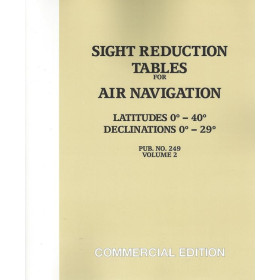
When precision matters most—whether navigating Arctic shipping lanes or transpolar flight paths—this Sight Reduction Tables for Air Navigation Volume 3 delivers the critical data needed for accurate celestial fixes. Designed for latitudes from 39° to 89°, this specialized volume addresses the unique challenges of high-latitude navigation, where traditional methods often fall short. Its streamlined tables cover declinations from 0° to 29° (North or South), providing precomputed solutions for the Sun, Moon, planets, and key stars, eliminating the need for time-consuming manual calculations.
Engineered for efficiency without compromising accuracy
Weighing just 1.5 kg and bound in a durable spiral format, this publication condenses the functionality of bulkier six-volume sets into a single, portable resource. The Pub. 249/HO-249 standard ensures seamless integration with existing celestial navigation workflows, while its eight-year validity period makes it a cost-effective solution for long-term planning. Ideal for aviators, mariners, and expedition leaders, it transforms complex sight reduction into a straightforward process, even in the most demanding conditions.
Built for professionals who operate where others cannot
From commercial pilots flying polar routes to sailors navigating the Northwest Passage, this volume is the trusted companion for operations in extreme environments. Its clear, tabular layout minimizes errors during high-pressure situations, while the focus on high latitudes fills a critical gap in navigation references. Whether used as a primary tool or a backup to electronic systems, it provides the reliability needed when every degree of accuracy counts.
This Sight Reduction Tables for Air Navigation Volume 3 provides precomputed data for latitudes 39° to 89° (North or South) and declinations 0° to 29° (North or South), covering celestial observations for the Sun, Moon, planets, and key stars. Published under the Pub. 249/HO-249 standard, it features a lightweight 1.5 kg spiral-bound paperback format, ensuring durability and portability for field use. Valid for an eight-year period centered on its epoch date, it is optimized for both aviation and maritime applications.
With decades of expertise in celestial navigation resources, this publisher delivers precision tools trusted by aviators, mariners, and military professionals worldwide. Their publications are designed to meet the rigorous demands of high-stakes navigation, combining time-tested methodologies with practical, user-friendly formats. Each volume reflects a commitment to accuracy, durability, and operational efficiency, making them indispensable for those who rely on celestial fixes in critical environments.
This volume covers latitudes from 39° to 89°, both North and South.
Yes, while designed for air navigation, they are also widely used by marine navigators.
The declination range covered is from 0° to 29°, both North and South.
It is applicable for a period of 8 years centered on the epoch date.
The book features a spiral-bound paperback format for ease of use.
Yes, they include tables for observations of the Sun, Moon, planets, and principal stars.
The weight of this volume is approximately 1.5 kg.
You might also like













![Admiralty - NP303(1) - Rapid Sight Reduction Tables Volume 1, Selected Stars [Epoch 2020]](https://www.nautic-way.com/86054-home_default/admiralty-np3031-rapid-sight-reduction-tables-volume-1-selected-stars-epoch-2020-maritime-bookshop-nautic-way.jpg)