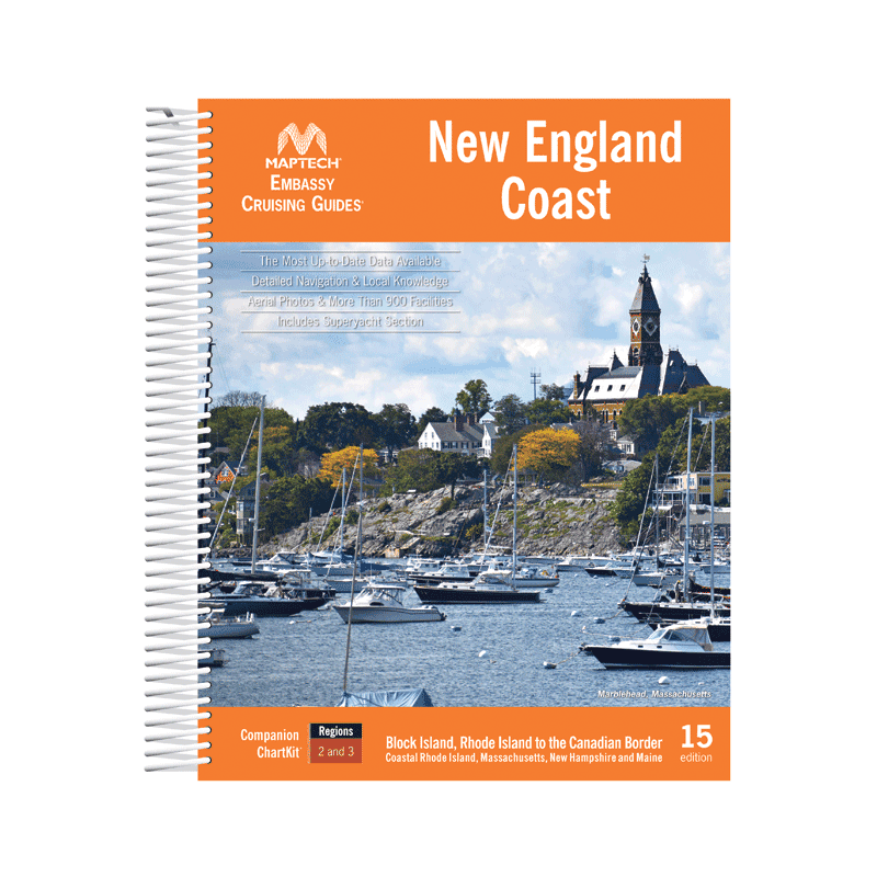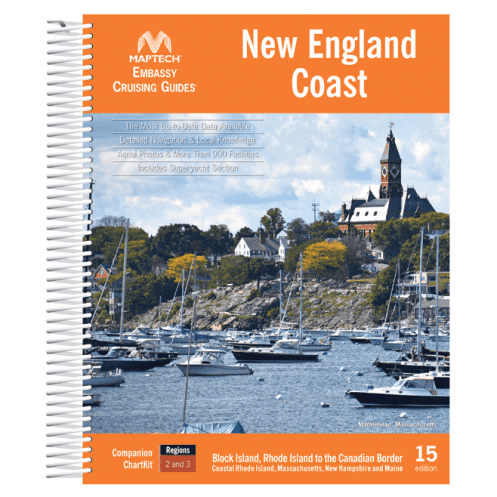




Explore the New England coast from Block Island to Canada with this detailed cruising guide. Features 900+ marinas, GPS waypoints, aerial photos, and expert local insights for boaters.
Data sheet
Specific References
Navigate with confidence along the stunning New England coastline
From Block Island, Rhode Island, to the Canadian border, this comprehensive cruising guide is your ultimate resource for safe and enjoyable sailing. Designed for boaters who demand accuracy and local insight, it covers over 900 marinas across 15 distinct cruising regions, ensuring you never miss a must-visit destination. Whether you're planning a weekend getaway or an extended voyage, this guide provides the tools you need to explore with ease.
Hundreds of GPS waypoints for effortless route planning
Say goodbye to guesswork with meticulously verified GPS coordinates that help you chart your course with pinpoint accuracy. The guide also features full-color aerial photos, giving you a bird’s-eye view of harbors, inlets, and navigation challenges before you arrive. These visual aids are invaluable for identifying landmarks, avoiding hazards, and selecting the best approach to your destination.
Insider tips from seasoned sailors and marina experts
More than just a collection of maps, this guide is packed with local knowledge to enhance your cruising experience. Discover the best anchorages, learn about tidal patterns, and get recommendations for shore-side attractions—all curated by experts familiar with the region. Whether you're docking at a bustling marina or dropping anchor in a secluded cove, you'll have the insights needed to make the most of every stop.
Practical, durable, and easy to use on the water
Built to withstand the rigors of life on the water, this spiral-bound guide lies flat for hands-free reference, making it ideal for use in the cockpit or at the helm. Its 640 pages are organized for quick access to critical information, so you can spend less time flipping through pages and more time enjoying the journey. The 14th edition (2021) ensures you have the most up-to-date data, including marina services, fuel availability, and local regulations.
From bustling ports to tranquil hideaways, this guide has it all
New England’s coastline is a tapestry of vibrant fishing villages, historic lighthouses, and pristine natural harbors. This guide highlights both well-known destinations and off-the-beaten-path treasures, offering something for every type of boater. Whether you're seeking a lively waterfront town with great dining or a quiet bay for a peaceful night’s rest, you’ll find detailed descriptions and practical advice to help you plan your perfect itinerary.
Unlock the full potential of your New England coastal adventure
This all-in-one cruising guide is the result of decades of maritime expertise, combining detailed cartography, local insights, and practical navigation tools into a single, easy-to-use resource. With coverage spanning from Block Island to the Canadian border, it’s the only guide you’ll need to explore the diverse and dynamic waters of New England. Whether you're a seasoned sailor or a weekend cruiser, this guide ensures you’re prepared for every twist and turn along the way.
Built for durability and convenience on the water
Weighing just 2 kg (4.4 lbs), this 640-page guide is lightweight enough to carry anywhere but comprehensive enough to cover every detail of your journey. The spiral-bound format allows it to lay flat, making it easy to reference while navigating or planning your next stop. Printed on high-quality, water-resistant paper, it’s designed to withstand the elements, so you can trust it in any weather.
Stay up-to-date with the latest edition
The 14th edition (2021) of this guide reflects the most current information available, including updates to marina listings, navigation aids, and local regulations. With hundreds of GPS waypoints and full-color aerial photos, you’ll have the confidence to navigate even the most challenging waters. Whether you're plotting a course through the rocky shores of Maine or the bustling harbors of Massachusetts, this guide provides the accuracy and detail you need to sail safely and efficiently.
This comprehensive cruising guide features 640 pages of detailed information, including GPS waypoints, full-color aerial photos, and listings for over 900 marinas. The 14th edition (2021) is spiral-bound for durability and ease of use, with a lightweight design at just 2 kg. It covers the New England coastline from Block Island, Rhode Island, to the Canadian border, offering local navigation tips, anchorage details, and visitor recommendations.
For decades, this series has been a trusted name among boaters, offering meticulously researched and regularly updated guides for coastal navigation. Known for combining detailed cartography with practical local insights, these guides are designed to enhance safety, convenience, and enjoyment on the water. Each edition is crafted with input from seasoned sailors and marina experts, ensuring accuracy and relevance for every voyage.
The guide covers the New England coast from Block Island, Rhode Island, up to the Canadian border, including over 900 marinas across 15 cruising regions.
Yes, the guide includes hundreds of GPS waypoints to assist with navigation along the New England coast.
This guide features a spiralbound format, making it easy to lay flat for convenient use on board.
Yes, it includes details on anchorages, as well as local navigation tips and visitor advice for popular destinations.
This edition provides detailed listings for over 900 marinas in the covered regions.
No, this edition is only available in English.
The guide weighs approximately 2 kg (4.4 lbs).
You might also like