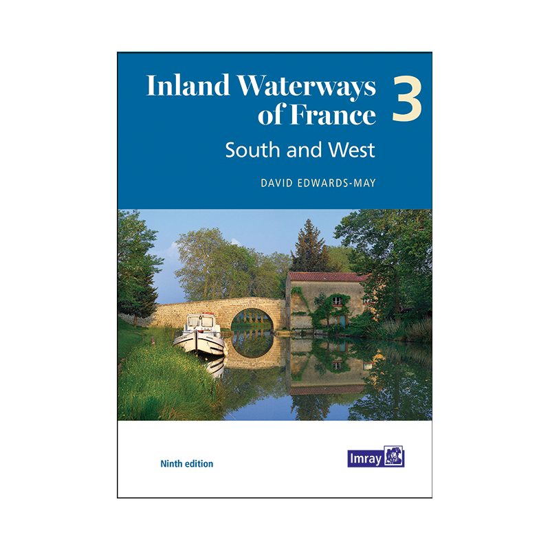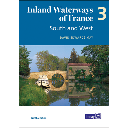


Imray - Inland Waterways of France Volume 3 South and West
search
  • googlemap
  • Imray - Inland Waterways of France Volume 3 South and West
  • Imray - Inland Waterways of France Volume 3 South and West

Imray - Inland Waterways of France Volume 3 South and West

€35.80
Tax included
Imray
In English language
Estimated preparation time: 5 to 14 days

Explore 3,000 km of France’s most scenic inland waterways with this essential guide. Detailed maps, route descriptions, and practical tips for cruising the South and West in confidence.

INL0303

Data sheet

What is the classification?
navigation book
Who is the publisher or the author?
David Edwards-May
On what digital medium is this nautical chart / book stored?
paper medium
From which year does this nautical chart date?
2021 - 9th edition
What type of navigation book is this?
pilot
Picto
In English language

Specific References

UPC
400000055367
EAN13
9781786793089
New
Description détaillée

Inland Waterways of France Volume 3: South and West

Guide in English
Paperback edition

Your Essential Companion for Exploring France’s Southern and Western Waterways

Navigating France’s inland waterways is an unparalleled experience, offering boaters a chance to explore some of Europe’s most scenic and culturally rich routes. This comprehensive guide is meticulously crafted for recreational boaters seeking to traverse the 3,000 kilometers of meticulously maintained waterways spanning the South ("Midi"), Southwest, and West of France. Whether you're planning a leisurely cruise or an extended voyage, this guide provides everything you need to navigate with confidence and ease.

Detailed Coverage of Key Waterways

This volume focuses on the southern and western regions of France, offering in-depth coverage of the country’s most iconic and diverse waterways. From the historic Canal du Midi, a UNESCO World Heritage site, to the picturesque rivers and canals of the Southwest and West, this guide ensures you have the most up-to-date information at your fingertips. Each waterway is presented with clear, full-color maps that highlight junctions, key sites, and essential navigation points, making route planning straightforward and efficient.

Comprehensive Route Descriptions and Practical Insights

Beyond maps, this guide delivers detailed route descriptions that help you anticipate what to expect along your journey. It includes practical information on mooring facilities, fuel stops, and local services, ensuring you’re never left unprepared. Historical notes add depth to your voyage, offering context about the regions you traverse, while vibrant color photographs bring the landscapes and landmarks to life. Whether you're a seasoned boater or a first-time cruiser, these insights enhance your experience and help you make the most of every mile.
Expertise You Can Trust

Written by David Edwards-May, a renowned authority on France’s inland waterways, this guide reflects decades of firsthand experience and expertise. As a key participant in waterway restoration projects, the author provides unique perspectives on the evolution of these routes, including updates on ongoing and completed initiatives. This ninth edition (2021) is the most current resource available, ensuring you have access to the latest developments, regulations, and navigational tips.

Designed for Boaters, by Boaters

This guide is tailored specifically for recreational boaters, with a focus on usability and practicality. The 146-page paperback edition is lightweight and easy to handle, making it a convenient companion on deck or in the cabin. Its full-color layout enhances readability, while the detailed charts and concise descriptions streamline navigation. Whether you're plotting a short trip or an extended adventure, this guide is an indispensable tool for safe, enjoyable, and well-informed cruising.

Unlock the Beauty of France’s Southern and Western Waterways
Embark on a journey through France’s most breathtaking inland waterways with this essential guide, designed to equip boaters with the knowledge and tools needed for a seamless adventure. Covering 3,000 kilometers of meticulously maintained routes, this volume focuses on the South ("Midi"), Southwest, and West of France, offering unparalleled access to some of Europe’s most iconic and diverse waterways. Whether you're navigating the historic Canal du Midi or exploring the scenic rivers of the West, this guide ensures you’re prepared for every twist and turn.

Expertly Crafted for Recreational Boaters
Written by David Edwards-May, a leading authority on France’s inland waterways, this guide combines decades of expertise with practical insights tailored for recreational boaters. The ninth edition (2021) reflects the latest updates on waterway conditions, restoration projects, and navigational best practices, making it the most current and reliable resource available. With 146 full-color pages, it provides detailed maps, route descriptions, and practical information to help you plan and execute your voyage with confidence.

Comprehensive and User-Friendly Design
This paperback guide is designed for ease of use, featuring a lightweight format that’s perfect for on-deck reference. Its full-color layout includes detailed charts of key junctions and sites, as well as overview maps for each waterway, ensuring you can quickly orient yourself and make informed decisions. Practical information on mooring, fuel stops, and local services is complemented by historical notes and vibrant photographs, enriching your journey with context and visual appeal.

Your Trusted Companion for Safe and Enjoyable Cruising
Whether you're a seasoned boater or new to inland cruising, this guide is an indispensable tool for navigating France’s southern and western waterways. It provides the most accurate and up-to-date information, helping you avoid common pitfalls and make the most of your time on the water. With its focus on usability and practicality, this guide ensures your voyage is not only safe but also unforgettable.

This ninth edition (2021) guide offers a comprehensive overview of France’s southern and western waterways, spanning 3,000 kilometers. It features 146 full-color pages packed with detailed maps, route descriptions, and practical information for boaters. The paperback format weighs 900 grams, making it lightweight and easy to carry on board. Written in English, it is published by a leading name in nautical guides and is designed specifically for recreational navigation.

With a legacy of providing high-quality nautical guides, this publisher is a trusted name among boaters worldwide. Known for their meticulous attention to detail and commitment to accuracy, their guides are designed to enhance the cruising experience with expert insights, up-to-date information, and user-friendly formats. Whether for inland waterways or coastal navigation, their publications are essential tools for safe and enjoyable voyages.

  • This guide stands out for its comprehensive coverage of France’s southern and western waterways, offering detailed maps, route descriptions, and practical information tailored for recreational boaters.
  • Its full-color layout and lightweight design make it easy to use on deck, while the expertise of its author ensures you have the most accurate and up-to-date information.
  • Whether you're planning a short trip or an extended cruise, this guide is an invaluable resource for safe, informed, and enjoyable navigation.
What regions of France does this guide cover?

This guide covers the South ('Midi'), South-West, and West of France, including 3,000 kilometers of maintained waterways.

Is this guide suitable for planning long cruising routes?

Yes, it includes detailed route descriptions, practical information, and historical notes to help plan extended cruises.

Are the maps in this guide color-printed?

Yes, the guide features 146 full-color pages with detailed maps of key junctions and waterway sites.

Does this edition include updates on waterway restoration projects?

Yes, it highlights ongoing and completed restoration projects for the waterways covered.

What is the weight of the guide?

The guide weighs approximately 900 grams.

Is this guide available in languages other than English?

No, this edition is only available in English.

How many pages does this guide contain?

The guide contains 146 pages.

Loading...