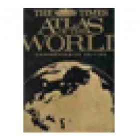




This concise world atlas offers 155,000 place names, detailed city plans, and thematic maps on climate and economy. A trusted resource for accurate global insights.
Data sheet
Specific References
The Times Concise Atlas of the World stands as the definitive cartographic resource for maritime professionals, offering unparalleled accuracy and depth. With 155,000 place names meticulously mapped, this 14th edition provides a comprehensive and up-to-date view of the world’s geography, essential for navigation, logistics, and strategic planning. Every detail is crafted to meet the rigorous demands of the maritime industry, ensuring reliability in even the most complex operational environments.
This atlas delivers an exhaustive representation of the world, featuring detailed maps of continents, oceans, and key maritime routes. It includes high-resolution satellite imagery of landmasses, offering a clear perspective on coastal regions, ports, and critical waterways. The inclusion of 41 detailed city plans further enhances its utility, providing precise urban layouts for major global hubs—an indispensable tool for route optimization and logistical coordination.
Beyond traditional cartography, this edition integrates thematic content addressing critical global challenges, including climate patterns, economic trends, and geopolitical shifts. These insights empower maritime professionals to anticipate environmental and regulatory changes, ensuring compliance and operational efficiency. Updated with over 3,500 name changes and new administrative regions, the atlas reflects the latest geopolitical realities, making it a trusted resource for decision-making.
The Times Concise Atlas of the World bridges past and present with a collection of historical maps spanning 150 years, offering context for long-term maritime trends. New additions, such as Arctic Ocean mapping and "Under the Ice" polar projections, provide cutting-edge data for navigating evolving polar routes. This blend of historical depth and modern innovation ensures the atlas remains a cornerstone for maritime professionals navigating both familiar and emerging waters.
Designed for frequent use, this hardcover edition combines durability with practicality. Its 448 pages are organized for quick reference, while the 1.5 kg weight and compact dimensions (10.90 x 14.80 x 1.70 inches) make it suitable for onboard use. The English-language format ensures accessibility for international crews, reinforcing its role as a universal tool for maritime operations worldwide.
Navigate the World with Unrivaled Accuracy
The Times Concise Atlas of the World redefines cartographic precision for maritime professionals, delivering a 14th edition that sets the standard for global navigation. With 155,000 place names meticulously mapped, this atlas provides an exhaustive and up-to-date representation of the world’s geography, essential for route planning, port logistics, and strategic decision-making. Its 448 pages of detailed maps, satellite imagery, and city plans ensure that every critical detail—from coastal features to urban infrastructure—is captured with clarity.
Engineered for Maritime Excellence
Weighing 1.5 kg and bound in a durable hardcover format, this atlas is built to withstand the demands of onboard use. Its dimensions (10.90 x 14.80 x 1.70 inches) strike the perfect balance between portability and readability, making it an indispensable tool for crews and logistics teams. The 2020 edition introduces over 3,500 updates, including new administrative regions and thematic maps on climate and economic trends, ensuring that maritime professionals have the most current data at their fingertips.
Strategic Insights for a Dynamic World
Beyond traditional mapping, this atlas offers strategic insights into global challenges, from geopolitical shifts to environmental changes. The inclusion of historical maps spanning 150 years provides context for long-term trends, while new features like Arctic Ocean mapping and polar projections equip users to navigate emerging maritime routes. Whether for compliance, risk assessment, or operational planning, this atlas delivers the depth and accuracy required to stay ahead in a rapidly evolving industry.
The Times Concise Atlas of the World combines precision and practicality in a hardcover edition designed for maritime professionals. Featuring 448 pages of detailed cartography, it includes 155,000 place names, 41 city plans, and updated thematic maps on climate and economics. Weighing 1.5 kg with dimensions of 10.90 x 14.80 x 1.70 inches, this 14th edition (2020) is built for durability and ease of use in demanding environments.
For decades, this publisher has been a leader in cartographic innovation, producing atlases that set the benchmark for accuracy and reliability. Their works are trusted by professionals across industries, from maritime navigation to academic research, thanks to a commitment to meticulous detail and up-to-date global data. Each edition reflects years of expertise, ensuring users have access to the most comprehensive and current geographic information available.
This edition includes 155,000 place names, providing a highly detailed representation of global locations.
Yes, this edition includes updated administrative regions for France and Northern Ireland, reflecting recent changes.
Yes, it features historical maps covering the last 150 years, offering insights into geographical changes over time.
Detailed maps are provided for 41 major cities worldwide, showcasing urban layouts and key landmarks.
The dimensions are 10.90 inches in length, 14.80 inches in height, and 1.70 inches in thickness.
No, it also covers thematic topics such as climate, economy, and the influence of cartography, alongside physical geography.
This edition incorporates over 3,500 name changes, ensuring up-to-date and accurate geographical information.
You might also like