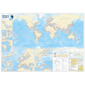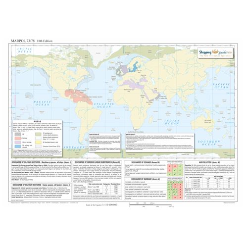



Color-coded, laminated A3 map of MARPOL 73/78 special areas and discharge regulations. Includes latest amendments for Annexes I-VI, ensuring compliance for maritime operations. Durable and up-to-date.
Data sheet
Specific References
Your Essential MARPOL Compliance Companion for Global Shipping Operations
In the complex regulatory landscape of international maritime operations, this MARPOL 73/78 compliance map serves as your definitive visual reference for environmental regulations across global waters. Designed by maritime compliance experts, this 18th edition map transforms intricate international conventions into an intuitive, color-coded system that eliminates guesswork from environmental compliance. Whether you're navigating the Emission Control Areas of Northern Europe or the special discharge zones of the Mediterranean, this tool provides immediate clarity on regional requirements that could impact your vessel's operations.
Precision-Engineered for Maritime Professionals
This professional-grade reference combines cartographic accuracy with regulatory precision, featuring the latest amendments to all six MARPOL annexes. The map clearly delineates special areas where enhanced environmental protections apply, including the recently implemented Annex II regulations for Northwestern European waters. At 11.7 x 16.5 inches (A3 format), the encapsulated design withstands the rigors of shipboard use while maintaining crystal-clear readability of all compliance zones and regulatory summaries. The double-sided lamination provides protection against moisture, UV exposure, and frequent handling, ensuring your compliance reference remains intact through countless voyages.
Strategic Compliance Management for Modern Shipping
Beyond simple cartography, this tool serves as a strategic compliance asset that helps shipping companies avoid costly violations while optimizing operational efficiency. The color-coded system enables rapid risk assessment for different maritime regions, allowing crews to plan appropriate waste management, discharge procedures, and emission controls before entering regulated zones. For environmental compliance officers, this map provides an indispensable visual aid during audits, training sessions, and operational briefings, transforming abstract international regulations into actionable operational protocols.
This professional maritime compliance tool features an A3-sized (11.7 x 16.5 inches) encapsulated design with full-color printing on durable laminated material. The 18th edition map weighs 1.5 kg and includes comprehensive coverage of all MARPOL 73/78 special areas, with particular emphasis on recent regulatory updates for Northwestern European waters. Waterproof construction and double-sided plastic coating ensure long-term durability in marine environments.
For over two decades, this publisher has specialized in creating authoritative maritime compliance resources that bridge the gap between complex international regulations and practical shipboard operations. Their publications are developed in collaboration with maritime industry experts and regulatory bodies to ensure accuracy and relevance for commercial shipping professionals worldwide. Each product undergoes rigorous quality control to meet the demanding standards of the global maritime community.
The map measures 11.7 x 16.5 inches, making it suitable for display and reference in various settings.
Yes, the map is laminated with a double-sided protective plastic layer, making it waterproof and durable for onboard or educational use.
The map includes regulations from Annex I (oil discharges), Annex II (noxious liquid substances), Annex IV (sewage), Annex V (garbage), and Annex VI (NOx and SOx emissions).
Yes, the 18th edition includes the latest amendments, such as Regulation 13.7.1.4 of Annex II for discharges in Northwestern Europe.
Absolutely, its clear color-coding and summary boxes make it an ideal tool for training and educational purposes.
Yes, a PDF format is available alongside the physical laminated A3 version.
You might also like