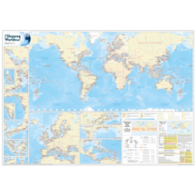



Explore the world with unmatched precision through 96 detailed maps, enhanced by hill shading and relief coloring for exceptional clarity. Includes 32 pages of global insights and 48 city profiles.
Data sheet
Specific References
Navigate the globe with unparalleled accuracy using this comprehensive atlas, designed to meet the rigorous demands of maritime professionals. Every map is crafted to international cartographic standards, ensuring detailed and reliable representations of landmasses, oceans, and critical maritime routes. The use of hill shading and relief coloring provides an intuitive visual understanding of terrain, allowing for quick and informed decision-making at sea or in port.
This atlas delivers an extensive collection of 96 meticulously designed world maps, offering a complete overview of the planet’s geography. Whether charting coastal regions, identifying key ports, or planning transoceanic voyages, these maps provide the clarity and detail needed for safe and efficient navigation. The inclusion of 32 pages dedicated to "The World in Focus" offers deeper insights into regional specifics, from political boundaries to natural landmarks, ensuring no detail is overlooked.
Beyond open waters, this atlas equips professionals with 48 pages of detailed city maps, covering major global hubs. These urban layouts are indispensable for port operations, logistics planning, and onshore navigation, providing clear representations of infrastructure, transportation networks, and key landmarks. Ideal for maritime operators, shipping companies, and logistics teams, this section bridges the gap between sea and land with precision.
Engineered for the demands of maritime environments, this atlas combines high-quality paper with a robust binding to withstand frequent use. Weighing just 1.5 kg, it strikes the perfect balance between portability and durability, making it a reliable companion for onboard reference or office planning. The English-language format ensures accessibility for international crews and global operations, standardizing communication across teams.
From ship captains to logistics coordinators, this atlas is an essential tool for anyone involved in maritime trade. Its detailed maps, combined with practical urban and regional insights, provide a holistic view of the world’s geography, empowering professionals to optimize routes, comply with regulations, and enhance operational efficiency. Whether used for pre-voyage planning or real-time navigation, this atlas sets the standard for maritime cartographic excellence.
Explore the world with the ultimate cartographic precision
This Atlas of the World redefines global navigation with its unparalleled accuracy and detail, tailored for professionals who demand the highest standards. Designed to international cartographic specifications, it transforms complex geographical data into clear, actionable maps, making it an indispensable resource for maritime operations, logistics, and global trade.
Engineered for clarity and durability
Featuring 96 pages of world maps, 32 pages of in-depth regional analysis, and 48 pages of detailed city layouts, this atlas covers every critical aspect of global geography. The innovative use of hill shading and relief coloring enhances readability, allowing users to quickly interpret terrain and plan routes with confidence. Weighing just 1.5 kg, its sturdy construction ensures it stands up to the rigors of frequent use, whether on board a vessel or in a planning office.
Optimized for maritime and logistical efficiency
Beyond its technical precision, this atlas is a strategic tool for optimizing maritime operations. The detailed city maps provide essential insights for port navigation and urban logistics, while the global and regional sections support route planning and compliance with international maritime regulations. Its English-language format ensures seamless communication across multinational teams, making it a universal resource for global professionals.
This atlas delivers a total of 176 pages of high-precision cartography, including 96 world maps, 32 pages of regional focus, and 48 pages of detailed city layouts. Weighing 1.5 kg, it is designed for both portability and durability, with a robust paperback format that withstands frequent handling. The entire content is presented in English, ensuring accessibility for international maritime and logistics professionals.
With a legacy rooted in cartographic excellence, this brand has established itself as a leader in precision mapping and geographical reference materials. Renowned for its innovative techniques, such as hill shading and relief coloring, it delivers tools that combine technical accuracy with practical usability. Trusted by professionals across maritime, logistics, and global trade sectors, its products are designed to meet the highest standards of reliability and clarity.
The maps use hill shading and relief coloring to create a graphic impression of landforms, making them easier to read.
There are 48 pages dedicated to major world cities.
No, the entire content, including maps and text, is only available in English.
The atlas contains a total of 176 pages, including world maps, thematic sections, and city pages.
The atlas weighs approximately 1.5 kilograms.
Yes, the reference maps are prepared to meet the highest international cartography standards for accuracy and detail.
You might also like