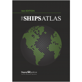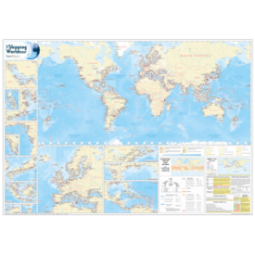



The definitive world atlas, now in its 16th edition, featuring over 200,000 place names and 263 pages of detailed mapping. A trusted global reference for accuracy and depth.
Data sheet
Specific References
Navigate the world with the most authoritative atlas available
When accuracy is non-negotiable, this world atlas stands as the ultimate reference for maritime professionals, logisticians, and global strategists. With its 16th edition, it has been rigorously updated to reflect the latest geopolitical shifts, infrastructure developments, and place name changes—over 8,000 updates alone, including new country names like Eswatini and North Macedonia, as well as indigenous place names in Australia and New Zealand. This isn’t just a map collection; it’s a dynamic tool designed to support critical operations in shipping, trade, and international navigation.
Unrivaled detail for professional use
Featuring 263 pages of continuous, large-scale mapping and 223 pages of meticulously curated indexes, this atlas provides instant access to over 200,000 place names. Every detail—from maritime boundaries to transportation networks—is rendered with precision, ensuring that professionals can rely on it for route planning, port logistics, and geopolitical analysis. The inclusion of expert essays on global themes like climate change and oceanography further enhances its value, offering contextual insights that go beyond traditional cartography.
Engineered for durability and efficiency
Built to withstand frequent use, this hardcover atlas measures 45 cm in height and weighs 1.5 kg, making it substantial yet manageable for professional settings. Its protective slipcase and two ribbon bookmarks ensure quick access to critical information, while the robust binding guarantees longevity. Whether used in an office, on a vessel, or in the field, this atlas is designed to perform under the most demanding conditions.
This 16th edition of the world atlas spans 486 pages, including 263 pages of detailed cartography and 223 pages of comprehensive indexing. Measuring 45 cm in height and weighing 1.5 kg, it is presented in a durable hardcover format with a protective slipcase. Published in 2023, it features over 200,000 place names and incorporates the latest geopolitical and infrastructural updates, making it the most current and reliable reference for global navigation.
For decades, this publisher has been synonymous with cartographic excellence, producing reference works that set the standard for accuracy and detail. Their atlases are trusted by governments, international organizations, and professionals worldwide, offering unparalleled precision in mapping and geographic data. Each edition is meticulously updated to reflect the latest geopolitical and infrastructural changes, ensuring relevance and reliability for users across industries.
The atlas contains 263 pages of detailed cartography and 223 pages of extended indexing, totaling 486 pages.
Yes, this edition includes updates such as new country names like Eswatini and North Macedonia, along with over 8,000 place name changes, particularly in Kazakhstan and Ukraine.
Yes, it features indigenous names, such as K’gari for Fraser Island in Australia and Māori names in New Zealand.
The atlas measures 45 cm in height and weighs 1.5 kg, making it a substantial reference volume.
Yes, it includes updates on worldwide road, rail, and airport infrastructures, as well as administrative boundary changes.
Yes, the atlas features a preliminary section with expert essays on global themes like population, climate change, and the solar system.
This atlas is hardbound, ensuring durability for frequent use.
You might also like