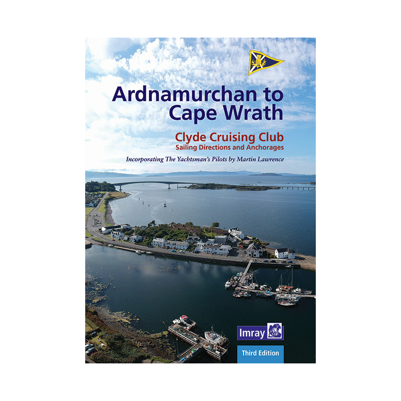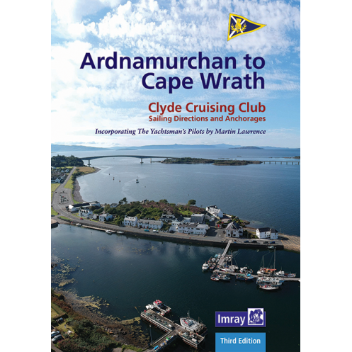




Explore Scotland’s northwest coast from Ardnamurchan to Cape Wrath with this expert guide. Updated charts, clear directions, and water-resistant pages ensure confident navigation in all conditions.
Data sheet
Specific References
Your indispensable companion for cruising Scotland’s most dramatic and remote waters
From Ardnamurchan Point to Cape Wrath, this comprehensive cruising guide unlocks the secrets of Scotland’s northwest coast, a labyrinth of sea lochs, towering cliffs, and hidden anchorages. Designed for sailors who seek adventure without compromise, this guide delivers unparalleled detail for navigating one of the most challenging yet rewarding cruising grounds in the British Isles. Whether you’re threading through the narrows of the Sound of Sleat or exploring the sheltered bays of the Small Isles, this book ensures you have the local knowledge to sail safely and make the most of every stop.
Expertly updated for modern sailors
The 2022 third edition has been meticulously revised by seasoned mariners, incorporating the latest hydrographic data and firsthand insights from cruising experts. Every page reflects current conditions, with updated navigation notes, revised chartlets, and new aerial photographs to help you identify landmarks and hazards with precision. The guide also integrates information from large-scale Antares charts, providing an extra layer of detail for tricky passages and poorly charted areas. Whether you’re planning a multi-day voyage or a weekend escape, this edition ensures you’re equipped with the most accurate and practical information available.
Built for the demands of real-world cruising
This isn’t just another guidebook—it’s a tool engineered for life on the water. The spiral-bound, water-resistant pages lie flat for easy reference at the chart table or in the cockpit, even in rough conditions. Clear, large-scale chartlets and high-quality aerial photos eliminate guesswork, while concise, no-nonsense text gets straight to the point: depths, tidal streams, hazards, and the best anchorages. The guide’s A4 format strikes the perfect balance between portability and readability, making it as practical for quick consultations as it is for detailed passage planning. With coverage extending from the rugged Ardnamurchan Peninsula to the remote beauty of Cape Wrath, it’s the only resource you’ll need to explore this iconic stretch of coastline.
Trusted by sailors for decades
For generations, cruising sailors have relied on this guide to navigate Scotland’s northwest coast safely and efficiently. Its reputation is built on a foundation of accuracy, clarity, and practicality—qualities that have made it a staple in the libraries of both weekend sailors and long-distance cruisers. Whether you’re a first-time visitor or a seasoned veteran of these waters, this guide provides the confidence to tackle even the most complex passages, from the tidal races of Kyle Rhea to the exposed anchorages of the Summer Isles. With its combination of expert local knowledge and user-friendly design, it’s more than just a book—it’s your ticket to unforgettable adventures along one of the world’s most breathtaking coastlines.
Master Scotland’s Northwest Coast with the Ultimate Cruising Companion
Explore the wild beauty of Scotland’s northwest coast with this essential cruising guide, covering the stunning and often challenging waters from Ardnamurchan Point to Cape Wrath. This 2022 third edition is your key to unlocking the secrets of this rugged coastline, offering detailed navigation advice, updated chartlets, and practical insights for every sailor. Whether you’re navigating the intricate sea lochs of Skye or seeking shelter in the remote anchorages of the Small Isles, this guide provides the clarity and confidence you need to sail safely and make the most of every voyage.
Engineered for sailors, by sailors
Designed with the realities of cruising in mind, this guide features a durable spiral binding that lies flat for easy use at the chart table or in the cockpit. The water-resistant pages ensure your guide stays readable even in wet conditions, while the A4 format strikes the perfect balance between portability and readability. With 160 pages of expertly curated content, including high-quality aerial photographs and large-scale chartlets, this guide eliminates guesswork and helps you navigate with precision. Every detail, from tidal streams to hidden hazards, is presented in a clear, concise format that’s easy to reference on the go.
Updated with the latest hydrographic data and local insights
This third edition has been thoroughly revised to reflect the most current conditions, incorporating feedback from experienced sailors and the latest hydrographic data. The guide now includes information from large-scale Antares charts, providing an extra layer of detail for complex passages and poorly charted areas. Whether you’re planning a short coastal hop or a multi-day expedition, you’ll find everything you need to navigate safely, from waypoint coordinates to recommended anchorages. The guide’s comprehensive coverage ensures you’re prepared for every challenge, from the tidal races of Kyle Rhea to the exposed waters of Cape Wrath.
A trusted resource for sailors of all levels
For decades, this guide has been the go-to resource for sailors exploring Scotland’s northwest coast. Its reputation for accuracy, clarity, and practicality has made it a staple in the libraries of both weekend sailors and long-distance cruisers. Whether you’re a first-time visitor or a seasoned veteran of these waters, this guide provides the local knowledge and confidence to tackle even the most demanding passages. With its combination of expert insights and user-friendly design, it’s more than just a guide—it’s your passport to unforgettable adventures along one of the world’s most spectacular coastlines.
This 2022 third edition of the cruising guide covers the northwest coast of Scotland from Ardnamurchan to Cape Wrath, including Skye and the Small Isles. With 160 pages of detailed navigation notes, updated chartlets, and aerial photographs, it provides everything you need for safe and enjoyable cruising. The guide features a durable spiral binding, water-resistant paper, and an A4 format for easy reference at the chart table or in the cockpit. Approved by the UK Hydrographic Office, it’s a trusted resource for sailors navigating these challenging and rewarding waters.
With a legacy spanning over a century, this publisher is renowned for producing high-quality nautical guides and charts that sailors trust worldwide. Their publications are celebrated for their accuracy, practicality, and durability, making them indispensable tools for both recreational and professional mariners. Each guide is crafted with input from experienced sailors and hydrographic experts, ensuring that every detail is tailored to the needs of those who rely on them at sea.
The guide is printed on water-resistant paper, designed to withstand harsh marine conditions.
Yes, the 2022 edition includes updated navigation directions, revised text, and current chartlets, making it reliable for recent use.
The guide provides highly detailed anchorage plans, including chartlets and aerial photographs for precise navigation and mooring.
Yes, the spiral binding and water-resistant paper make it durable and practical for use in a cockpit or chart table, even in challenging conditions.
Yes, it includes comprehensive coverage of the Small Isles, along with the Isle of Skye and the coastline from Ardnamurchan to Cape Wrath.
Yes, the guide includes precise latitudes and longitudes that can be used with GPS systems for accurate navigation.
The guide contains 160 pages of detailed navigation directions, plans, and photographs.
You might also like