
Inland waterways of southern Germany
search
  • googlemap
  • Inland waterways of southern Germany
  • Inland waterways of southern Germany

Inland waterways of southern Germany

€35.15
Tax included
Edwardsmay
In English language
Estimated preparation time: 3 to 5 days

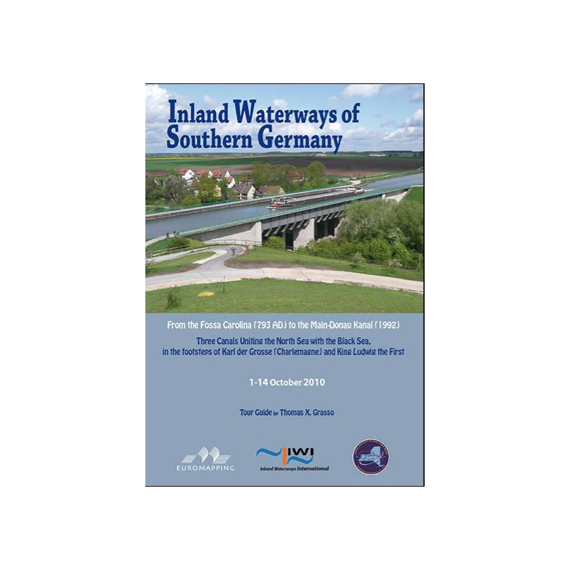
Explore southern Germany’s intricate inland waterways with this detailed 72-page nautical guide, featuring maps, photos, and expert insights for a 12-day Rhine-Danube journey.

SR00210

Data sheet

What is the classification?
navigation book
What type of nautical chart is this?
navigation chart
On what digital medium is this nautical chart / book stored?
paper medium
What type of format does this paper nautical chart have?
folded chart
What type of navigation book is this?
pilot
Picto
In English language

Specific References

UPC
400000055268
EAN13
4000000200956
New
Description détaillée

Southern Germany Inland Waterways Guide

Book in English
Paperback edition

Explore Southern Germany’s Waterways with Expert Guidance

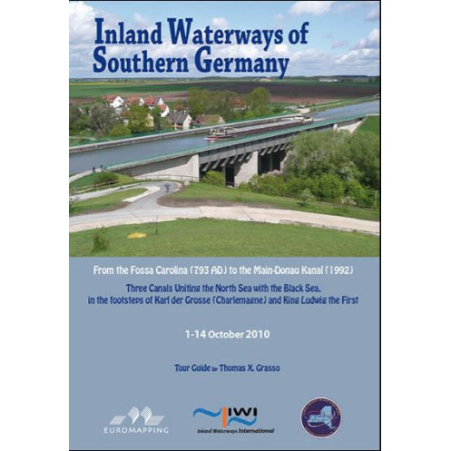
Embark on a journey through the heart of southern Germany with this meticulously crafted nautical guide. Designed for boaters, travelers, and geography enthusiasts, this book offers an unparalleled look at the region’s intricate network of rivers, canals, and waterways. Whether you're planning a leisurely cruise or a detailed exploration, this guide provides the insights and practical information needed to navigate with confidence.

A Comprehensive Introduction to the Region’s Geography

Dive into a richly detailed introduction that paints a vivid picture of southern Germany’s physical landscape. From the geological history that shaped its waterways to the modern engineering marvels that connect them, this section offers a fascinating blend of science and storytelling. Learn about the drainage patterns, watershed divides, and the natural forces that have influenced the region’s water systems over millions of years. This foundational knowledge sets the stage for a deeper appreciation of the routes and landmarks you’ll encounter.

A 12-Day Itinerary for an Unforgettable Journey

Follow a carefully curated 12-day itinerary that takes you from the mighty Rhine to the historic Danube, with stops along the Main River and the iconic Main-Danube Canal. Each leg of the journey is accompanied by detailed descriptions, practical tips, and insider insights to help you make the most of your adventure. Whether you're navigating the bustling waterways near major cities or enjoying the serene beauty of rural landscapes, this guide ensures you won’t miss a thing.

Richly Illustrated with Maps and Photographs

Enhance your understanding of the routes with an abundance of high-quality maps and photographs. These visual aids provide clear, easy-to-follow references for navigation, while also capturing the scenic beauty and cultural highlights of the region. From detailed river charts to stunning landscape shots, the illustrations bring the journey to life, making planning and execution seamless.

Up-to-Date and Reliable Information

Published through a print-on-demand process, this guide guarantees the most current information, including the latest corrections and updates. Originally released by Euromapping and now part of the Transmanche collection, it reflects years of expertise and a commitment to accuracy. Whether you're a seasoned boater or a first-time explorer, you can trust this guide to provide reliable, up-to-date details for a smooth and enjoyable journey.

Perfect for Boaters and Travel Enthusiasts

Weighing just 0.6 kg and designed in a convenient 30 × 21 cm format, this guide is easy to carry and use on the go. Its durable paperback construction ensures it can withstand the rigors of travel, while its clear, concise layout makes it simple to reference while on the water. Whether you're plotting your course from the comfort of home or checking details during your trip, this guide is an indispensable companion for anyone exploring southern Germany’s inland waterways.

Discover the Hidden Gems of Southern Germany’s Waterways
Southern Germany’s inland waterways are a marvel of natural beauty and engineering ingenuity, offering some of Europe’s most scenic and historically rich boating routes. This guide is your key to unlocking the secrets of the region, providing everything you need to navigate the Rhine, Main, and Danube rivers with ease. Whether you're a seasoned sailor or a curious traveler, this book transforms a simple journey into an unforgettable adventure.

Expertly Crafted for Boaters and Explorers
Written by nautical expert Tom Grasso, this guide is the result of meticulous research and firsthand experience. It was originally prepared for a 2010 tour, ensuring that the information is both practical and time-tested. With 72 pages of detailed content, it strikes the perfect balance between depth and accessibility, making it ideal for both planning and on-the-go reference. The guide’s focus on southern Germany’s waterways ensures that every page is packed with relevant, actionable insights.

Visual Storytelling with Maps and Photographs
What sets this guide apart is its rich visual content. Featuring an abundance of maps and photographs, it provides a clear, engaging way to understand the routes and landmarks. The maps are designed for easy navigation, while the photographs capture the essence of the region’s landscapes, towns, and cultural sites. This combination of practicality and beauty makes the guide not just a tool, but a keepsake of your journey.

Always Up-to-Date with Print-on-Demand Technology
Thanks to digital print-on-demand technology, this guide is always current. Any corrections or updates are seamlessly incorporated, ensuring you have the most accurate information at your fingertips. Originally published by Euromapping and now part of the Transmanche collection, this guide reflects a legacy of quality and reliability. Whether you're planning a short trip or an extended voyage, you can trust this book to be your dependable companion.

Designed for Convenience and Durability
Weighing just 0.6 kg and measuring 30 × 21 cm, this guide is lightweight and portable, making it easy to carry on board or pack in your travel bag. Its paperback format is durable enough to withstand the demands of travel, while its clear, concise layout ensures quick and easy reference. Whether you're plotting your course at home or checking details on the water, this guide is designed to be as practical as it is informative.

This guide to southern Germany’s inland waterways is a 72-page paperback book, offering a compact yet comprehensive resource for boaters and travelers. Measuring 30 × 21 cm and weighing 0.6 kg, it is designed for easy portability without sacrificing content. Written entirely in English, it features a folded map format for convenient navigation and is printed on demand to ensure the latest updates and corrections are included.

With a focus on delivering high-quality nautical guides, this publisher brings together expertise in geography, travel, and navigation. Known for its detailed and visually engaging content, the brand ensures that every guide is both practical and inspiring, making it a trusted resource for boaters and explorers alike.

  • This guide stands out for its expertly curated content, combining detailed maps, practical navigation tips, and stunning visuals to create an indispensable tool for exploring southern Germany’s waterways. Its print-on-demand format guarantees up-to-date information, while its portable design makes it easy to use on the go. Whether you're planning a trip or navigating in real time, this guide offers unmatched clarity and convenience.
What regions are covered in this navigational guide?

The guide covers the inland waterways of southern Germany, including detailed routes along the Rhine, Main, Main-Danube Canal, and Danube.

Is this guide suitable for beginners in inland waterway navigation?

Yes, it includes a comprehensive introduction explaining physical characteristics, water drainage analysis, and geological history, making it accessible for beginners.

How up-to-date is the information in this guide?

The guide is printed on demand using digital methods, ensuring it includes the latest corrections and updates available as of its preparation in 2010.

What type of illustrations are included in the guide?

The guide is abundantly illustrated with navigational maps and photographs to assist in route planning and understanding the waterways.

How long does the suggested tour take to complete?

The guide details a 12-day tour covering the key waterways in southern Germany.

Can this guide be used alongside digital navigation tools?

Yes, while it is a paper-based guide, its detailed maps and descriptions can complement digital navigation tools for enhanced planning and reference.

Loading...