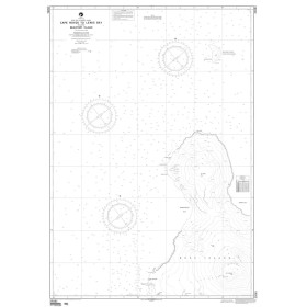

This waterproof nautical chart covers Saint-Vaast and the Channel Islands, offering durable, bilingual navigation aid. Includes depths, hazards, and mooring spots for safe coastal cruising.
Data sheet
Specific References
For sailors and boating enthusiasts, precision and reliability are non-negotiable when navigating coastal waters. This nautical chart delivers exactly that—a clear, detailed, and practical tool designed for safe and efficient navigation in one of the most frequented areas of the English Channel. Whether you're planning a route, identifying hazards, or selecting a safe anchorage, this chart provides the essential information you need at a glance.
Whether you're a seasoned sailor or a weekend cruiser, this nautical chart is an indispensable part of your navigation toolkit—combining durability, accuracy, and ease of use for safer voyages along the Normandy coast and beyond.
Navigate with confidence using this essential nautical chart for the English Channel
Designed for boaters who demand precision and reliability, this folded nautical chart provides comprehensive coverage of the Saint-Vaast and Channel Islands region—one of the most dynamic and frequently sailed areas in the English Channel. Printed on durable, moisture-resistant paper, it delivers clear, up-to-date information to support safe coastal navigation, route planning, and emergency preparedness. Whether you're plotting a course, identifying hazards, or selecting a safe anchorage, this chart is engineered to meet the real-world needs of recreational and professional sailors alike.
Engineered for durability and practical use at sea
Unlike standard maps, this nautical chart is built to withstand the harsh marine environment. Its latex-coated paper resists water, salt spray, and repeated handling, ensuring it remains legible and intact even in challenging conditions. The ability to write and erase pencil markings allows for dynamic route adjustments without damaging the surface, making it a versatile tool for both planning and active navigation. Folded to a convenient size (166 × 315 mm), it fits seamlessly into navigation stations while unfolding to a full A0 format (118.9 × 84.1 cm) for detailed, large-scale reference.
Comprehensive coverage for critical coastal waters
This double-sided chart combines two essential references (528 and 1014) to provide seamless coverage of the Saint-Vaast region and the Channel Islands. It includes detailed insets of major ports, anchorages, and navigational hazards, ensuring you have all the information needed for safe passage. The chart features depth soundings, seabed composition, navigational aids, light sectors, and tidal information—all presented in a bilingual format (French and English) for accessibility. Compatible with the WGS 84 reference system, it aligns perfectly with modern GPS devices, offering a reliable backup in case of electronic failure.
Trusted by sailors for accuracy and ease of use
With a scale of 1:100,000, this chart strikes the ideal balance between broad coverage and fine detail, allowing you to navigate with confidence in both open waters and near-shore environments. Regularly updated to reflect the latest hydrographic data, it ensures you’re always working with the most current information available. Whether you're a seasoned sailor or a weekend cruiser, this nautical chart is an indispensable tool for safer, more enjoyable voyages along the Normandy coast and beyond.
This nautical chart is a folded, double-sided paper map designed for coastal navigation in the English Channel, specifically covering the Saint-Vaast and Channel Islands area. Printed on moisture-resistant, latex-coated paper, it measures 118.9 × 84.1 cm when unfolded (A0 format) and folds down to 166 × 315 mm for easy storage. With a scale of 1:100,000, it provides detailed coverage of depth soundings, seabed composition, navigational aids, and light sectors, all presented in a bilingual French/English layout. Compatible with the WGS 84 reference system, it weighs just 0.090 kg and was last updated in 2019.
With decades of expertise in marine navigation, this brand specializes in producing high-quality nautical charts tailored for recreational and professional boaters. Focused on accuracy, durability, and practicality, their charts cover key sailing regions in France and Spain, providing sailors with reliable tools for safe and efficient navigation. Each chart is designed to complement modern electronic systems while serving as a trusted backup in all conditions.
The chart is drawn at a scale of 1:100,000, providing detailed coverage of coastal features and navigational hazards.
Yes, the chart is printed on latex-coated paper that resists moisture and spray, allowing you to write and erase navigation notes as needed.
It covers the waters around Saint-Vaast and the Channel Islands, including detailed coastal plans and harbor insets.
Yes, it uses the WGS 84 datum, ensuring compatibility with all modern GPS and electronic navigation systems.
When folded, the chart measures 166 × 315 mm, making it easy to store and handle on board.
Yes, the chart includes soundings, seabed composition, buoys, lights, and all essential navigational hazards.
Always verify the edition date before use, as charts should be updated regularly to reflect changes in navigational aids and coastal features.
You might also like