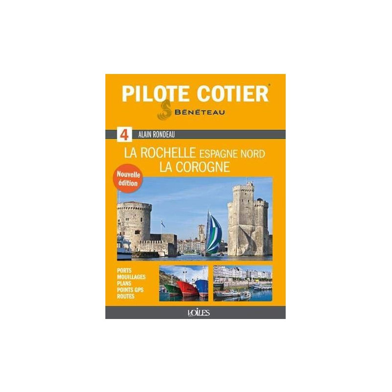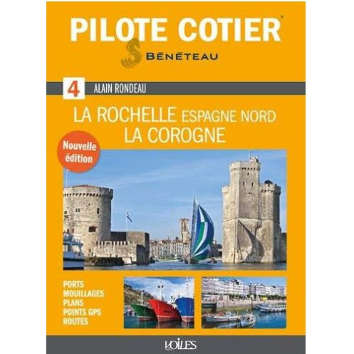




Sail from La Rochelle to La Corogne with this essential coastal guide. 153 maps, 900 photos, and expert tips for navigating ports, coves, and challenging passages with ease.
Data sheet
Specific References
Navigate the Atlantic Coast with Confidence
This comprehensive coastal pilot guide is your ultimate resource for safe and enjoyable sailing along the stunning Atlantic coastline from La Rochelle, France, to A Coruña, Spain. Designed for recreational boaters and anglers, this guide provides detailed, up-to-date information on everything you need to know for a seamless journey. Whether you're exploring hidden coves, docking at charming fishing villages, or navigating challenging passages, this guide ensures you have the most accurate and practical insights at your fingertips.
Expertly Crafted for Boaters
Written by seasoned mariners and updated by industry experts, this guide combines decades of nautical experience with the latest navigational data. It covers a vast stretch of coastline, including the picturesque French Atlantic shores and the rugged beauty of northern Spain. With a focus on safety and precision, it highlights critical areas such as the Gironde estuary, the Landes region, the Basque Country, and the Galician rias, ensuring you’re prepared for every twist and turn of your voyage.
Detailed Coverage of Key Locations
From bustling marinas to secluded anchorages, this guide leaves no stone unturned. Discover the best spots to drop anchor, such as the idyllic Île d'Aix, the serene Plage des Saumonards, and the sheltered Bonne Anse. Explore quaint harbors like Le Chapus, Socoa, and Guetaria, or dock at major marinas in La Rochelle, Arcachon, Bilbao, and Santander. The guide also includes essential details on welcoming fishing ports like Château d'Oléron, La Cotinière, and Castro Urdiales, as well as tips for navigating tricky passages like the Maumusson inlet, Arcachon passes, and the Adour entrance.
Practical Tools for Every Sailor
Packed with practical advice, this guide offers more than just maps and coordinates. It includes distances, routes, waypoints, and aerial views to help you plan your journey with ease. You’ll also find useful addresses, phone numbers, and insider tips to make your trip smoother. With annual updates on buoy positions and navigational aids, you can trust that the information is current and reliable, giving you peace of mind as you sail.
Rich Visual and Cartographic Resources
Enhance your navigation with 900 full-color photos and 153 detailed maps and charts. These visual aids provide a clear understanding of the coastline, ports, and potential hazards, making it easier to identify landmarks and plan your route. Whether you're a seasoned sailor or a weekend boater, these resources are invaluable for ensuring a safe and enjoyable voyage.
Designed for Easy Use
This guide is crafted with boaters in mind, offering a user-friendly format that’s easy to navigate. Its durable, compact design makes it perfect for use on board, while the clear, concise information ensures you can quickly find what you need. Whether you're plotting your next stop or looking for local services, this guide is your go-to companion for coastal navigation along one of Europe’s most beautiful and diverse coastlines.
Your Ultimate Guide to Atlantic Coastal Navigation from La Rochelle to A Coruña
Embark on your next maritime adventure with confidence using this meticulously crafted coastal pilot guide, covering the breathtaking stretch from La Rochelle, France, to A Coruña, Spain. This essential resource is tailored for recreational boaters, anglers, and anyone seeking to explore the Atlantic coastline with precision and ease. With 384 pages of expertly curated content, this guide is your trusted companion for navigating both well-trodden routes and hidden gems along the way.
Comprehensive Coverage of Iconic and Hidden Locations
This guide offers unparalleled coverage of the Atlantic coastline, including major marinas like La Rochelle, Arcachon, Bilbao, and Santander, as well as charming fishing ports such as Château d'Oléron, La Cotinière, and Castro Urdiales. It also highlights some of the region’s most picturesque anchorages, from the tranquil Île d'Aix to the scenic Plage des Saumonards and the sheltered Bonne Anse. Whether you're seeking bustling harbors or secluded coves, this guide ensures you won’t miss a thing.
Expert Insights for Safe and Efficient Navigation
Navigating the Atlantic coastline comes with its challenges, from the tricky passes of Arcachon to the strong currents of the Adour entrance. This guide provides detailed advice on handling these complex areas, including the Gironde estuary, the Landes region, the Basque Country, and the Galician rias. With annual updates on buoy positions and navigational aids, you can trust that the information is accurate and up-to-date, helping you avoid hazards and sail with confidence.
Practical Tools for Every Stage of Your Journey
Beyond maps and coordinates, this guide is packed with practical tools to enhance your sailing experience. It includes distances, routes, and waypoints to help you plan your voyage efficiently, as well as aerial views for better orientation. You’ll also find useful addresses, phone numbers, and insider tips for local services, ensuring you have everything you need for a smooth and enjoyable trip. Whether you're docking for the night or stocking up on supplies, this guide has you covered.
Rich Visual Resources for Enhanced Navigation
With 900 full-color photos and 153 detailed maps and charts, this guide brings the coastline to life. These visual resources provide a clear and comprehensive understanding of the terrain, ports, and potential obstacles, making it easier to identify landmarks and plan your route. The high-quality imagery ensures you can navigate with precision, whether you're entering a busy marina or exploring a remote anchorage.
Durable and User-Friendly Design
Designed for use on board, this guide features a sturdy, compact format that withstands the rigors of life at sea. Its intuitive layout and clear, concise information make it easy to find what you need, whether you're checking coordinates, looking for local services, or planning your next stop. Weighing just 1.1 kg, it’s lightweight enough to carry with you wherever your journey takes you.
This coastal pilot guide is a comprehensive resource for navigating the Atlantic coastline from La Rochelle to A Coruña. It features 384 pages of detailed information, including 900 full-color photos and 153 maps and charts. The guide measures 16.2 x 22 x 1.7 cm and weighs 1.1 kg, making it a practical and portable companion for any boater. Updated annually, it provides the latest navigational data, including buoy positions, waypoints, and routes, ensuring you have the most accurate and reliable information for your journey.
With a reputation for precision and reliability, this series of coastal pilot guides has become a trusted resource for boaters exploring Europe’s most beautiful and challenging coastlines. Each edition is crafted by experienced mariners and updated regularly to ensure the information remains current and accurate. Known for their detailed coverage and practical insights, these guides are designed to enhance the safety and enjoyment of every voyage.
The guide covers coastal navigation from La Rochelle, France, to La Corogne, Spain, including the French Atlantic and Spanish Cantabrian coasts, with detailed information on harbors, marinas, fishing ports, and challenging passages.
The guide is updated annually, ensuring that details like buoy positions and navigational aids are current for safe and accurate coastal navigation.
It includes 900 color photos, 153 maps and charts, as well as aerial views to assist with navigation and planning.
Yes, the guide provides detailed advice for challenging areas such as the Maumusson channel, Arcachon passes, Adour entrance, and Spanish capes in rough seas.
The guide measures 16.2 x 22 x 1.7 cm and weighs 1.1 kg, making it portable yet comprehensive for onboard use.
Yes, it provides useful addresses, phone numbers, and practical tips for marinas, fishing ports, and other key locations along the route.
Absolutely, it is designed as an essential tool for both pleasure boaters and fishermen, offering detailed navigational and practical information.
You might also like