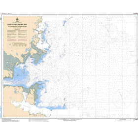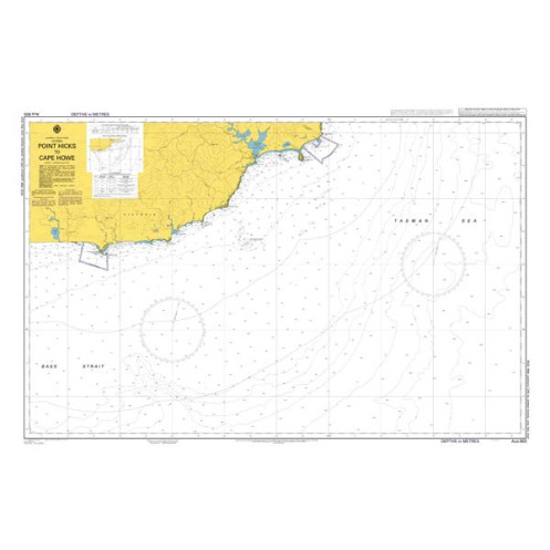



AHO - AUS805 - nautical chart - Point Hicks to Cape Howe
search
  • googlemap
  • AHO - AUS805 - nautical chart - Point Hicks to Cape Howe

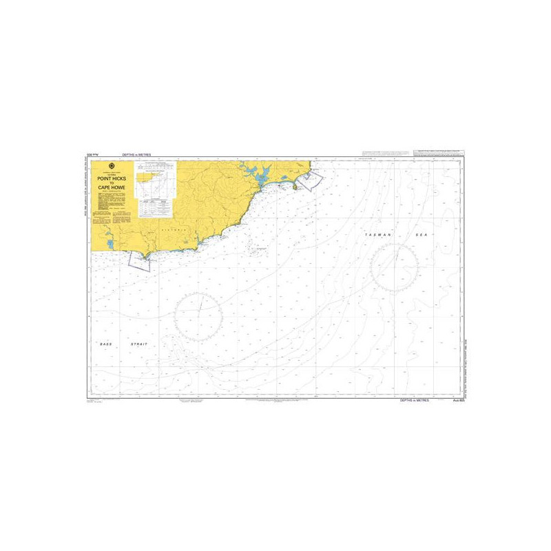
Nautical chart AHO - AUS805 - Point Hicks to Cape Howe

€78.58
AHO - Australian Hydrographic Office
In English language Rolled paper chart
chart printed to order
Preparation time: 5 to 14 days
The Australian Hydrographic Office Marine chart Catalog offers a very complete selection of nautical charts from Australia.
aho-AUS805

Data sheet

Year
chart printed to order incorporating the latest corrections
Author
Australian Hydrographic Office
Scale
1:150.000
Picto
In English language
Rolled paper chart
Classification scale paper chart
Coastals
Paper chart format
Flat chart (rolled in a tube)
Support
paper version
Navigation area
Pacific Ocean
Chart type
Navigation chart

Specific References

UPC
400000107769
EAN13
4000000111184
New
chart printed to order
Description détaillée

This Australian Hydrographic Office paper navigation chart (flat chart) covers Pacific Ocean, the area Point Hicks to Cape Howe.

Australian Hydrographic Office (AHO) nautical charts are the official reference for safe navigation in Australian waters and across large parts of the South Pacific. Produced by the Australian Hydrographic Office, these charts are trusted by professional mariners, offshore sailors, and experienced cruisers operating in demanding and often remote maritime environments.

Available from the Nautic Way online maritime bookstore, AHO charts cover key navigation areas including:

  • the Australian coastline,
  • the Great Barrier Reef,
  • Tasmania,
  • South Pacific island regions.

Navigating in these areas involves specific challenges such as coral reefs, narrow passes, shifting seabeds, and isolated coastlines. Choosing the right AHO chart is therefore essential to ensure accuracy, safety, and compliance with international navigation standards.

What is an Australian Hydrographic Office nautical chart used for?

AHO charts are designed to support navigation in complex, remote, and environmentally sensitive maritime zones.

Practical uses

These charts are used for:

  • Coastal navigation along Australia
  • Offshore sailing in the South Pacific
  • Long-distance cruising and world voyages
  • Navigation through reef systems and hazardous areas
  • Approaches to remote or technically demanding ports

Real-life navigation scenarios

  • Crossing the Great Barrier Reef via narrow reef passages
  • Sailing between Pacific islands
  • Approaching Australian ports with environmental constraints
  • Identifying shallow areas and submerged reef structures

Added value compared to generic or digital-only charts

AHO charts provide:

  • Official, locally adapted cartography
  • Enhanced accuracy in reef and shallow-water zones
  • Reliable and standardized chart presentation, critical in remote navigation

Who are AHO charts recommended for?

AHO charts are intended for navigators operating in challenging offshore environments.

Target users

  • Experienced offshore sailors
  • Skippers on long-distance voyages
  • Maritime professionals working in the region
  • Advanced recreational sailors engaged in bluewater cruising

Navigation conditions

  • Suitable for day and night navigation
  • Ideal for regular or extended voyages
  • Used in combination with GPS, chartplotters, or ECDIS systems

These charts provide both strategic overview and local detail, essential in isolated regions.

How to read and use an AHO nautical chart

AHO charts follow international standards while integrating the specific characteristics of Australian waters.

Understanding chart scale

  • Small scale: ocean route planning
  • Medium scale: coastal navigation
  • Large scale: reef passages, harbors, and confined waters

In areas like the Great Barrier Reef, large-scale charts are critical for precise hazard identification.

Key information displayed

An AHO chart includes:

  • Detailed depth soundings
  • Seabed composition (coral, sand, rock)
  • International buoyage system (IALA)
  • Reefs, shoals, and isolated dangers
  • Recommended routes and restricted areas
  • Ports, anchorages, and shelters

Essential user knowledge

  • Accurate interpretation of reef areas
  • Understanding tidal effects on depth
  • Awareness of partially surveyed or unsurveyed zones

In these regions, charts are a critical safety tool, not just a navigation aid.

Reliability, updates, and safety (E-E-A-T)

A structured update system

The AHO provides:

  • Notices to Mariners
  • Regular chart corrections
  • Updated chart editions

These updates are essential in areas where maritime data can evolve.

Standards and compatibility

  • Based on the WGS 84 geodetic system (GPS compatible)
  • Compliant with international hydrographic standards
  • Compatible with ECDIS navigation systems

Best safety practices

  • Always check the chart edition date
  • Apply relevant updates and corrections
  • Maintain paper chart backups onboard

In remote navigation, chart reliability is a key safety factor.

Paper vs digital AHO charts – why keep paper onboard?

Advantages of paper charts

  • Immediate wide-area visual overview
  • Easier interpretation of complex zones (reefs, passes)
  • No dependence on power or electronics
  • Official reference for safe navigation

Complementarity with digital tools

  • Cross-checking GPS data
  • Route planning and validation
  • Ensuring redundancy in navigation systems

In remote areas, paper charts remain a vital safety backup.

Why choose AHO charts from Nautic Way?

About the Australian Hydrographic Office

The Australian Hydrographic Office is recognized for:

  • high-precision hydrographic surveys
  • expertise in complex maritime environments
  • contribution to international maritime safety

The Nautic Way advantage

At Nautic Way, you benefit from:

  • A carefully curated selection of AHO charts
  • Editions aligned with real navigation needs
  • Expert guidance to choose the right coverage
  • A specialized maritime e-commerce platform

very chart is selected for its practical value in real navigation, not just for catalog completeness.

FAQ – Australian Hydrographic Office charts

Which AHO chart should I choose for navigating in Australia?
It depends on your sailing area (coastal, reef, offshore) and the level of detail required. Multiple charts are often necessary.

Is an AHO chart sufficient on its own?
It is an excellent primary reference, but should ideally be used alongside electronic navigation systems.

How often should AHO charts be updated?
Whenever a new edition is released or when significant corrections are issued.

Are AHO charts compatible with GPS?
Yes, they are based on the WGS 84 system and fully compatible with modern navigation equipment.

What is the difference between AHO, SHOM, and Admiralty charts?
AHO charts are specifically optimized for Australian and South Pacific waters, offering detailed and locally adapted information.

Summary – AHO charts: navigating safely in demanding environments

Australian Hydrographic Office nautical charts are essential tools for navigating Australia and the South Pacific. They provide accurate, reliable, and region-specific information, crucial in areas where navigation conditions can be particularly challenging.

By choosing them from Nautic Way, you gain access to expert selection, trusted cartography, and professional guidance, ensuring safe and confident navigation wherever your journey takes you.

Australian Hydrographic Office nautical charts are updated daily and printed only on demand. On the day of printing, they incorporate the latest updates. The chart's publication year is indicated on it.

We strive to offer only the latest versions of nautical charts incorporating the most recent updates.

All nautical charts, whether paper or digital, are printed on demand and include the latest updates. In accordance with Article L221-28 of the French Consumer Code, the right of withdrawal cannot be exercised for goods liable to become obsolete rapidly. Paper charts and digital charts are neither returnable nor exchangeable. Consequently, these orders are final upon placement by the Customer, according to the terms and conditions specified in these General Terms and Conditions of Sale.

Loading...