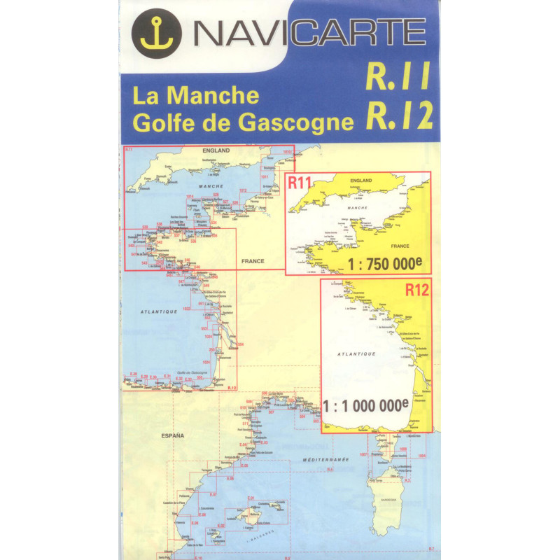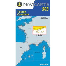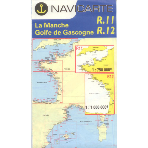





Navicarte nautical chart, coasts of France and Spain.
Data sheet
Specific References
The Navicarte R11 + R12 – English Channel + Bay of Biscay nautical chart is a folded paper chart designed for offshore and long-distance navigation. It covers a large maritime area including the English Channel and the Bay of Biscay.
With a scale of 1:1,000,000, this chart provides a general representation suitable for planning longer routes, crossings and offshore navigation. It allows the navigator to view a large section of the European Atlantic and plan an overall route before moving to larger-scale coastal charts for approaches and detailed navigation areas.
Navicarte R11 + R12 differs from the coastal charts in the Navicarte series because of its 1:1,000,000 scale.
At this scale, the main purpose is not to provide a highly detailed representation of a coastal area or harbour entrance, but to provide a broad view for planning navigation over a significant distance.
It is particularly suitable for studying a route between different areas of the English Channel and Bay of Biscay, or for planning a coastal or offshore itinerary requiring an overall view.
This representation allows the navigator to step back from detailed coastal charts and establish the general route before selecting the documents required for each stage.
A 1:1,000,000 chart is particularly useful for planning a long-distance route.
The navigator can use it to visualise the overall direction of the passage, assess general distances, identify the main maritime areas crossed and organise the charts required for navigation.
For a Bay of Biscay crossing, for example, a general chart makes it possible to begin the planning process by considering the entire route rather than each coastal area separately.
Detailed planning should then be carried out using charts appropriate to coastal areas and harbour approaches.
Navicarte R11 + R12 brings together two major maritime areas that are particularly important for navigation in Western Europe: the English Channel and the Bay of Biscay.
The English Channel is an important navigation area characterised by significant maritime traffic and major coastal and cross-Channel routes.
The Bay of Biscay is a large open maritime area facing the Atlantic and is crossed by vessels travelling between the French Atlantic coast, northern Spain and the Iberian Peninsula.
The chart allows these large maritime areas to be viewed on a single support and provides a basis for planning the overall route before moving to larger-scale charts.
Navicarte R11 + R12 does not replace detailed coastal charts.
Its 1:1,000,000 scale is suitable for general route planning, but it does not provide the same level of detail as a 1:50,000 chart or a chart at a larger scale.
When a vessel approaches the coast, a harbour, a channel or an area requiring more detailed navigation, the navigator must use charts appropriate to that stage of the passage.
R11 + R12 therefore plays a complementary role: it helps establish the overall route and organise the chart documentation required for the voyage.
Navicarte R11 + R12 is a paper chart. It is not intended to be loaded directly into a GPS or chartplotter.
It can nevertheless be used alongside an electronic navigation system.
GPS provides the vessel's position while the paper chart maintains an overall view of the route. This combination is particularly useful during crossings and long-distance passages.
The paper chart also provides an independent reference in the event of a power failure, equipment failure or electronic navigation system malfunction.
Publisher: Navicarte
Chart numbers: R11 + R12
Area: English Channel + Bay of Biscay
Countries concerned: France and Spain
Maritime area: Atlantic Ocean
Type: nautical navigation chart
Use: recreational boating
Navigation: offshore
Support: paper
Format: folded chart
Unfolded size: A0, 118.9 × 84.1 cm
Scale: 1:1,000,000
Language indicated: French
Navicarte R11 + R12 is particularly suitable for planning offshore navigation or a crossing covering a significant part of the English Channel and Bay of Biscay.
It can be used by recreational sailors preparing a long cruise, a passage between France and Spain or an itinerary requiring a general view of the European Atlantic.
It also helps determine which coastal charts will be required for the different stages of the voyage.
Planning a long-distance voyage often begins with a general representation of the route.
R11 + R12 can be used for this first stage: overall distance, general direction, succession of maritime areas and organisation of the required chart documentation.
Once the general route has been established, the navigator can select the coastal charts required for departure, arrival and the different areas of coastal navigation along the route.
This method makes it possible to build coherent chart coverage rather than trying to use a single chart scale for the entire voyage.
Navicarte R11 + R12 can also be used to teach offshore navigation.
It provides a useful basis for working on course, distance, bearing, position and the organisation of a passage.
At a scale of 1:1,000,000, it also provides an opportunity to understand the difference between a general chart designed for route planning and a coastal chart used for more precise navigation.
What area does Navicarte R11 + R12 cover?
It covers the English Channel and Bay of Biscay on the same chart set.
What is the scale of Navicarte R11 + R12?
The product information indicates a scale of 1:1,000,000.
Is Navicarte R11 + R12 designed for offshore navigation?
Yes. Its small scale is particularly suitable for planning long-distance routes and crossings.
Is Navicarte R11 + R12 a paper chart?
Yes. It is a folded paper chart that unfolds to A0 size.
What are the dimensions of Navicarte R11 + R12?
The unfolded format is 118.9 × 84.1 cm.
Can this chart be used to plan a Bay of Biscay crossing?
Yes. It is suitable for general planning of a Bay of Biscay crossing. Larger-scale charts are required for coastal approaches and harbour navigation.
Can R11 + R12 be used with GPS?
Yes. It can be used as a complementary paper chart alongside GPS or a chartplotter.
Does R11 + R12 replace a coastal chart?
No. Its 1:1,000,000 scale is intended for an overall view and long-distance route planning. Coastal areas and approaches require larger-scale charts.
What types of vessels is this chart suitable for?
It is particularly suitable for sailing yachts and motorboats undertaking long-distance navigation or crossings.
What documents should complement Navicarte R11 + R12?
Depending on the voyage, it should be complemented by larger-scale coastal charts and the nautical documents required for planning and conducting the passage.
You might also like