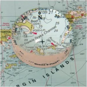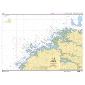

Navicarte - 538 + 539 - Nautical Chart - Ploumanac'h, Roscoff, Argenton
search
  • googlemap
  • Navicarte - 538 + 539 - Nautical Chart - Ploumanac'h, Roscoff, Argenton
  • Navicarte - 538 + 539 - Nautical Chart - Ploumanac'h, Roscoff, Argenton

Carte marine Navicarte - 538 + 539 - Ploumanac'h, Roscoff, Argenton

€29.50
Tax included
Navicarte
Folded paper chart In French language
Estimated preparation time: 0 to 2 days
Essential for sailors, this laminated marine chart resists water and wear while covering Ploumanac’h, Roscoff, and Argenton. Includes port plans, navigation aids, and hazard photos at 1:50,000 scale.
105222010
1 Item

Data sheet

What is the classification?
nautical chart
Who is the publisher or the author?
Navicarte
What type of nautical chart is this?
navigation chart
What is this nautical chart used for?
recreational
For what type of navigation is this chart suitable?
inshore
What is the geographical navigation area of ​​this nautical chart?
English Channel
Along the coast of which country is this nautical chart located?
France
On what medium is this nautical chart / book stored?
paper medium
What type of format does this paper nautical chart have?
folded chart
What is the size of this paper nautical chart?
A0 (118,9 x 84,1 cm)
From what year does this book or nautical chart date?
2021
What is the scale of this nautical chart?
1:50.000
Picto
Folded paper chart
In French language

Specific References

UPC
400000153919
EAN13
3347572220106
New
Description détaillée

This nautical chart (folded) covers the English Channel zone Ploumanac’h, Roscoff, Argenton

Designed for sailors who demand precision and durability, this folded nautical chart delivers unmatched clarity for navigating the rugged coastlines of Brittany. Whether you're a recreational boater or a seasoned mariner, this chart provides the essential tools to navigate with confidence, combining detailed cartography with practical, real-world navigation aids.

Engineered for Real-World Navigation

  • Built on a 1:50,000 scale, this chart offers a perfect balance between broad coverage and fine detail, allowing you to plan routes with accuracy while maintaining a clear view of critical landmarks, hazards, and navigation markers.
  • The water-resistant, latex-coated paper ensures durability in harsh marine conditions—write, erase, and update your notes without compromising the chart’s integrity, even when exposed to moisture.
  • Bilingual French/English legends and a color-coded layout simplify interpretation, making it accessible for international crews and reducing the risk of misreading critical information.

Precision Where It Matters Most

  • Detailed port plans for Ploumanac’h, Roscoff, and Argenton provide turn-by-turn guidance for safe entry and docking, including depth soundings, mooring zones, and harbor infrastructure.
  • High-contrast black-and-white photographs of challenging passages—such as narrow channels or rocky outcrops—offer visual confirmation of key waypoints, helping you anticipate and navigate tricky areas with ease.
  • Comprehensive navigation aids, including lighthouses, buoys, and beacons, are clearly marked, ensuring compliance with maritime regulations and enhancing situational awareness.

Optimized for Practical Use

  • The compact folded format (166 × 315 mm) fits seamlessly into navigation stations, chart tables, or even a jacket pocket, making it ideal for both onboard use and pre-trip planning.
  • Despite its portability, the chart unfolds to a full A0 size (118.9 × 84.1 cm), providing ample space to trace routes, mark waypoints, or collaborate with crew members.
  • Updated in 2021, the chart reflects the latest hydrographic data, ensuring you have the most current information on depths, hazards, and navigational changes.

Trusted by Mariners for Over a Decade

  • This chart is part of a series developed specifically for coastal navigation, where precision and reliability are non-negotiable. Its design prioritizes readability and functionality, reducing the cognitive load during critical moments at sea.
  • The inclusion of multiple cartons—such as enlarged port plans—eliminates the need for additional reference materials, streamlining your navigation toolkit.
  • Whether you're exploring the scenic islands of Brittany, fishing in local waters, or sailing along the English Channel, this chart adapts to your needs, offering both broad overviews and granular details.

For sailors who refuse to compromise on safety or efficiency, this nautical chart is more than a tool—it’s a partner in every voyage. Equip yourself with the clarity and confidence to navigate even the most demanding coastal waters.

Navigate Brittany’s iconic coastline with unmatched precision
This folded nautical chart is your essential companion for exploring the English Channel’s most challenging and scenic waters, from the rocky shores of Ploumanac’h to the bustling ports of Roscoff and Argenton. Designed for sailors who prioritize accuracy and durability, it combines a 1:50,000 scale with water-resistant, latex-coated paper, ensuring reliable performance in all conditions. Whether you're plotting a course through narrow channels or docking in a crowded harbor, this chart provides the clarity and detail you need to navigate with confidence.

Built for the demands of real-world sailing
Unlike standard maps, this chart is engineered to withstand the rigors of marine environments. The latex-coated paper resists moisture, allowing you to write and erase notes without damaging the surface, while its robust construction ensures it remains legible even after repeated folding and unfolding. The bilingual French/English legends and color-coded layout make it accessible to international crews, reducing the risk of misinterpretation during critical moments at sea.

Comprehensive navigation aids for safer voyages
This chart goes beyond basic cartography by including detailed port plans for Ploumanac’h, Roscoff, and Argenton, complete with depth soundings, mooring zones, and harbor infrastructure. High-contrast black-and-white photographs of challenging passages—such as rocky outcrops or narrow channels—provide visual confirmation of key waypoints, helping you anticipate and navigate tricky areas with ease. Additionally, all essential navigation aids, including lighthouses, buoys, and beacons, are clearly marked, ensuring compliance with maritime regulations and enhancing situational awareness.

Designed for convenience and reliability
The compact folded format (166 × 315 mm) makes it easy to store and use, whether you're at the helm or planning your route ashore. When unfolded, the chart expands to a full A0 size (118.9 × 84.1 cm), offering ample space for route planning, waypoint marking, or crew briefings. Updated in 2021, it reflects the latest hydrographic data, ensuring you have the most current information on depths, hazards, and navigational changes. Lightweight at just 0.090 kg, it won’t weigh down your gear, yet it delivers the durability and precision required for safe coastal navigation.

This folded nautical chart covers the English Channel’s Ploumanac’h, Roscoff, and Argenton zones at a 1:50,000 scale, offering a perfect balance of broad coverage and fine detail. Measuring 166 × 315 mm when folded and expanding to a full A0 size (118.9 × 84.1 cm) when unfolded, it features water-resistant, latex-coated paper that allows for writing and erasing notes without damage. The chart includes detailed port plans, navigation aids like lighthouses and buoys, and high-contrast photographs of challenging passages, all presented in a bilingual French/English format for international use.

Specializing in high-quality laminated nautical charts for coastal navigation, this brand is trusted by sailors for its precision, durability, and practical design. Their charts are tailored to real-world navigation needs, featuring water-resistant materials, detailed port plans, and bilingual legends to ensure clarity and reliability in all conditions.

  • This nautical chart stands out for its unmatched combination of precision, durability, and practicality.
  • The 1:50,000 scale provides the ideal balance of detail and coverage, while the water-resistant, latex-coated paper ensures long-lasting performance in harsh marine environments.
  • Detailed port plans, navigation aids, and high-contrast photographs of challenging passages enhance safety and confidence, making it an indispensable tool for both recreational and professional sailors.
  • Its compact folded format and bilingual layout further add to its versatility, ensuring it meets the needs of mariners navigating the English Channel’s most demanding waters.
What is the scale of this nautical chart?

The chart is printed at a scale of 1:50,000, providing detailed coverage of coastal areas and navigational aids.

Can I write on the chart with a pencil and erase it later?

Yes, the latex-coated paper allows you to write and erase navigation notes, even when the chart is damp.

Does the chart include harbor plans for the covered area?

Yes, it features detailed plans of the main harbors, along with navigational aids, buoys, and lights.

What are the folded dimensions of the chart?

When folded, the chart measures 166 × 315 mm, making it easy to store and handle on board.

Is the chart water-resistant?

Yes, both the paper and printing are water-resistant, ensuring durability in marine conditions.

Are the charts bilingual?

Yes, all legends, labels, and navigational information are provided in both French and English.

What year was this edition published?

This edition was published in 2021, ensuring up-to-date navigational data for the covered area.

Loading...