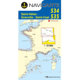

Waterproof nautical chart for Boulogne, Dieppe, and Le Havre. Bilingual and tear-resistant, it details depths, hazards, buoys, and ports for safe coastal navigation in the English Channel.
Data sheet
Specific References
Navigate the English Channel with confidence using this meticulously designed nautical chart, tailored for both recreational boaters and coastal professionals. Whether you're planning a weekend cruise, a fishing trip, or a professional voyage, this chart provides the clarity and precision needed to ensure safe and efficient navigation. Covering the critical stretch between Boulogne, Dieppe, and Le Havre, it transforms complex coastal waters into an easily readable, actionable tool for every mariner.
Navigate the English Channel with unmatched precision and confidence
This nautical chart is your essential companion for safe and efficient coastal navigation between Boulogne, Dieppe, and Le Havre. Designed for both recreational boaters and professionals, it combines detailed cartography with practical features to ensure you can plan routes, avoid hazards, and navigate with ease. Covering a critical stretch of the English Channel, this chart is an indispensable tool for anyone venturing into these waters.
Engineered for durability and clarity
Built to withstand the demands of marine environments, this chart is printed on latex-coated paper that resists moisture, folding, and frequent annotations. Its compact folded size (166 × 315 mm) makes it easy to store and handle on board, while the full A0 format (118.9 × 84.1 cm) provides expansive coverage when needed. Weighing just 90 grams, it’s lightweight yet robust, ensuring it remains a reliable resource throughout your journey.
Comprehensive and bilingual for international use
This chart offers a bilingual French/English layout, making it accessible to crews from around the world. It includes detailed port plans, navigational markers, depth soundings, and critical information on hazards, ensuring you have everything needed for safe passage. Compatible with the WGS 84 standard, it seamlessly integrates with GPS and electronic navigation systems, providing a unified and reliable navigation experience.
Designed for real-world navigation
Whether you're planning a route in advance or navigating in real-time, this chart provides the clarity and precision needed to make informed decisions. Its intuitive layout and large-scale presentation ensure readability even in low-light or high-stress conditions. Regularly updated to reflect the latest hydrographic data, it guarantees you have the most current information for safe and efficient navigation.
This nautical chart delivers precise and reliable coverage of the English Channel between Boulogne, Dieppe, and Le Havre. Printed on durable, latex-coated paper, it resists moisture and wear, ensuring longevity even in harsh marine conditions. The chart is available in a folded format (166 × 315 mm) for easy storage and handling, while the full A0 size (118.9 × 84.1 cm) provides expansive coverage when unfolded. With an scale of 1:100,000, it offers detailed cartography, including depth soundings, navigational aids, and port plans, all presented in a bilingual French/English layout for international use.
With a strong reputation in the marine industry, this brand specializes in creating high-quality nautical charts tailored for recreational and professional navigation. Based in France, it is part of a trusted group known for its commitment to accuracy, durability, and innovation in marine safety products. Their charts are designed to meet the needs of mariners, providing reliable tools for safe and efficient navigation in coastal waters.
The chart is drawn at a scale of 1:100,000, allowing detailed coastal navigation and precise planning.
Yes, the chart is printed on latex-coated paper that resists moisture, folding, and annotations, ensuring durability during use.
When folded, the chart measures 166 × 315 mm, making it easy to store and handle on board.
Yes, it features detailed plans of the main ports within the covered area, along with coastal layouts, buoys, lights, and depth soundings.
Yes, it is fully compatible with the WGS 84 reference system, allowing seamless use alongside GPS or chart plotters.
This edition was published in 2019. Always verify that your chart is up to date before navigation.
This chart is designed for coastal and recreational navigation in the English Channel, covering the area between Boulogne, Dieppe, and Le Havre.
You might also like