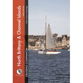

Folded 1:50,000 marine chart for Saint-Cast to Ploumanac’h. Waterproof, bilingual, and packed with official navigation data, hazards, and landmarks for safe coastal cruising.
Data sheet
Specific References
Navigate with confidence along the stunning Breton coastline with this meticulously crafted nautical chart, designed for both recreational boaters and seasoned sailors. Whether you're planning a coastal cruise, exploring hidden coves, or ensuring safe passage through tricky waters, this chart delivers unparalleled precision and reliability. Built for real-world navigation, it transforms complex maritime data into clear, actionable insights—so you can focus on the journey, not the guesswork.
Unlike generic maps or digital-only solutions, this nautical chart combines the tactile reliability of paper with the precision of modern hydrography. It’s a tool built by navigators, for navigators—whether you’re charting a weekend sail, a fishing expedition, or a multi-day coastal adventure. No batteries required, no signal dependence—just dependable, distraction-free navigation, mile after mile.
Master the Breton coastline with this essential nautical chart for safe and confident coastal navigation.
Designed for sailors who demand both precision and practicality, this folded nautical chart covers the picturesque waters from Saint-Cast to Ploumanac’h in the English Channel. Whether you're a weekend cruiser or a seasoned mariner, this chart provides the critical details you need to navigate with confidence—depth soundings, navigational aids, hazards, and coastal landmarks—all presented in a clear, easy-to-read format.
Built for real-world use, not just the bookshelf.
Printed on durable, latex-coated paper, this chart resists moisture and allows you to mark routes, waypoints, or notes directly on its surface. The bilingual (French/English) layout ensures accessibility for international crews, while the compact folded size (166 × 315 mm) makes it easy to store in any cockpit or navigation station. With an optimized scale of 1:50,000, it strikes the perfect balance between broad coverage and fine detail, ideal for coastal cruising, fishing, or exploring hidden coves.
Reliability you can trust, mile after mile.
Sourced from official hydrographic data and regularly updated, this chart reflects the latest changes in coastal topography, buoyage, and hazards. It’s compatible with the WGS 84 geodetic standard, ensuring seamless integration with GPS and electronic navigation systems. Whether you're plotting a course, identifying safe anchorages, or avoiding shallow waters, this chart is your indispensable companion for safe and enjoyable navigation along the Breton coast.
This nautical chart is designed for coastal navigation in the English Channel, covering the zone from Saint-Cast to Ploumanac’h. It features a 1:50,000 scale for optimal detail, printed on moisture-resistant, latex-coated paper that allows for writing and erasing. The chart is bilingual (French/English), folded to a compact size of 166 × 315 mm, and based on official hydrographic data updated to the 2017 edition. Compatible with WGS 84, it provides accurate depth soundings, navigational aids, and coastal landmarks for safe and precise navigation.
With decades of expertise in maritime navigation, this brand specializes in producing high-quality nautical charts tailored for coastal cruising. Known for their precision, durability, and practical design, their charts are trusted by recreational boaters and professionals alike. Each chart is crafted using official hydrographic data, ensuring reliability and accuracy for safe navigation in some of Europe’s most beloved sailing regions.
The chart is drawn at a scale of 1:50,000, providing detailed coastal navigation data.
The chart is printed on latex-coated paper that resists moisture, allowing you to write and erase navigation notes.
It covers the coastal zone from Saint-Cast to Ploumanac’h in the English Channel.
The chart is bilingual, featuring both French and English text.
When folded, the chart measures 166 × 315 mm.
The chart is based on official data and is revised regularly to ensure accuracy.
The chart is compatible with the WGS 84 reference system.
You might also like