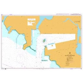

Durable, waterproof nautical chart for the English Channel, spanning Ostend to Boulogne and Zeebrugge. Includes port plans, lights, and markers in a bilingual format for effortless coastal navigation.
Data sheet
Specific References
Designed for both recreational boaters and professionals, this nautical chart delivers unmatched clarity and precision for safe navigation along one of Europe’s busiest maritime corridors. The English Channel is a dynamic environment where tides, currents, and heavy commercial traffic demand reliable, up-to-date cartography. This chart provides a comprehensive overview of the coastal waters from Ostende to Boulogne, including the critical Strait of Dover and the ports of Zeebrugge, ensuring you have all the essential data at your fingertips.
Navigating the English Channel and the Strait of Dover requires precision, preparation, and the right tools. This nautical chart is more than just a map—it’s a comprehensive navigation system designed to keep you safe, informed, and in control. Whether you’re a seasoned sailor or a weekend cruiser, its combination of durability, detail, and practicality makes it an indispensable asset for any voyage in this high-traffic region.
Navigate the English Channel with confidence using this precision-engineered nautical chart
Covering the critical waters from Ostende to Boulogne, including the Strait of Dover and Zeebrugge, this folded nautical chart is an essential tool for recreational boaters and professionals alike. Designed at a 1:100,000 scale, it offers the perfect balance of broad coverage and detailed information, making it ideal for coastal navigation in one of Europe’s most complex maritime environments. Whether you’re planning a cross-Channel trip, exploring the Belgian coast, or navigating the busy shipping lanes of the Pas de Calais, this chart provides the clarity and accuracy you need to sail safely.
Engineered for durability and ease of use at sea
Printed on high-quality, water-resistant paper, this chart is built to withstand the rigors of marine environments, resisting moisture, tearing, and fading. Its compact folded dimensions (16.5 x 31.5 cm) make it easy to store and handle on board, while the unfolded A0 size (118.9 x 84.1 cm) ensures you have all the detail you need at a glance. Weighing just 90 grams, it’s lightweight yet robust, designed to stay legible and intact even in challenging conditions.
Comprehensive navigation data for safer voyages
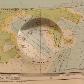
This chart includes detailed port plans for major harbors like Ostende and Zeebrugge, complete with entry and exit routes, depths, and mooring information. It also features critical navigation aids such as buoys, beacons, and lighthouses, along with tidal stream data and shallow areas to help you avoid hazards. Black-and-white photographs of complex passages provide visual references, ensuring you can recognize key landmarks and navigate with confidence. Bilingual (French/English) and compatible with the WGS 84 geodetic system, it integrates seamlessly with GPS and other modern navigation tools.
Trusted by sailors for accuracy and reliability
Updated to reflect the latest hydrographic data and navigation aids, this chart ensures you’re working with the most current information available. Its 1:100,000 scale offers a comprehensive view of the region while maintaining enough detail for safe coastal navigation. Whether you’re a seasoned mariner or a weekend sailor, this chart is designed to enhance your situational awareness and keep you on course, no matter the conditions.
This nautical chart is designed for coastal navigation in the English Channel, covering the zone from Ostende to Boulogne, including the Strait of Dover and Zeebrugge. Printed on water-resistant paper, it measures 118.9 x 84.1 cm when unfolded (A0 size) and folds down to a compact 16.5 x 31.5 cm for easy storage and handling. Weighing just 90 grams, it features a 1:100,000 scale, bilingual French/English text, and includes detailed port plans, navigation aids, and visual references for complex passages.
Specializing in high-quality nautical charts for recreational and professional mariners, this brand delivers precision-engineered cartography designed for safe and efficient navigation. Produced in France and often aligned with official hydrographic data, their charts combine durability, accuracy, and practicality, making them a trusted resource for sailors exploring coastal waters and busy maritime corridors.
The chart is at a 1:100,000 scale, providing a broad overview of the coastal area while still offering enough detail for safe coastal navigation, including key landmarks, buoys, and port plans.
Yes, the chart is printed on water-resistant paper and designed to withstand humidity and splashes, making it suitable for use in marine environments. Its folded format also ensures easy handling on board.
Yes, it features detailed plans of the main ports in the Ostend to Boulogne region, along with navigational aids such as lights, buoys, and markings to assist in safe entry and exit.
When folded, the chart measures 16.5 cm in width and 31.5 cm in length, making it compact and convenient to store or use in limited spaces.
Yes, the chart is based on the WGS 84 reference system, ensuring compatibility with GPS devices for accurate positioning and navigation.
Yes, the chart includes black-and-white photographs of challenging passage points to help mariners identify key landmarks and navigate safely through difficult areas.
This edition was published in 2019, ensuring that the navigational data and details are up-to-date for safe and reliable use.
You might also like