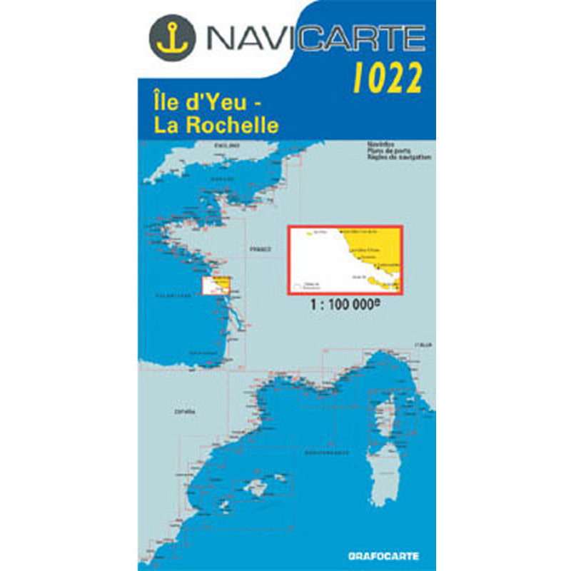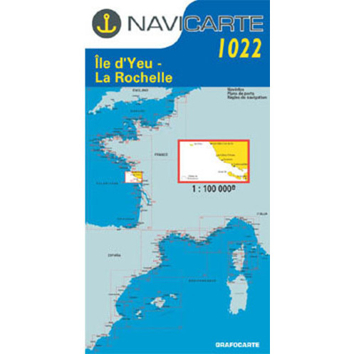





Navicarte 1022 nautical chart covering Île d’Yeu, La Rochelle and Les Sables-d’Olonne. At 1:100,000 scale, this folded paper chart is designed for coastal route planning and cruising along the French Atlantic coast.
Data sheet
Specific References
The Navicarte 1022 nautical chart covers a broad section of the French Atlantic coast between Île d’Yeu, La Rochelle and Les Sables-d’Olonne. At a scale of 1:100,000, this paper nautical chart is designed for coastal navigation and route planning along the French Atlantic coast. Its folded format makes it convenient to store and handle on board, while its unfolded A0 format provides a broad overview for planning a coastal passage.
The Navicarte 1022 provides coverage of the coastal area around Île d’Yeu, Les Sables-d’Olonne and La Rochelle. It is particularly useful for sailors planning a coastal cruise over an extended section of the French Atlantic coast.
The 1:100,000 scale provides a broad geographical view while retaining useful cartographic information for route planning. It allows several sections of coastline to be studied on a single chart and distances between different stages to be measured.
The chart can therefore be used to prepare a cruise between Les Sables-d’Olonne and La Rochelle, plan navigation around Île d’Yeu or organise a longer coastal itinerary.
At a scale of 1:100,000, one centimetre on the chart represents one kilometre on the ground. This scale is particularly suitable when the navigator needs to work on a relatively extensive section of coastline.
It provides a useful overall view without requiring frequent chart changes. Distances can be measured between different stages and alternative routes can be considered before departure.
The Navicarte 1022 is therefore primarily a coastal route-planning chart. More detailed charting should be used when a specific approach or navigation area requires a larger scale.
The Navicarte 1022 is suitable for both sailing yachts and motorboats. It can be used to prepare a coastal cruise, organise different stages and follow a route along the French Atlantic coast.
Before departure, the chart provides an overview of the itinerary and allows different route options to be studied. On board, it provides an independent paper representation of the navigation area.
It can also be used alongside GPS, chartplotters and navigation software, providing a paper reference that remains available independently of electronic equipment.
Electronic navigation and paper chartwork are complementary. GPS provides the vessel's dynamic position, while a paper nautical chart places that position within a wider geographical context.
The Navicarte 1022 can therefore be used alongside GPS, chartplotters and navigation software. It allows the route to be prepared before departure and the overall itinerary to be checked during the voyage.
A paper chart is also useful as an independent navigation reference if electronic equipment experiences a power or technical problem.
Publisher: Navicarte
Chart number: 1022
Coverage: Île d’Yeu, La Rochelle, Les Sables-d’Olonne
Maritime area: Atlantic Ocean
Country: France
Type: nautical navigation chart
Navigation: coastal
Scale: 1:100,000
Support: paper
Presentation: folded chart
Unfolded size: A0, approximately 118.9 × 84.1 cm
Folded size: approximately 16.5 × 31.5 cm
Language: French
What area does the Navicarte 1022 cover?
It covers the coastal area around Île d’Yeu, Les Sables-d’Olonne and La Rochelle on the French Atlantic coast.
What is the scale of the Navicarte 1022?
It is published at a scale of 1:100,000, meaning one centimetre on the chart represents one kilometre on the ground.
Is the Navicarte 1022 suitable for coastal navigation?
Yes. Its scale is suitable for planning coastal routes and cruises over an extended section of coastline.
Can the Navicarte 1022 be used around Île d’Yeu?
Yes. It provides chart coverage for route planning in the area. More detailed charting may be required for specific approaches.
Is the Navicarte 1022 suitable for sailing yachts?
Yes. It can be used to plan sailing routes along the French Atlantic coast.
Is it suitable for motorboats?
Yes. It can also be used to plan coastal navigation by motorboat.
Can the Navicarte 1022 be used with GPS?
Yes. The paper chart provides a useful independent reference alongside GPS and electronic navigation.
What is the format of the Navicarte 1022?
The chart is folded and unfolds to approximately A0 size, 118.9 × 84.1 cm.
Is it suitable for a cruise between Les Sables-d’Olonne and La Rochelle?
Yes. Its coverage allows the general route between these areas to be planned.
Is the Navicarte 1022 sufficient for detailed harbour approaches?
Not necessarily. Its 1:100,000 scale is primarily intended for general coastal navigation. More detailed charting should be used where required.
You might also like