
Navicarte 246 nautical chart of the Gulf of Morbihan, with additional coverage of the Vannes and Auray rivers. At 1:25,000 scale, this folded paper chart provides detailed mapping for recreational and coastal navigation.
Data sheet
Specific References
The Navicarte 246 nautical chart covers the Gulf of Morbihan, one of the most distinctive sailing areas in southern Brittany. At a scale of 1:25,000, it provides detailed cartographic coverage suitable for coastal navigation and route planning in an area characterised by islands, channels, shallow waters and significant tidal conditions.
The chart covers the Gulf of Morbihan from its entrance around Port-Navalo to the River Vannes and also includes navigation on the River Auray.
The Gulf of Morbihan requires careful chart reading and route planning. Its numerous islands, channels and shallow areas make detailed preparation particularly important.
The Navicarte 246 provides a detailed paper representation of the area. It can be used to plan sailing or motorboat navigation, study different route options and organise the stages of a coastal cruise.
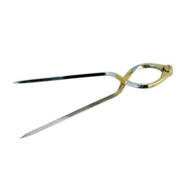
The chart can also be used at the chart table with dividers, a parallel ruler or a protractor to measure distances and prepare courses.
At a scale of 1:25,000, one centimetre on the chart represents 250 metres on the ground. This provides a higher level of detail than charts intended for general coastal navigation.
The scale is particularly useful in the Gulf of Morbihan, where the configuration of the coastline and navigable channels requires detailed cartographic information.
The navigator can study depths, shallow areas, buoyage and other charted features when preparing a route.
The Navicarte 246 is suitable for sailors navigating in the Gulf of Morbihan. It can be used to prepare the route before departure and provide a paper reference during navigation.
It is particularly useful for planning a cruise within the gulf, navigating between different coastal areas or preparing passages between the islands and ports covered by the chart.
Tidal conditions and the characteristics of each route are also important when planning navigation in the Gulf of Morbihan. The chart should therefore be used together with the nautical information required for the planned passage.
A paper nautical chart remains useful even when a boat is equipped with GPS or a chartplotter. It provides an independent geographical overview and does not depend on the electronic display or electrical power.
The Navicarte 246 can be used alongside electronic charting to plan a route, check the vessel's position and maintain a paper navigation reference on board.
Its detailed scale also makes it useful for navigation training, including chartwork, distance measurement, depth interpretation, buoyage and coastal route planning.
Publisher: Navicarte
Chart number: 246
Coverage: Gulf of Morbihan
Additional coverage: River Vannes and River Auray
Maritime area: Atlantic Ocean
Country: France
Type: nautical navigation chart
Use: recreational boating and coastal navigation
Scale: 1:25,000
Support: paper
Presentation: folded chart
Unfolded size: A0, approximately 118.9 × 84.1 cm
Language: French
What area does the Navicarte 246 cover?
It covers the Gulf of Morbihan from its entrance around Port-Navalo to the River Vannes and also includes the River Auray.
What is the scale of the Navicarte 246?
It is published at 1:25,000, meaning one centimetre on the chart represents 250 metres on the ground.
Is the Navicarte 246 suitable for navigation in the Gulf of Morbihan?
Yes. Its scale is particularly suitable for detailed route planning in this complex coastal area.
Is the Navicarte 246 suitable for sailing yachts?
Yes. It can be used to plan sailing navigation in the Gulf of Morbihan.
Is it suitable for motorboats?
Yes. It can also be used to plan motorboat navigation.
Why use a 1:25,000 chart in the Gulf of Morbihan?
This scale provides detailed coverage of channels, depths, islands, buoyage and other features useful for coastal route planning.
Can the Navicarte 246 be used with GPS?
Yes. It provides a useful paper complement to GPS and chartplotter navigation.
Is the Navicarte 246 useful for learning navigation?
Yes. Its scale is suitable for studying nautical chartwork, distances, depths, buoyage and route planning.
What is the format of the Navicarte 246?
It is a folded paper chart that unfolds to approximately A0 size, 118.9 × 84.1 cm.
Is the chart alone sufficient for navigation in the Gulf of Morbihan?
The chart provides essential cartographic information but should be used together with the other nautical information required for navigation, particularly information concerning tides and local conditions.
You might also like