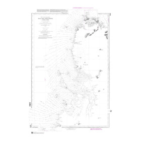

Navicarte nautical chart, coasts of France and Spain.
Data sheet
Specific References
The Navicarte 551 nautical chart covers the Île de Ré and La Rochelle area on the French Atlantic coast. With a scale of 1:50,000, it is designed for coastal navigation and recreational boating. Its folded paper format provides sailors with a large cartographic representation while remaining practical to store and handle on board.
This chart is particularly suitable for sailors looking for a paper nautical chart of Île de Ré and La Rochelle to plan a coastal passage, a cruise or a route around this part of the Atlantic coast.
The Navicarte 551 focuses on a coastal area frequently used for recreational boating. The presence of Île de Ré and La Rochelle in the title clearly identifies the geographical area covered by the chart.
For a sailor planning a route around La Rochelle or Île de Ré, a dedicated chart of this area provides an appropriate cartographic representation for the intended coastal navigation.
The 1:50,000 scale is particularly suitable for coastal use. It provides a sufficiently broad view of the area while retaining a useful level of detail for route planning.
A paper chart remains an important tool for navigation planning. It allows sailors to study the complete area before departure, visualise the planned route and compare different navigation options.
At the chart table, it provides a fixed and easily accessible overview of the area. It can also be used to explain the route to a crew member or prepare the different stages of a cruise.
The Navicarte 551 therefore directly meets the needs of sailors looking for a paper nautical chart covering La Rochelle and Île de Ré.
The chart 551 uses a 1:50,000 scale. This represents a useful compromise for coastal navigation: a relatively large geographical area can be shown while retaining the information required for nautical chart reading.
At this scale, one centimetre on the chart represents 500 metres on the ground. The navigator can therefore plan a route while retaining a coherent view of the surrounding area.
The scale should nevertheless always be considered according to the intended navigation. Areas requiring more detailed examination should be studied using appropriate larger-scale cartographic documents.
The Navicarte 551 is classified for recreational boating and coastal navigation. It is therefore suitable for sailors planning passages along this section of the French Atlantic coast.
It can be used for different types of navigation, including day sailing, regular coastal passages, recreational cruising or route planning between several areas of the Atlantic coast.
For both sailing yachts and motorboats, the chart provides a paper reference for route planning that is independent of electronic navigation equipment.
Paper charts and electronic navigation systems perform complementary functions.
GPS and chartplotters provide the vessel's position and allow the navigator to follow a digital route. The paper chart provides an overall view of the area and allows the route to be prepared without relying on an electronic display.
This combination is particularly useful when a passage involves several stages. The navigator can plan the route on paper and then use GPS to monitor the vessel's position while underway.
The paper chart also provides an independent reference in the event of electronic equipment failure or a power supply problem.
Publisher: Navicarte
Chart reference: 551
Type: nautical navigation chart
Use: recreational boating
Navigation: coastal
Geographical area: Atlantic Ocean
Coverage: Île de Ré, La Rochelle
Scale: 1:50,000
Support: paper
Format: folded chart
Unfolded format: A0, 118.9 × 84.1 cm
Language: French
The chart is supplied folded, making it easier to store in a chart table, onboard library or navigation storage area.
When unfolded, its A0 format provides a large cartographic surface. The navigator can therefore move from a broad overview of the area to a closer examination of a specific section.
Paper charts are also particularly practical when working with the crew. Several people can consult the same document at the same time, making route planning and the allocation of navigation tasks easier.
For a voyage departing from La Rochelle, chart 551 allows the navigator to work directly with a chart dedicated to the covered area. It can be used to plan a coastal trip or as part of a larger set of charts covering a longer route.
The inclusion of Île de Ré in the coverage is also important for sailors planning navigation around this coastal area.
The navigator should always select charts according to the intended route and check that the entire navigation area is covered at an appropriate scale and level of detail.
The Navicarte 551 is also relevant for sailors specifically looking for a nautical chart of Île de Ré.
The 1:50,000 scale allows the navigator to work with a sufficiently broad coastal area while retaining a useful level of detail compared with a smaller-scale overview chart.
For a longer cruise, this chart can be combined with additional charts covering the areas before or after the planned navigation sector.
A paper nautical chart should not be regarded simply as a reference document. It plays an important role in navigation planning and in understanding the environment in which the vessel operates.
It allows the navigator to step back from the instantaneous representation provided by an electronic display and maintain a broader understanding of the area.
The edition date should nevertheless be checked before use. Nautical information can change, and the navigator must always use documentation appropriate to the planned voyage.
What area does the Navicarte 551 cover?
It covers the Île de Ré and La Rochelle area on the French Atlantic coast.
What is the scale of chart 551?
The Navicarte 551 has a scale of 1:50,000.
Is it suitable for coastal navigation?
Yes. The product is classified as a chart intended for coastal navigation.
Is the Navicarte 551 suitable for recreational boating?
Yes. It is specifically classified for recreational boating.
What is its format?
It is a folded paper chart in A0 format when unfolded, measuring approximately 118.9 × 84.1 cm.
What year is indicated for chart 551?
The product page indicates 2018. This is the year shown on the product page, and the available edition should be checked before navigation.
Can this chart be used with a GPS chartplotter?
Yes. It is a complementary paper reference for electronic navigation and can be used alongside GPS and chartplotters.
Is it suitable for navigation around Île de Ré?
Yes. Île de Ré is one of the two geographical areas explicitly identified in the chart coverage, together with La Rochelle.
Is this chart useful for planning a cruise from La Rochelle?
Yes. Its scale and geographical coverage make it suitable for planning coastal navigation around La Rochelle and Île de Ré.
Why keep a paper chart on board?
It provides an overall view of the area without relying on electrical power and complements information supplied by GPS, chartplotters and electronic navigation applications.
You might also like