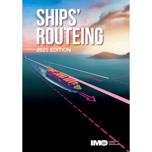


IMO - 927E - Ships' routeing
search
  • googlemap
  • IMO - 927E - Ships' routeing

IMO - 927E - Ships' routeing

€347.25
Tax included
OMI
In English language
Estimated preparation time: 5 to 14 days

Ensure safer voyages with this guide to ship routing measures. It details traffic separation schemes, deep-water routes, and avoidance zones, updated with regulations adopted before 2025.

IMO927E

Data sheet

What is the size?
paper medium
Picto
In English language

Specific References

UPC
400000006871
EAN13
4000000022299
New
Description détaillée

IMO Ships’ Routeing

Publication in English
Paperback edition

Essential Navigation Resource for Maritime Professionals

Ships’ Routeing is the definitive guide for maritime navigation, designed to enhance safety at sea and protect ocean environments. This comprehensive publication outlines internationally adopted routeing measures that regulate vessel traffic, ensuring efficient and secure maritime operations. By standardizing navigation practices, it minimizes risks of collisions, groundings, and environmental incidents while optimizing shipping routes for global trade.

Comprehensive Coverage of Routeing Measures

This edition consolidates all routeing measures adopted before July 2015, providing up-to-date guidelines for maritime professionals. It includes detailed descriptions of traffic separation schemes, deep-water routes, areas to be avoided, and recommended tracks, along with specific rules for high-traffic zones and straits. The publication also covers mandatory ship reporting systems, archipelagic sea lanes, and prohibited anchoring zones, offering a complete framework for safe and compliant navigation.

Designed for Practical Application

Structured for clarity and ease of use, Ships’ Routeing is organized into distinct sections that address various routeing measures and their implementation. Whether navigating coastal waters, open seas, or congested shipping lanes, maritime operators rely on this resource to make informed decisions. Its systematic approach ensures compliance with international maritime regulations while promoting best practices in vessel traffic management.

A Trusted Reference for the Maritime Industry

Recognized as an indispensable tool for shipowners, captains, navigators, and maritime authorities, this publication supports the International Maritime Organization’s mission to improve maritime safety and environmental protection. By providing standardized routeing measures, it facilitates smoother operations, reduces human error, and contributes to the sustainability of global shipping. Available in a durable paperback format, it remains a vital companion for professionals navigating the world’s oceans.

Optimize Maritime Navigation with IMO Ships’ Routeing
Ensure compliance and safety with the authoritative *Ships’ Routeing* publication, the industry-standard reference for maritime navigation. This essential guide provides a complete compilation of internationally adopted routeing measures, designed to regulate vessel traffic, prevent collisions, and protect marine environments. Whether navigating congested shipping lanes, deep-water routes, or environmentally sensitive areas, this resource delivers the critical information needed for safe and efficient maritime operations.

Up-to-Date and Comprehensive Navigation Guidelines
This 2015 edition includes all routeing measures adopted before July 2015, with updates reflecting the latest amendments as of September 2025. Covering traffic separation schemes, deep-water routes, areas to be avoided, and recommended tracks, it offers a structured approach to route planning. The publication also details mandatory ship reporting systems, archipelagic sea lanes, and specific rules for high-risk zones, ensuring full compliance with international maritime regulations.

Practical and Durable Paperback Format
Designed for onboard use, this 874-page paperback edition measures 210 mm x 150 mm and weighs 1.8 kg, making it a convenient and portable reference. Its clear organization and detailed charts support quick decision-making, while its durable construction ensures long-term reliability in demanding maritime environments. Ideal for shipowners, captains, navigators, and maritime authorities, this publication is a cornerstone of safe and efficient navigation.

This *Ships’ Routeing* publication is a paperback edition in English, featuring 874 pages of detailed navigation guidelines. Updated to include routeing measures adopted before September 2025, it measures 210 mm in height and 150 mm in width, with a weight of 1.8 kg. Published by the International Maritime Organization, this 2015 edition remains the go-to resource for maritime professionals worldwide.

With a legacy of setting global maritime standards, the publisher behind this publication is a leading authority in the shipping industry. Dedicated to enhancing safety, security, and environmental protection at sea, it provides essential resources that support compliance, operational efficiency, and sustainable maritime practices worldwide.

  • This *Ships’ Routeing* publication offers unparalleled accuracy with internationally recognized navigation guidelines, ensuring compliance with maritime regulations.
  • Its comprehensive coverage of routeing measures, including traffic separation schemes and mandatory reporting systems, enhances safety and operational efficiency.
  • The durable paperback format provides a reliable, portable reference for onboard use, while its structured organization allows for quick access to critical information.
  • Trusted by maritime professionals, it remains an indispensable tool for navigating global waters with confidence.
What is the cutoff date for the routing measures included in this edition?

This edition includes routing measures adopted before September 2025.

Is there a digital version available for this publication?

Yes, a locked digital version is available and can be read using the free reader.

What are the dimensions of the paper version?

The paper version measures 210 mm in height and 150 mm in width.

How many pages does this edition contain?

This edition contains 874 pages.

What types of routing measures are detailed in this publication?

It covers traffic separation schemes, deep-water routes, areas to avoid, recommended tracks, two-way routes, mandatory ship reporting systems, and archipelagic sea lanes.

What is the weight of the paper version?

The paper version weighs 1.8 kg.

Are there specific navigation rules for straits included in this edition?

Yes, it includes navigation rules and recommendations associated with specific traffic areas and straits.

Loading...