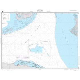

Navicarte nautical chart, coasts of France and Spain.
Data sheet
Specific References
The Navicarte 553 + 554 nautical chart covers the entrance to the Gironde and the Bordeaux area on the French Atlantic coast. This folded paper chart is published at a scale of 1:50,000 and is intended for coastal navigation and recreational boating.
The combination of references 553 and 554 provides a cartographic set dedicated to an important maritime and estuarine area. It is a useful planning document for sailors who want to study their route before departure and keep a paper representation of the area on board.
The Navicarte 553 + 554 focuses on the entrance to the Gironde and the Bordeaux area. This geographical description distinguishes it from other Navicarte charts covering the French Atlantic coast.
For sailors preparing navigation in this area, the chart provides a cartographic reference suitable for coastal route planning.
The 1:50,000 scale provides a sufficiently broad view to understand the general organisation of the area while retaining a level of detail appropriate for navigation planning.
The Navicarte 553 + 554 is classified for coastal navigation and recreational boating. It can therefore be used with different types of recreational vessels, including sailing yachts and motorboats.
It can be used to prepare navigation close to the coast, plan a route or work on one stage of a longer cruise.
For sailors looking for a nautical chart of the entrance to the Gironde, reference 553 + 554 provides a paper chart specifically dedicated to this area.
The 1:50,000 scale provides a balance between geographical coverage and cartographic detail. One centimetre on the chart represents 500 metres on the ground.
This scale allows the navigator to retain a relatively broad view of the planned route. It is particularly suitable for coastal navigation planning when the objective is to understand the general configuration of the area and plan the vessel's progress.
The scale should not, however, be confused with an indication of depth or navigational safety. Charted information must always be interpreted in context and used together with appropriate navigation information.
Chart work allows the navigator to anticipate the different stages of a passage. The coastline can be studied, charted information analysed, the route organised and areas requiring particular attention identified.
The Navicarte 553 + 554 can also serve as a common reference for the crew. A paper chart facilitates discussion around the planned route and allows several sections of the passage to be viewed at the same time.
This function complements electronic navigation systems, which can subsequently be used to monitor the vessel's position in real time.
Even when a boat is equipped with GPS and a chartplotter, a paper chart remains useful operationally.
GPS provides an accurate position and the chartplotter displays that position on electronic charting. The paper chart allows the navigator to step back and examine the entire area without depending on a screen.
This redundancy also improves navigation resilience. In the event of equipment failure, a power supply problem or the unavailability of electronic navigation equipment, the navigator retains a paper representation of the area.
Publisher: Navicarte
Chart references: 553 + 554
Scale: 1:50,000
Type: nautical navigation chart
Use: recreational boating
Navigation: coastal
Geographical area: Atlantic Ocean
Coverage: entrance to the Gironde, Bordeaux
Support: paper
Format: folded chart
Unfolded format: A0, 118.9 × 84.1 cm
Language indicated on the product page: French
The folded format makes the chart easier to store on board. When unfolded, its A0 format provides a large surface for route planning.
The navigator can therefore move from a general overview of the entire area to a closer examination of a particular section. The large format is also suitable for working around the chart table with several crew members.
The paper chart can be temporarily annotated during route planning according to the navigator's preferred working method.
Finding a nautical chart for the entrance to the Gironde requires a document covering the relevant area precisely. The Navicarte 553 + 554 addresses this requirement by explicitly identifying the entrance to the Gironde and Bordeaux in its title.
It can be used as a planning reference for navigation in this area and combined with additional charts when the planned route extends beyond its coverage.
Additional charts should be selected according to the planned route and the level of detail required for each stage.
For a navigator planning a passage towards Bordeaux, chart 553 + 554 provides a paper cartographic reference dedicated to the area identified in its coverage.
The passage should nevertheless be planned with full consideration of the specific characteristics of the navigation area and the applicable nautical information. The paper chart is a planning and monitoring tool but does not replace the nautical and regulatory information required for the intended passage.
The product page indicates 2021 for this edition. This should be understood as the year indicated on the product page rather than as a guarantee that this is the most recent edition available.
Before navigation, it is important to check the edition being used and consult any relevant nautical information that may have changed, particularly when navigating an area where buoyage, depths or regulations may be modified.
What area does the Navicarte 553 + 554 cover?
It covers the entrance to the Gironde and Bordeaux area on the French Atlantic coast.
What is the scale of this chart?
The Navicarte 553 + 554 has a scale of 1:50,000.
Is it suitable for coastal navigation?
Yes. The product is classified as a chart intended for coastal navigation.
Is the chart suitable for recreational boating?
Yes. It can be used to plan recreational sailing or motorboat navigation.
Is it a folded paper chart?
Yes. It is supplied as a folded paper nautical chart.
What is its unfolded size?
The chart is A0 size when unfolded, approximately 118.9 × 84.1 cm.
What year is indicated for this edition?
The product page indicates 2021. The available edition should nevertheless be checked before navigation.
Can this chart be used with GPS?
Yes. The paper chart complements GPS, chartplotters and electronic navigation systems.
Is the chart suitable for navigation towards Bordeaux?
It explicitly covers the entrance to the Gironde and Bordeaux area. The navigator should nevertheless ensure that the entire planned route is covered at the appropriate scale.
Why are references 553 and 554 combined?
This corresponds to the combined chart set offered for the geographical area covered by the two references.
Is the paper chart sufficient for planning navigation in the estuary?
It is an important planning reference, but it should be used together with the nautical and regulatory information required for the intended navigation.
You might also like