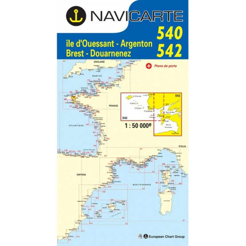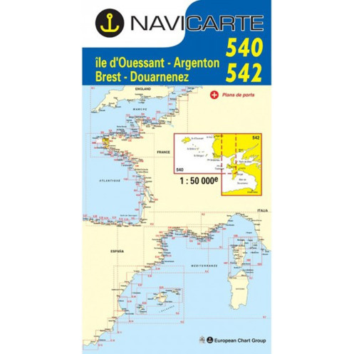





Navicarte 540 + 542 nautical chart covering Île d’Ouessant and the Douarnenez area on the western coast of Finistère. At 1:50,000 scale, this folded paper chart is designed for recreational and coastal navigation.
Data sheet
Specific References
The Navicarte 540 + 542 nautical chart covers the area around Ouessant Island and Douarnenez, on the western coast of Finistère in Brittany. At a scale of 1:50,000, this paper nautical chart provides a level of detail suitable for coastal navigation and cruise planning in Brittany.
It covers a significant section of coastline while maintaining sufficient cartographic detail for route planning, distance measurement and the study of the main charted features.
The Navicarte 540 + 542 provides chart coverage for sailors navigating along the Atlantic coast of Finistère. Its coverage around Ouessant and Douarnenez allows different coastal routes in this part of Brittany to be planned.
It can be used on sailing yachts and motorboats, for coastal passages as well as cruises involving several stages.
At a scale of 1:50,000, one centimetre on the chart represents 500 metres on the ground. This provides more detail than a general navigation chart while maintaining a sufficiently broad geographical view.
The scale allows coastal routes to be planned, distances measured, courses prepared and the general configuration of the coastline studied.
For harbour approaches requiring greater precision, the chart should be complemented by appropriate larger-scale nautical documentation.
The Navicarte 540 + 542 can be used to plan a coastal cruise in this part of Finistère. It provides a paper chart that can be used at the chart table before departure and during navigation.
The navigator can study route options, measure distances between stages and organise the overall itinerary.
The chart can also be combined with neighbouring Navicarte charts to build wider coverage of the Breton coastline.
Like other paper nautical charts, the Navicarte 540 + 542 can be used alongside GPS and chartplotters. Electronic navigation provides a dynamic position, while the paper chart provides an independent overall view.
This combination is useful for route planning and as an independent reference alongside electronic navigation equipment.
Publisher: Navicarte
Chart numbers: 540 + 542
Coverage: Ouessant Island, Douarnenez
Maritime area: Atlantic Ocean
Country: France
Type: nautical navigation chart
Use: recreational boating and coastal navigation
Classification: coastal area
Scale: 1:50,000
Support: paper
Presentation: folded chart
Unfolded size: A0, 118.9 × 84.1 cm
What area does the Navicarte 540 + 542 cover?
It covers the area around Ouessant Island and Douarnenez on the western coast of Finistère.
What is its scale?
The chart is published at 1:50,000, meaning one centimetre represents 500 metres on the ground.
Is the 540 + 542 chart suitable for sailing?
Yes. It is suitable for planning coastal sailing navigation.
Is it suitable for motorboats?
Yes. It can also be used for coastal motorboat navigation.
Is the Navicarte 540 + 542 a paper chart?
Yes. It is a folded paper nautical chart that unfolds to A0 size.
Can the chart be used with GPS?
Yes. It provides a useful paper complement to GPS and electronic chartplotter navigation.
Why use a 1:50,000 chart?
This scale provides a useful balance between geographical coverage and cartographic detail for coastal navigation.
Is the chart suitable for cruising in Brittany?
Yes. Its coverage of the Ouessant–Douarnenez area makes it suitable for planning coastal navigation and cruising in this part of Finistère.
Is the chart sufficient for all harbour approaches?
For approaches requiring greater detail, larger-scale nautical documentation should be used in addition.
What is the format of the chart?
The folded chart unfolds to approximately A0 size, 118.9 × 84.1 cm.
You might also like