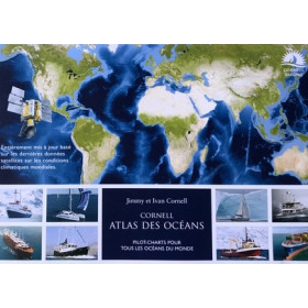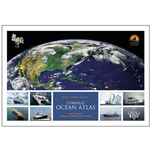




This pilot atlas offers 80 monthly charts of global winds, currents, and storm tracks, plus 60 route maps for strategic voyage planning. Spiral-bound for onboard use.
Data sheet
Specific References
Designed for sailors, motor yacht owners, and maritime professionals, the Jimmy Cornell Ocean Atlas is the definitive guide for planning safe and efficient offshore voyages. This comprehensive atlas provides unparalleled insights into global weather patterns, currents, and oceanic conditions, making it an indispensable resource for anyone preparing for long-distance sailing or transoceanic crossings.
Featuring 80 monthly charts covering all the world’s oceans, this atlas offers a detailed overview of wind and current patterns, the approximate extent of the Intertropical Convergence Zone (ITCZ), the most common tracks of tropical revolving storms, and the mean location of high-pressure systems. Whether you're plotting a course across the Atlantic, Pacific, or Indian Ocean, these charts provide the critical data needed to navigate with confidence.
With 60 detailed route charts of the most frequented ocean passages, this atlas simplifies the process of selecting the best course based on prevailing weather conditions. Each route chart is meticulously crafted to help sailors avoid adverse weather, capitalize on favorable winds and currents, and reduce passage times. The inclusion of monthly windgrams for major ocean crossings offers a quick visual reference for wind strength and direction, ensuring informed decision-making before setting sail.
Built on 25 years of satellite observations (1991–2016), the Ocean Atlas delivers unmatched accuracy in its meteorological and oceanographic data. Each windrose in the atlas is based on 218,000 data samples, providing a robust foundation for reliable route planning. This level of detail ensures that sailors can anticipate conditions with precision, whether navigating the trade winds, avoiding storm tracks, or timing their departure for optimal safety and efficiency.
While primarily tailored for sailboat and motor yacht owners, this atlas is also a valuable tool for commercial vessels and military ships. Its large-format, spiral-bound design (43.6 x 29.7 cm) ensures easy handling on board, while the clear, illustrated charts make complex data accessible at a glance. Whether you're a seasoned offshore sailor or preparing for your first ocean passage, the Ocean Atlas equips you with the knowledge to navigate the world’s oceans with confidence.
Plan Your Ocean Voyages with Unmatched Precision
The Jimmy Cornell Ocean Atlas is the most comprehensive and data-driven resource available for offshore navigation planning. Designed by legendary sailor Jimmy Cornell and his son Ivan, this third edition (2023) is the result of decades of maritime expertise and cutting-edge meteorological research. Whether you're preparing for a transatlantic crossing, a Pacific circuit, or a high-latitude adventure, this atlas provides the critical information needed to make informed decisions and ensure a safe, efficient passage.
Built on Decades of Satellite Data
At the heart of this atlas is a 25-year dataset (1991–2016) of satellite-derived meteorological and oceanographic observations. This extensive period of data collection ensures that the charts reflect long-term trends rather than short-term anomalies, giving sailors a reliable foundation for route planning. Each windrose in the atlas is based on 218,000 data samples, providing an unprecedented level of detail for wind and current patterns across the globe.
Monthly Charts for Every Ocean
The atlas features 80 monthly charts covering all major oceans, offering a dynamic view of seasonal variations in wind, currents, and weather systems. These charts include the approximate extent of the Intertropical Convergence Zone (ITCZ), the most common tracks of tropical storms, and the mean location of high-pressure systems. This level of detail allows sailors to time their departures, avoid hazardous conditions, and take advantage of favorable winds and currents.
Detailed Route Planning for Popular Passages
For sailors following established ocean routes, the atlas includes 60 detailed route charts of the most frequented passages. These charts provide a clear overview of prevailing conditions along each route, helping sailors optimize their course for safety and efficiency. Additionally, monthly windgrams for major crossings offer a quick visual summary of wind strength and direction, making it easy to compare conditions across different months and plan accordingly.
Designed for Practical Use at Sea
The large-format, spiral-bound design (43.6 x 29.7 cm) ensures that the atlas is easy to use on board, even in challenging conditions. The 156-page layout is organized for quick reference, with clear illustrations and English-language labels that make complex data accessible to all sailors. Weighing just 2.2 kg, it’s a manageable yet comprehensive resource for any voyage.
The Jimmy Cornell Ocean Atlas is a 156-page, spiral-bound publication in a large format (43.6 x 29.7 cm), weighing 2.2 kg. This third edition (2023) is based on 25 years of satellite-derived meteorological data, featuring 80 monthly ocean charts, 60 detailed route charts, and windgrams for major crossings. All content is presented in English, with clear illustrations and windrose data based on 218,000 samples per chart.
For over four decades, the creators of this atlas have been at the forefront of offshore sailing and navigation planning. With a legacy of circumnavigations, transoceanic voyages, and best-selling maritime publications, their expertise is trusted by sailors worldwide. This atlas reflects their commitment to providing accurate, practical, and accessible tools for safe and enjoyable ocean navigation.
The meteorological data is based on 25 years of satellite observations, covering the period from 1991 to 2016.
The atlas includes monthly windgrams for the main ocean crossing routes, providing a visual summary of wind forces and directions.
The atlas measures 43.6 x 29.7 cm and weighs 2.2 kg, making it suitable for use on board.
Yes, the atlas features 80 monthly charts covering all oceans, indicating wind and current variations throughout the year.
Yes, it is designed for sailboat owners, motor yacht operators, and even commercial and military vessels.
Each windrose in the atlas is based on 218,000 data samples from satellite observations.
The atlas uses a spiral binding, allowing it to lay flat for easy reference while navigating.
You might also like