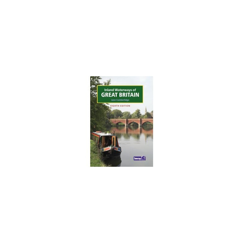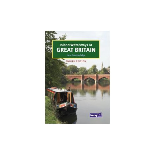


Imray - Inland Waterways of Great Britain
search
  • googlemap
  • Imray - Inland Waterways of Great Britain
  • Imray - Inland Waterways of Great Britain
  • Imray - Inland Waterways of Great Britain

Imray - Inland Waterways of Great Britain

€49.95
Tax included
Imray
In English language
Estimated preparation time: 5 to 14 days

Explore Britain’s inland waterways with this fully updated guide, featuring detailed maps, navigational tips, and points of interest for boaters and waterway enthusiasts.

INL0290

Data sheet

What is the classification?
navigation book
Who is the publisher or the author?
Jane Cumberlidge
On what digital medium is this nautical chart / book stored?
paper medium
From which year does this nautical chart date?
2009
What type of navigation book is this?
pilot
Picto
In English language

Specific References

UPC
400000055381
EAN13
9781846230103
New
Description détaillée

Inland Waterways of Great Britain

Book in English
Hardcover edition

Your Essential Companion for Navigating Britain’s Inland Waterways

Explore the vast network of rivers, canals, and lakes across England, Wales, and Scotland with confidence. This comprehensive guide is the definitive resource for boaters, offering detailed insights into over 4,000 miles of navigable waterways. Whether you're planning a weekend cruise or a long-distance journey, this book ensures you have the most accurate and up-to-date information at your fingertips.

Designed for Boaters, by Experts

Created with the needs of recreational boaters in mind, this guide combines practical navigation advice with essential local knowledge. It covers everything from lock locations and mooring spots to waterway regulations and points of interest along the way. The 8th edition has been thoroughly revised to include the latest updates, making it an indispensable tool for both seasoned sailors and newcomers to inland boating.

Richly Illustrated for Easy NavigationNavigate with ease thanks to full-color maps, detailed charts, and high-quality illustrations that bring Britain’s waterways to life. Each section is designed to help you quickly locate key information, from bridge heights and canal depths to nearby facilities like marinas, fuel stops, and repair services. The visual layout ensures you can plan your route efficiently, whether you're on a narrowboat, cruiser, or any other vessel.

Beyond Navigation: A Guide for All Waterway Enthusiasts

While this book is a must-have for boaters, it’s also a valuable resource for anyone who loves Britain’s inland waterways. Cyclists, walkers, and history buffs will appreciate the detailed descriptions of scenic routes, historic landmarks, and cultural sites along the canals and rivers. Discover hidden gems, picturesque villages, and bustling waterside towns, all while gaining a deeper appreciation for the unique heritage of these waterways.

Built to Last, Designed for the Journey

This hardcover edition is built to withstand the rigors of life on the water. Its durable construction ensures it remains a reliable companion, whether stored in a boat’s cabin or used on deck. The compact yet comprehensive format makes it easy to carry, while the high-quality paper and printing guarantee clarity and readability in all conditions.

Stay Informed with the Latest Updates

The 8th edition reflects the most current information available, including recent changes to waterway infrastructure, new facilities, and updated regulations. With contributions from experienced boaters and waterway authorities, this guide provides peace of mind, knowing you’re equipped with the most accurate data for a safe and enjoyable journey.

Plan Your Adventure with Confidence

From the tranquil canals of the Midlands to the rugged beauty of Scotland’s lochs, this guide empowers you to explore Britain’s inland waterways with confidence. Whether you're seeking a peaceful escape or an action-packed voyage, it’s your key to unlocking unforgettable experiences on the water.

Unlock the Full Potential of Britain’s Inland Waterways
This comprehensive guide is the ultimate resource for navigating the intricate network of rivers, canals, and lakes that crisscross England, Wales, and Scotland. With over 4,000 miles of waterways covered, it provides boaters with everything they need to plan safe, efficient, and enjoyable journeys. The 8th edition has been meticulously updated to include the latest information on routes, facilities, and regulations, ensuring you’re always prepared for the adventure ahead.

Expertly Crafted for Boaters of All Levels
Written by Jane Cumberlidge, a respected authority on Britain’s inland waterways, this guide is tailored to meet the needs of both novice and experienced boaters. It offers clear, concise instructions on navigation, lock operations, and mooring, along with insights into local attractions, historical sites, and practical amenities like fuel stops and repair services. The full-color illustrations and detailed maps make it easy to visualize your route and stay on course.

Durable and Practical for Life on the Water
Designed to endure the demands of boating, this hardcover guide is built to last. Weighing just 1.2 kg, it’s lightweight enough to carry on board yet sturdy enough to withstand frequent use. The high-quality printing ensures that maps and charts remain clear and legible, even in challenging conditions. Whether you're planning a short trip or an extended voyage, this guide is an essential tool for every boater’s library.

More Than Just a Navigation Tool
Beyond its practical navigation features, this guide is a gateway to discovering the rich culture and history of Britain’s waterways. Explore charming villages, historic landmarks, and scenic landscapes along your route. With updated information on facilities, events, and points of interest, it’s the perfect companion for anyone who wants to make the most of their time on the water.

This 8th edition guide is a hardcover book published in 2009, offering a durable and reliable resource for boaters. Weighing 1.2 kg, it features full-color illustrations throughout, providing detailed maps and charts for navigating Britain’s inland waterways. Written in English, it includes comprehensive coverage of over 4,000 miles of rivers, canals, and lakes, with updated information on routes, facilities, and regulations.

With decades of experience in maritime publishing, this publisher is a trusted name among boaters and waterway enthusiasts. Known for producing high-quality navigation guides, charts, and almanacs, their publications are renowned for accuracy, durability, and practicality. Their expertise ensures that every guide is meticulously researched and updated to provide the most reliable information for safe and enjoyable journeys on the water.

  • Unparalleled depth of information, covering every navigable waterway in Great Britain with precision.
  • Full-color maps and illustrations provide clear, easy-to-follow navigation aids.
  • Updated 8th edition ensures you have the latest details on routes, facilities, and regulations.
  • Durable hardcover design makes it ideal for use on board.
  • Expert insights from seasoned boaters add invaluable practical advice for both beginners and experienced sailors.
What is the weight of the book and its shipping weight?

The book weighs 1.2 kg, and the shipping weight is 2100 g.

Is this edition updated with the latest information on inland waterways?

Yes, this is the 8th edition, fully revised and updated with the latest details on inland waterways across England, Wales, and Scotland.

Are the maps and illustrations in color?

Yes, the book features full-color illustrations and maps throughout.

What type of binding does this book have?

The book is hardbound, ensuring durability for frequent use.

Does this guide cover waterways in Scotland as well?

Yes, it includes detailed information on inland waterways in England, Wales, and Scotland.

Who is the author of this guide?

The guide is authored by Jane Cumberlidge.

Is this guide suitable for non-boaters?

Yes, the expanded content appeals to both boaters and anyone interested in using or exploring inland waterways.

Loading...