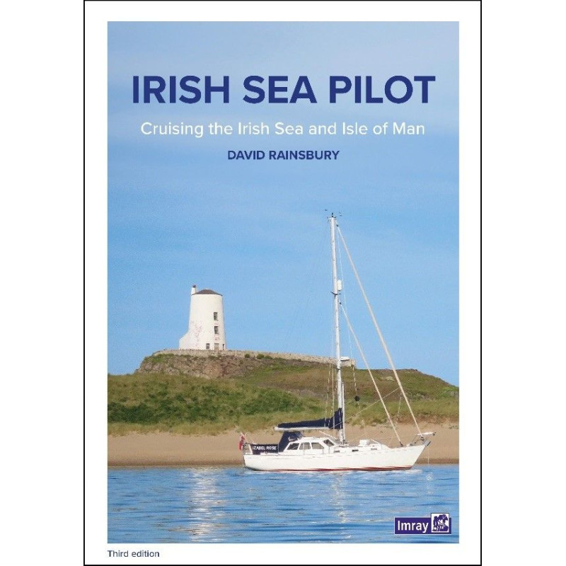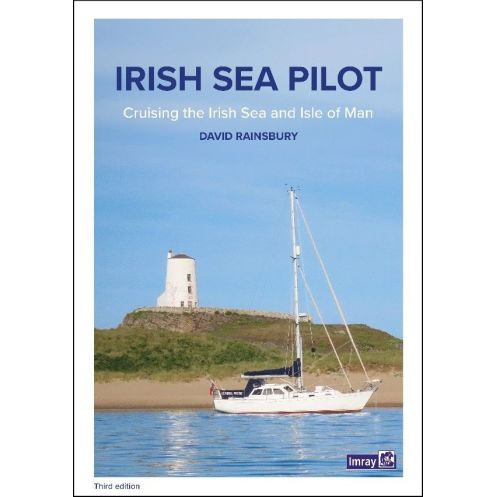


Imray - Irish Sea Pilot
search
  • googlemap
  • Imray - Irish Sea Pilot

Imray - Irish Sea Pilot

€49.40
Imray
In English language
Estimated preparation time: 0 to 2 days

This pilot guide covers the Irish Sea from Milford Haven to Portpatrick, offering updated navigation directions, harbor plans, tidal data, and coastal notes for safer sailing.

PIL0957
1 Item

Data sheet

Year
2nd edition
Author
David Rainsbury
Picto
In English language
Book in version
paper version
Book type
Guide / Pilot

Specific References

UPC
400000063829
EAN13
9781846235917
New
Description détaillée

Irish Sea Pilot

Guide in English
Paperback edition

Comprehensive Navigation for the Irish Sea

The Irish Sea is a dynamic and challenging body of water, stretching from Milford Haven to Portpatrick and from Rathlin Island to Carnsore Point. This essential pilot guide provides boaters with meticulously updated navigation directions, coastal notes, and detailed port plans to ensure safe and confident sailing. Whether you're navigating strong currents or seeking sheltered waters, this guide delivers the critical insights needed for a seamless journey.

Expertly Curated Coastal and Port Information

Written by seasoned navigator David Rainsbury, this second edition (2015) offers an unparalleled level of detail for both coastal and harbor navigation. Each port description is structured to highlight accessibility, tidal considerations, and shelter conditions, followed by precise pilotage notes. The guide also includes vibrant color port plans, making it easier to visualize approaches and anchorages. With updates on offshore wind farms and marine wildlife, it’s an indispensable resource for planning routes and avoiding hazards.

Enhanced with Practical and Environmental Insights

Beyond navigation, this guide enriches your sailing experience with insights into the Irish Sea’s unique ecosystem. Discover the diverse marine life, from dolphins and porpoises to leatherback turtles and whales, and learn how to navigate while respecting these natural habitats. The guide also addresses the challenges of strong currents and varying weather conditions, ensuring you’re prepared for every scenario. Whether you're a seasoned sailor or a weekend cruiser, this book is your trusted companion for exploring one of the UK’s most vibrant sailing regions.

Designed for Boaters, by Boaters

Tailored specifically for recreational sailors, this pilot guide combines practicality with clarity. The paperback format is durable and easy to handle, while the unfolded dimensions of 21 x 30 cm provide ample space for detailed charts and notes. Updated with the latest navigational data, including new photographs and coastal descriptions, it’s the definitive tool for anyone looking to explore the Irish Sea with confidence and ease.

Navigate the Irish Sea with confidence using this expertly crafted pilot guide.
Designed for boaters seeking reliable and up-to-date navigation information, this comprehensive guide covers the entire Irish Sea, from Milford Haven to Portpatrick and Rathlin Island to Carnsore Point. Weighing just 1.2 kg, this paperback edition is lightweight yet packed with essential details, including updated navigation directions, color port plans, and coastal notes. Whether you're planning a short coastal cruise or a longer voyage, this guide ensures you have the critical insights needed to navigate safely and efficiently.

Expertly written and meticulously updated for modern sailors.
Written by David Rainsbury, a trusted name in maritime navigation, this second edition (2015) reflects the latest changes in the region, including updates on offshore wind farms and marine wildlife. The guide features detailed descriptions of ports, with key information on accessibility, tidal conditions, and shelter, followed by precise pilotage notes. The unfolded dimensions of 21 x 30 cm provide ample space for clear, easy-to-read charts and plans, making it a practical tool for both planning and on-the-water navigation.

Explore the Irish Sea’s rich biodiversity and unique challenges.
The Irish Sea is home to a diverse ecosystem, including dolphins, porpoises, leatherback turtles, and whales. This guide not only helps you navigate the region’s strong currents and varying weather conditions but also provides insights into the marine life you may encounter. With new photographs and updated coastal descriptions, it’s an invaluable resource for boaters who want to explore the Irish Sea while respecting its natural beauty.

This pilot guide is a paperback edition, weighing 1.2 kg and measuring 21 x 30 cm when unfolded. It covers the Irish Sea from Milford Haven to Portpatrick and Rathlin Island to Carnsore Point, providing detailed navigation directions, color port plans, and coastal notes. Written in English, it includes updated information on tides, marine wildlife, and offshore wind farms, making it an essential tool for boaters navigating this region.

For over two centuries, this publisher has been a trusted name in maritime navigation, producing high-quality pilot guides and nautical charts. Known for their accuracy and attention to detail, their publications are relied upon by sailors, boaters, and maritime professionals worldwide. Each guide is crafted by experienced navigators and updated regularly to reflect the latest changes in coastal and offshore conditions.

  • This pilot guide offers unparalleled coverage of the Irish Sea, with detailed port plans, updated navigation directions, and insights into marine wildlife. Its lightweight paperback format makes it easy to carry on board, while the clear, color-coded charts ensure quick and accurate navigation. Whether you're a seasoned sailor or a weekend cruiser, this guide provides the essential information needed to explore the Irish Sea safely and confidently.
  • With expertly curated coastal notes and practical pilotage advice, this guide is designed to enhance your sailing experience. It includes the latest updates on offshore wind farms and tidal conditions, ensuring you have the most current information at your fingertips. The durable paperback design is built to withstand the rigors of life on the water, making it a reliable companion for every voyage.
What areas are covered in this nautical guide?

The guide covers both sides of the Irish Sea, from Milford Haven to Portpatrick and from Rathlin Island to Carnsore Point, including coastal navigation details for these regions.

Are the harbor plans in color or black and white?

The harbor plans included in this guide are in color, providing clear visual references for navigation.

Does this edition include information on tidal currents?

Yes, it provides updated details on tidal currents, as well as coastal navigation notes and essential tidal information for safe passage.

What are the unfolded dimensions of this guide?

The guide measures 21 x 30 cm when unfolded, making it easy to handle and reference while on board.

Is there information about marine wildlife in this guide?

Yes, it includes details on local marine wildlife, such as dolphins, porpoises, leatherback turtles, and whales, along with maritime features.

Does this edition include updates on offshore wind farms?

Yes, this edition features a dedicated section on offshore wind farms, providing relevant navigation information for these areas.

How is the port accessibility information organized?

Port descriptions are structured to highlight essential details like accessibility, tidal considerations, and shelter, followed by detailed pilotage notes for navigation.

Loading...