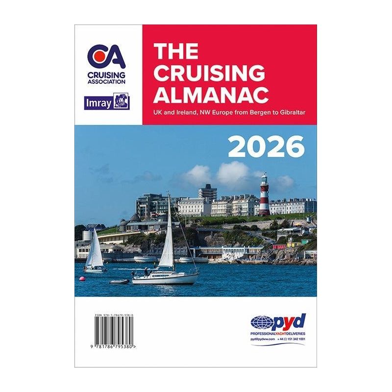





The 2026 Cruising Almanac covers Northwest Europe, from the Shetlands to Gibraltar. Updated with color-coded charts, port plans, and tide tables for 47 ports, it ensures precise voyage planning.
Data sheet
Specific References
Unmatched Coverage for Northern European Waters
Navigate with confidence from the Shetland Islands to Gibraltar and from the Baltic Sea to Ireland’s western coast. This almanac delivers comprehensive, up-to-date information for hundreds of ports and marinas, making it the go-to resource for cruisers planning passages or seeking quick reference details while underway. Whether you're charting a course through the English Channel or exploring the rugged coastlines of Scotland, this guide ensures you have the critical data needed for safe and efficient sailing.
Redesigned for Clarity and Ease of Use
The 2026 edition introduces a modernized layout with color-coded navigation and contact information, streamlining your planning process. Port plans have been meticulously updated using the latest hydrographic office data and local expert insights, repositioned alongside relevant text for instant access. Entry ports are now listed at the beginning of each chapter, while the introduction includes the most current regulations on customs, immigration, and EU entry formalities, including updates on EES and ETIAS systems.
Precision Tidal Data for Accurate Passage Planning
Stay ahead of tidal changes with the included 2026 tide tables for 47 standard ports, provided in a separate booklet for quick reference. Secondary port tide details and full-color Imray chartlets further enhance your ability to time passages and anchorages with precision. Monthly corrections are available online, ensuring your data remains current throughout the year.
Trusted by Sailors for Over a Century
First published in 1909 and an independent edition since 2002, this almanac is compiled by the Cruising Association, combining decades of maritime expertise with the latest navigational advancements. The 2026 update features improved plans for the River Medway and a new chart for Walls in the Shetland Islands, reflecting ongoing enhancements to support modern cruising needs. With hundreds of detailed chartlets, tidal stream diagrams, and passage notes, it’s the definitive tool for sailors who demand reliability and depth in their navigational resources.
Plan Your Voyages with the Most Trusted Almanac for Northern European Waters
The 2026 edition of this essential cruising guide is your all-in-one solution for navigating the diverse coastlines of Northern Europe. Designed for sailors who prioritize accuracy and convenience, it covers over 1,000 ports and marinas across a vast area, from the remote Shetland Islands to the bustling harbors of Gibraltar. The A4 paperback format ensures durability and ease of use on board, while its English-language content makes it accessible to an international audience of cruisers.
Updated and Enhanced for 2026
This year’s edition introduces a refreshed design with color-coded sections to help you quickly locate navigation and contact details. Port plans have been thoroughly revised using the latest hydrographic data, ensuring you have the most accurate representations of harbors, anchorages, and approach routes. The almanac also includes a separate booklet with tide tables for 47 standard ports, allowing you to plan passages with confidence. Monthly updates are available online, keeping your information current throughout the sailing season.
Comprehensive Tools for Every Stage of Your Journey
Beyond port details, this almanac provides invaluable resources for passage planning, including tidal stream diagrams, secondary port tide information, and notes on local regulations. The introduction covers essential updates on EU customs and immigration procedures, as well as the latest requirements for EES and ETIAS. Whether you’re preparing for a short coastal hop or a longer offshore voyage, this guide equips you with the knowledge to navigate safely and efficiently.
Built on a Legacy of Maritime Expertise
With roots dating back to 1909, this almanac has evolved alongside the needs of sailors, offering a blend of tradition and innovation. Compiled by the Cruising Association, it reflects the collective knowledge of experienced mariners and local experts. The 2026 edition includes enhanced plans for key areas like the River Medway and a new chart for Walls in the Shetlands, demonstrating its commitment to continuous improvement. For cruisers who demand reliability, this almanac is an indispensable tool for exploring Northern Europe’s waters.
This 2026 cruising almanac delivers comprehensive coverage in a durable A4 paperback format, weighing 2.28 kg. It includes full-color Imray chartlets, updated port plans, and a separate booklet with tide tables for 47 standard ports. The English-language edition features color-coded navigation details, monthly online updates, and the latest EU entry regulations, making it a complete resource for sailors navigating Northern European waters.
With a legacy spanning over a century, this publisher has established itself as a leader in maritime navigation resources. Known for combining expert insights with practical tools, their publications are trusted by sailors worldwide for accuracy, reliability, and innovation. Each edition reflects a commitment to supporting safe and enjoyable cruising experiences.
It covers Northwest Europe from the Shetlands to Gibraltar, including the coasts and islands of Great Britain and Ireland, as well as Bergen to the approaches of the Baltic.
No, the tidal tables for 47 standard ports are provided in a separate booklet included with the almanac.
Corrections are published monthly on the Cruising Association’s website.
The 2026 edition features improved plans for the River Medway and a new plan for Walls in the Shetlands, along with a redesigned layout and color-coded navigation information.
Yes, it includes the latest regulations on entry ports, EU customs, and immigration formalities, as well as updates on EES and ETIAS.
The port plans are presented as full-color chartlets, repositioned next to the relevant text for easier reference.
Yes, it includes passage notes, tidal stream plans, and secondary port tide details, making it ideal for planning both short and long-distance passages.
You might also like