Due to technical issues currently affecting our @nautic-way.com email system, we kindly ask you to temporarily use our backup email [email protected] Please continue using this address until this notice is removed.




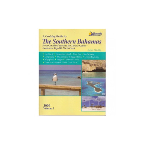
Plan passages across the southern Bahamas with detailed navigation instructions, GPS waypoints, harbor approaches, anchorages, and more than 100 color sketch charts for practical onboard reference.
Data sheet
Specific References
Guide in English
Paperback edition
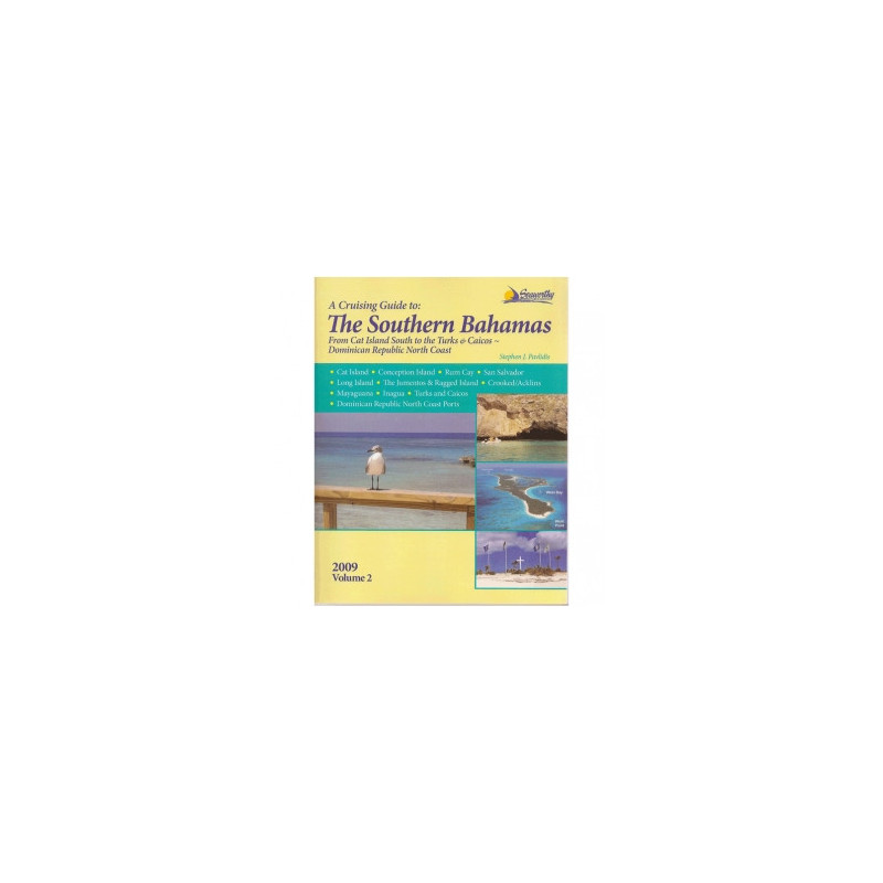
This cruising guide gives recreational boaters practical guidance for exploring the Southern Bahamas, the Turks and Caicos Islands, and ports along the north coast of the Dominican Republic. Written by Stephen J. Pavlidis, it covers destinations from Cat Island and Long Island to Inagua, including the Jumentos and Ragged Islands, Crooked and Acklins Islands, and Mayaguana.
Designed for use aboard, the guide brings together navigational instructions and local cruising information to support route planning and decisions on the water. Its coverage includes approaches, routes, anchorages, harbors, and available local services, with GPS waypoints and detailed information based on the author's independent surveys.
Alongside its route and harbor coverage, this volume includes practical information for cruising in the Bahamas, dive sites, historical notes, appendices, an index, and a bibliography. Color charts and aerial photographs help readers assess destinations and prepare for passages, while the guide's regional scope makes it a useful onboard reference for boaters planning an extended itinerary.
Volume 2 is a 295-page paperback guide in English. Its compact book format is intended to be kept close at hand for passage planning and reference while cruising. With detailed regional coverage, survey-based information, charts, and practical local insights, it offers recreational boaters a focused resource for navigating the Southern Bahamas and nearby waters.
A detailed cruising guide to the Southern Bahamas
This cruising guide gives recreational boaters practical guidance for exploring the Southern Bahamas, the Turks and Caicos Islands, and ports along the north coast of the Dominican Republic. Written by Stephen J. Pavlidis, it covers destinations from Cat Island and Long Island to Inagua, including the Jumentos and Ragged Islands, Crooked and Acklins Islands, and Mayaguana.
Navigation information for planning and underway use
Designed for use aboard, the guide brings together navigational instructions and local cruising information to support route planning and decisions on the water. Its coverage includes approaches, routes, anchorages, harbors, and available local services, with GPS waypoints and detailed information based on the author's independent surveys.
Useful reference material for cruising boaters
Alongside its route and harbor coverage, this volume includes practical information for cruising in the Bahamas, dive sites, historical notes, appendices, an index, and a bibliography. Color charts and aerial photographs help readers assess destinations and prepare for passages, while the guide's regional scope makes it a useful onboard reference for boaters planning an extended itinerary.
Paperback format for onboard reference
Volume 2 is a 295-page paperback guide in English. Its compact book format is intended to be kept close at hand for passage planning and reference while cruising. With detailed regional coverage, survey-based information, charts, and practical local insights, it offers recreational boaters a focused resource for navigating the Southern Bahamas and nearby waters.
English-language paperback by Stephen J. Pavlidis, published in 2015. This 295-page cruising guide includes more than 100 color sketch charts, aerial harbor photographs, GPS waypoints, and information on approaches, routes, anchorages, ports, and local services. Approximate dimensions: 11 × 9 × 1 inches; weight: 2 pounds. EAN: 9781892399298.
Seaworthy Publications specializes in detailed nautical cruising guides. Its guides are recognized for drawing on the author's personal surveys and providing comprehensive information for mariners.
Which destinations and islands are covered in the guide?
Coverage includes Cat Island, Long Island, Conception Island, Rum Cay, San Salvador, the Jumentos and Ragged Islands, Crooked and Acklins Islands, Mayaguana, Inagua, the Turks and Caicos, and ports on the northern coast of the Dominican Republic.
What navigation information does the guide provide?
It includes detailed navigation instructions, GPS waypoints, approaches and routes, plus information on anchorages, ports, local services, weather, currents, and cruising logistics.
What types of charts and images are included?
The guide features more than 100 color sketch charts and aerial photographs of ports, along with hydrographic data.
Does the guide include information beyond navigation?
Yes. It also covers diving sites and local history, and includes appendices, an index, and a bibliography.
Who wrote the guide, and what language is it in?
It was written by Stephen J. Pavlidis and is in English.
What are the book’s format and physical specifications?
It is a paperback with 295 pages. Listed dimensions are 11 × 9 × 1 inches, and its weight is approximately 2 pounds.
You might also like