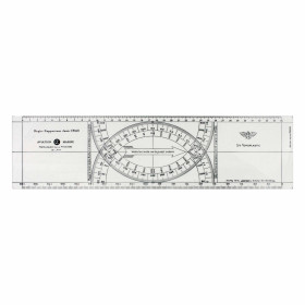

Navicarte nautical chart, coasts of France and Spain.
Data sheet
Specific References
The Navicarte E31 – Santander – Suances nautical chart is a folded paper chart designed for coastal navigation along the northern coast of Spain. It covers the area between Santander and Suances, on the Spanish Atlantic coast.
With a scale of 1:50,000, Navicarte E31 can be used to plan a coastal route, study the configuration of the coastline and prepare recreational sailing or motorboat navigation. Its paper format provides an overall representation of the area directly on the chart table.
This chart forms part of the Navicarte series covering different sections of the Spanish Atlantic coastline.
Navicarte E31 covers the Santander – Suances area. It allows the navigator to work on a defined section of the northern Spanish coast and plan the different stages of a coastal route.
For sailors navigating in Cantabria, this chart provides suitable coverage for route planning. It can also be incorporated into a longer passage along the Spanish coast by combining it with Navicarte charts covering neighbouring areas.
The 1:50,000 scale provides a useful balance between the extent of the area represented and the level of detail required for coastal navigation.
A paper nautical chart is a practical working tool for planning a route before departure.
With Navicarte E31, the navigator can plot the intended route, measure distances, determine the main course changes and examine the general configuration of the coastline.
This preparation makes it possible to study the coastal geography before using GPS or a chartplotter at a higher zoom level.
The paper representation also makes it possible to compare different route options without relying on the successive display of different areas on an electronic screen.
The 1:50,000 scale of Navicarte E31 is suitable for working over a relatively extensive coastal area.
Reading the chart requires an understanding of soundings, seabed information, buoyage, lights, hazards and the different landmarks used for coastal navigation.
The cartographic information allows the navigator to plan a coherent route and anticipate course changes before approaching coastal or harbour areas.
For sailors in training, E31 also provides a useful support for learning how to read and interpret a nautical chart in a real coastal navigation context.
Navicarte E31 is a folded paper chart and is not electronic chart data designed to be loaded into a GPS or chartplotter.
It can nevertheless be used together with these systems.
The GPS provides the vessel's position and the chartplotter displays the electronic route, while the paper chart maintains an overall view of the area.
This combination allows the navigator to check the consistency of the route and provides an independent reference in the event of an electronic equipment failure.
Publisher: Navicarte
Chart number: E31
Area: Santander – Suances
Country: Spain
Maritime area: Atlantic Ocean
Type: nautical navigation chart
Use: recreational boating
Navigation: coastal waters
Support: paper
Format: folded chart
Unfolded size: A0, 118.9 × 84.1 cm
Scale: 1:50,000
Language indicated: French
Navicarte E31 is designed for coastal navigation in the Santander – Suances area.
It can be used by recreational sailors and motorboat users, both for local navigation and as part of a longer cruise along the northern coast of Spain.
It can also be combined with other Navicarte charts in the series to create chart coverage suitable for a longer coastal itinerary.
Using several charts makes it possible to maintain an appropriate scale for each section of the voyage.
Navicarte E31 can also be used in a teaching environment.
Working with a paper chart helps sailors learn how to determine a route, measure a distance, understand depth information and identify the various elements required for navigation.
It therefore provides a useful complement to electronic navigation exercises and GPS training.
For sailing schools and instructors, a paper chart also makes it possible to work on cartographic concepts independently of the vessel's electronic equipment.
Navicarte E31 provides chart coverage of the Santander – Suances area. It should be incorporated, when necessary, into more comprehensive nautical documentation.
Depending on the voyage, navigation conditions and areas visited, the navigator may need additional information concerning tides, harbours, lights, weather, regulations and nautical information intended for mariners.
The paper chart therefore remains an important part of navigation planning but should be used within a complete preparation process.
What area does Navicarte E31 cover?
Navicarte E31 covers the Santander – Suances area on the Atlantic coast of northern Spain.
What is the scale of Navicarte E31?
The chart is published at a scale of 1:50,000.
Is Navicarte E31 a paper nautical chart?
Yes. It is a folded paper chart that unfolds to A0 size.
What are the dimensions of Navicarte E31?
The unfolded format is 118.9 × 84.1 cm.
What language is indicated on Navicarte E31?
The product information indicates French.
Is Navicarte E31 suitable for recreational boating?
Yes. It is intended for recreational boating and coastal navigation.
Can Navicarte E31 be used with GPS?
Yes. It can be used alongside GPS or a chartplotter.
Does Navicarte E31 cover the whole of Cantabria?
No. It covers the Santander – Suances area. Additional charts may be required for areas beyond this coverage.
Is Navicarte E31 suitable for sailing?
Yes. It is suitable for planning coastal sailing as well as motorboat navigation.
What additional documents should be consulted with Navicarte E31?
Depending on the route, documents concerning tides, harbours, lights, weather and nautical information may be required.
You might also like