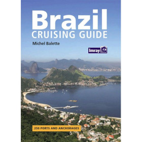
Plan your South Atlantic voyage with precision. This guide offers 90+ detailed anchorage charts, color photos, and expert advice for navigating Brazil, Uruguay, and Argentina’s 3,000-mile coastline.
Data sheet
Specific References
Planning a voyage along the stunning yet challenging coastlines of Brazil, Uruguay, or Argentina? This comprehensive pilot guide is your trusted resource, meticulously crafted to support sailors navigating approximately 3,000 miles of diverse and often remote waters. From the tropical shores of Natal, Brazil, to the rugged beauty of Caleta Horno or Carolina in Argentina, this guide delivers unparalleled insights to ensure safe, efficient, and enjoyable passages.
Written primarily by Tom Morgan, a seasoned sailor with firsthand experience in these waters, this guide benefits from contributions by fellow cruisers who have explored these coasts. Their collective expertise transforms this book into more than just a navigational aid—it’s a repository of practical knowledge, local tips, and real-world advice. Whether you’re seeking the best anchorages, understanding local regulations, or preparing for weather patterns, this guide bridges the gap between theory and practice.
With more than 90 meticulously drafted black-and-white plans, this guide provides precise, easy-to-follow charts for harbors, anchorages, and ports along the route. Each plan is designed to simplify navigation, highlighting key features such as depths, hazards, entry points, and recommended anchoring spots. Complementing these plans are full-color photographs that offer visual references to help you identify landmarks and assess conditions before arrival.
This guide goes beyond charts and coordinates. It includes country profiles that cover essential topics such as language, currency, travel logistics, and local cuisine. These insights help you prepare for interactions with authorities, resupplying in port, or simply enjoying the local culture. Whether you need to know the best time to clear customs or where to find fresh provisions, this guide equips you with the information to navigate both the waters and the local way of life.
Designed specifically for long-distance sailors, this guide is tailored to the unique challenges of extended voyages. It covers a vast stretch of coastline, offering flexibility for those planning multi-month trips or shorter segments. The A4 format ensures readability, while the softcover binding makes it durable yet lightweight enough for onboard use. With 140 pages of expertly curated content, it strikes the perfect balance between depth and portability.
Since its first edition in 2002, this guide has become a staple for sailors tackling the South Atlantic Circuit. Its reputation is built on accuracy, reliability, and the practicality of its information. Whether you’re a seasoned offshore sailor or embarking on your first long-distance voyage, this guide provides the confidence to explore with peace of mind.
Navigate the South Atlantic with Confidence and Precision
Embarking on a journey along the Atlantic coast of South America demands more than just a chartplotter—it requires a guide that combines expert navigation advice with local insights. This pilot guide is your ultimate companion for cruising approximately 3,000 miles of coastline, from the vibrant shores of Natal, Brazil, to the windswept inlets of Argentina. Designed for long-distance sailors, it delivers everything you need to plan safe, efficient, and enjoyable passages through some of the most diverse and challenging waters in the world.
Unparalleled Coverage of 80+ Destinations
This guide doesn’t just scratch the surface—it dives deep into over 80 harbors, anchorages, and ports, providing more than 90 detailed black-and-white plans to simplify your navigation. Each plan is crafted to highlight critical details such as depths, hazards, entry points, and optimal anchoring spots, ensuring you can approach every destination with confidence. Full-color photographs complement these plans, offering visual references to help you identify landmarks and assess conditions before arrival.
Written by Sailors, for Sailors
What sets this guide apart is its authenticity. Primarily authored by Tom Morgan, a sailor with extensive firsthand experience in these waters, it also incorporates contributions from fellow cruisers who have navigated these coasts. This collaborative approach ensures the guide is packed with practical, real-world advice—from the best anchorages to local customs and regulations. It’s not just a book; it’s a collection of hard-earned wisdom from those who’ve been there.
More Than Just a Navigation Tool
Beyond charts and coordinates, this guide serves as a cultural and practical handbook. Country profiles provide essential information on language, currency, travel logistics, and local cuisine, helping you prepare for everything from clearing customs to resupplying in port. Whether you need to know the best time to check in with authorities or where to find fresh provisions, this guide equips you with the knowledge to navigate both the waters and the local way of life.
Built for the Demands of Long-Distance Cruising
Tailored for sailors tackling extended voyages, this guide is optimized for durability and usability. The A4 format ensures readability, while the softcover binding makes it lightweight yet sturdy enough to withstand the rigors of life onboard. With 140 pages of expertly curated content, it strikes the perfect balance between comprehensive coverage and portability, making it an indispensable resource for any cruiser.
This pilot guide is a paperback edition published in 2002, covering 3,000 miles of coastline from Brazil to Argentina. It includes over 90 detailed black-and-white navigational plans, full-color photographs, and country profiles for practical and cultural insights. The A4 format (140 pages) ensures readability and durability, with a softcover binding designed for onboard use.
With a legacy rooted in the cruising community, this publisher specializes in creating pilot guides that combine expert navigation advice with practical, real-world insights. Their guides are trusted by long-distance sailors for their accuracy, reliability, and depth of information, making them an essential resource for those exploring remote and challenging waters.
This guide covers approximately 3000 miles of the South American coastline, from Natal in Brazil to Caleta Horno or Carolina in Argentina.
The guide includes over 90 detailed black-and-white plans of havens, anchorages, and ports.
The plans are in black and white, while the photos are in color.
This guide is softbound (paperback) with an A4 format.
The first edition contains between 140 and 152 pages.
The guide provides country profiles covering language, currency, travel tips, local food, and other practical information for sailors.
Yes, it is specifically designed for long-distance sailors navigating the South Atlantic coast of South America.
You might also like