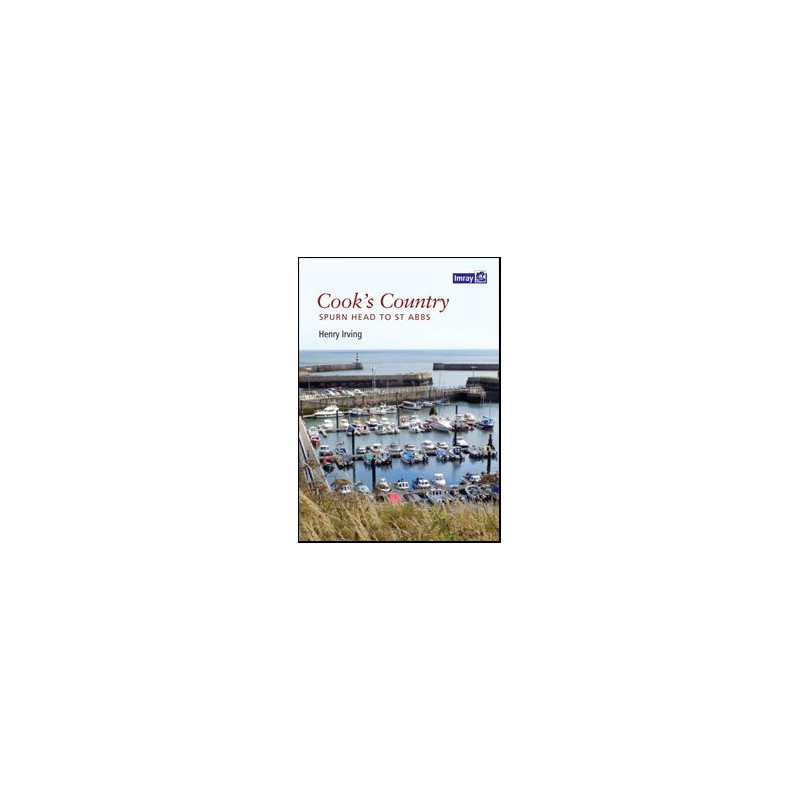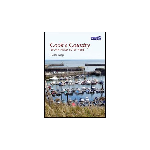




This nautical guide covers Spurn Head to St Abbs with detailed coastal charts, navigation hazards, tidal data, and safe anchorage spots. Ideal for sailors and fishermen.
Data sheet
Specific References
Discover the rugged beauty and rich maritime history of England’s northeastern coastline with this meticulously crafted nautical guide. Designed for sailors, anglers, and coastal adventurers, this guide delivers unmatched insights into the waters stretching from Spurn Head to St Abbs, blending practical navigation data with the personal expertise of a seasoned local mariner. Whether you're plotting a weekend cruise, fishing expedition, or historical exploration, this guide ensures you navigate with confidence and precision.
Written by Henry Irving, a lifelong sailor with deep ties to the Humber and Yorkshire coasts, this guide goes beyond standard charts. Irving’s firsthand experience aboard vessels like the *Venture*—a traditional Hull shrimper—and the historic steam trawler *William McCann* infuses the book with practical wisdom. From hidden hazards to the best anchorages, his insights transform raw data into actionable knowledge, making this an indispensable tool for both novice and experienced sailors.
This guide leaves no stone unturned, offering detailed topographical maps, up-to-date navigation aids, and critical tidal information. It highlights safe moorings, depth soundings, and potential dangers, ensuring you can plan routes with accuracy. The inclusion of IMO-compliant standards guarantees reliability, while the waterproof, laminated pages stand up to the harshest marine conditions. Whether you're navigating rocky outcrops or seeking sheltered coves, this guide equips you with the tools to explore safely and efficiently.
Ideal for those who prefer the intimacy of coastal sailing over open-water voyages, this guide focuses on the unique challenges and rewards of the North Yorkshire and Northumberland shores. It’s perfect for sailors who value local knowledge, fishermen targeting prime spots, or researchers documenting maritime history. The 1:50,000 scale strikes the perfect balance between detail and usability, making it easy to interpret while providing the depth of information needed for precise navigation.
More than just a chart, this guide is a testament to the region’s maritime heritage, offering a blend of technical precision and personal narrative. Its durable construction ensures it withstands the elements, while its clear, concise layout makes it a pleasure to use. Whether you're preparing for a short trip or an extended coastal adventure, this guide is your key to unlocking the secrets of one of England’s most captivating coastlines.
Navigate the Northeast Coast with Confidence
This essential nautical guide is your passport to exploring the historic and scenic waters from Spurn Head to St Abbs. Designed for sailors, fishermen, and maritime enthusiasts, it combines expert local knowledge with precise navigation data to ensure safe and enjoyable voyages along England’s northeastern coastline. Whether you're charting a course for a weekend getaway or conducting in-depth maritime research, this guide provides the tools you need to navigate with accuracy and ease.
Built for the Demands of Coastal Sailing
Crafted by a lifelong sailor with decades of experience on the Humber and Yorkshire coasts, this guide offers more than just maps—it delivers practical insights into the region’s unique challenges. From identifying hidden hazards to locating the best anchorages, the author’s firsthand expertise ensures you’re prepared for every twist and turn of these storied waters. The guide’s waterproof, laminated pages are built to withstand the rigors of marine environments, making it a reliable companion for any voyage.
Precision Mapping for Every Adventure
Featuring a 1:50,000 scale, this guide strikes the perfect balance between detail and usability, providing clear, easy-to-read charts that cover everything from depth soundings to navigation aids. It includes critical information on tides, safe moorings, and coastal topography, ensuring you can plan your route with confidence. Compliant with IMO standards, the guide meets the highest levels of accuracy and reliability, making it a trusted resource for both recreational and professional mariners.
Durable, Practical, and Ready for the Sea
Weighing just 400 grams and measuring 840 mm x 600 mm, this guide is designed for easy handling on deck or in the cabin. Its PVC-laminated paper resists water, tears, and wear, ensuring it remains legible even in challenging conditions. Whether you're navigating rocky shores, exploring sheltered coves, or fishing in prime locations, this guide is built to last and ready to support your maritime adventures.
This nautical guide offers a robust set of features tailored for coastal navigation, including a 1:50,000 scale for precise charting, waterproof and tear-resistant PVC-laminated pages, and compliance with IMO standards. Covering the coastline from Spurn Head to St Abbs, it provides detailed topographical data, depth soundings, tidal information, and navigation aids, all presented in a durable 840 mm x 600 mm format weighing 400 grams.
With a legacy spanning over two centuries, this publisher is renowned for producing high-quality nautical charts and guides trusted by mariners worldwide. Specializing in accurate, durable, and user-friendly navigation resources, their products are designed to meet the needs of both recreational sailors and professional seafarers, ensuring safety and precision on every voyage.
The chart is scaled at 1:50,000, providing detailed and precise coastal navigation information for accurate route planning.
Yes, the chart is made of PVC-laminated paper, making it water-resistant and durable for extended marine use.
It covers the coastline from Spurn Head to St Abbs, including detailed topographical and navigational data for this region.
Yes, it provides comprehensive tidal information, including depth soundings and tidal patterns for safe navigation.
The chart measures 840 mm by 600 mm when fully unfolded, offering a large and clear view of the coastal area.
Yes, the chart highlights navigation hazards, safe anchorages, and aids to navigation for enhanced safety during coastal trips.
Yes, it meets IMO (International Maritime Organization) standards, ensuring reliability for professional and recreational use.
You might also like